
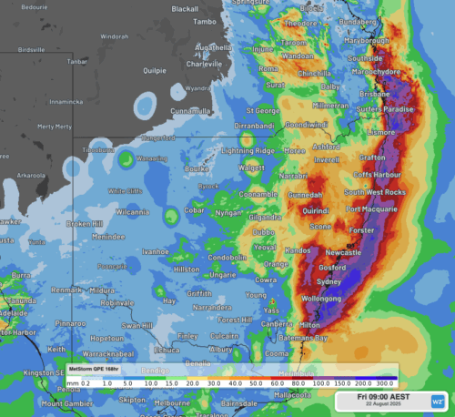
Relentless rainfall has soaked already sodden areas of eastern NSW this week, leading to flooding, road and rail disruptions, and Sydney’s wettest August day in nearly two decades. A deep stream of moist easterly winds has cause rain to soak parts of NSW and southeast Queensland every day between Monday and Friday this week. Most […]
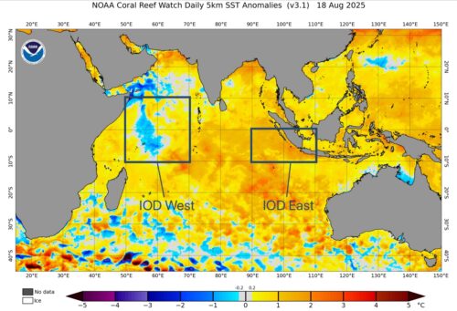
One of Australia’s key climate drivers is gaining strength over the Indian Ocean, firming up the odds of a wet spring for large parts of the country. The Indian Ocean Dipole (IOD) refers to an index that measures the difference in sea surface temperature anomalies across the tropical Indian Ocean. It’s an index watched closely […]

With an overnight minimum of a bone-chilling –13.2°C, Thredbo Top Station just registered Australia’s coldest night of 2025 to date by more than three degrees. It was the coldest temperature recorded anywhere in New South Wales since 2018, and the coldest in Australia since –13.5°C was recorded in the tiny town of Liawenee on Tasmanian’s […]
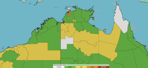
Increased fire danger across parts of northern Australia, including Darwin, comes with a surge of hot and dry winds from the interior. 75 days without rain The dry season is living up to its name for Darwin and the Northern Territory, with over 75 days since the last rain recorded in Darwin. This allows the […]
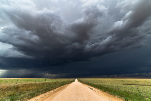
Abnormally warm oceans surrounding Australia and a developing negative Indian Ocean Dipole will increase the likelihood of abnormally wet weather across large parts of the country this spring, along with an increased risk of flooding and severe thunderstorms disrupting businesses and industries. Spring in Australia runs for three months from the start of September to […]
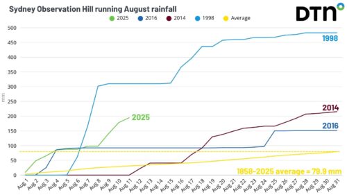
Sydney’s soggiest August weekend in nearly three decades adds onto an already well above average month of rain as moist onshore winds stream into eastern NSW, with saturated grounds leaving NSW businesses and industries in a vulnerable position. Video: Radar imagery showing rainfall moving across the metropolitan region on Sunday, August 10, 2025. A moist […]

There has only been one completely dry day in Sydney so far this month and the city will see more wet weather this weekend, continuing its wettest August in 9 years. In an average August, Sydney would typically receive about 80 mm of rain during the entire month. But this August has already exceeded this […]
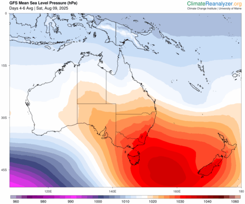
A strong positive phase of the Southern Annular Mode (SAM) is about to occur in the Southern Hemisphere, increasing the likelihood of wet weather in eastern Australia and reducing snow prospects in southern Australia over the coming week. What is the SAM? The SAM is an index that measures the north-south displacement of a belt […]
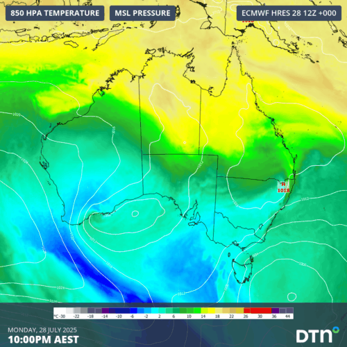
A cold Southern Ocean air mass will spread across Australia this week, causing a run of wintry days and nights for much of the country before possibly culminating in heavy rain along the east coast. The image below shows a tongue of cold air extending from the Southern Ocean towards southwestern Australia on Monday. This […]

Australia’s tropical cyclone season is officially underway, but we may not see much activity for few months yet. The season runs from November to April, and for mining operators and businesses across northern Australia, 2026-27 is shaping up to be a season where the headline numbers and the real risk may not line up. On […]

A positive Indian Ocean Dipole is underway, but this one is unlikely to deliver the textbook dry spring and summer that businesses have come to expect from the pattern. The Bureau of Meteorology officially declared a positive IOD on Tuesday, October 27, which typically like El Niño can cause drier and warmer conditions over parts of […]

Waters off Indonesia have cooled in recent weeks, an indication that a positive Indian Ocean Dipole (IOD) event could be developing. It’s an important climate driver for Australia, and it could shape rainfall and temperatures heading into summer, with flow-on effects for farmers, energy and other industries. What is the Indian Ocean Dipole? The IOD […]

Leonora, WA, had its wettest September day on record earlier this month. Three weeks later, more than 1.3 million lightning pulses were detected within 800 km of the town in 48 hours. Why is a stalled trough delivering storms to mining country, and what it could mean for operations? The DTN Total Lightning Network detected […]
