
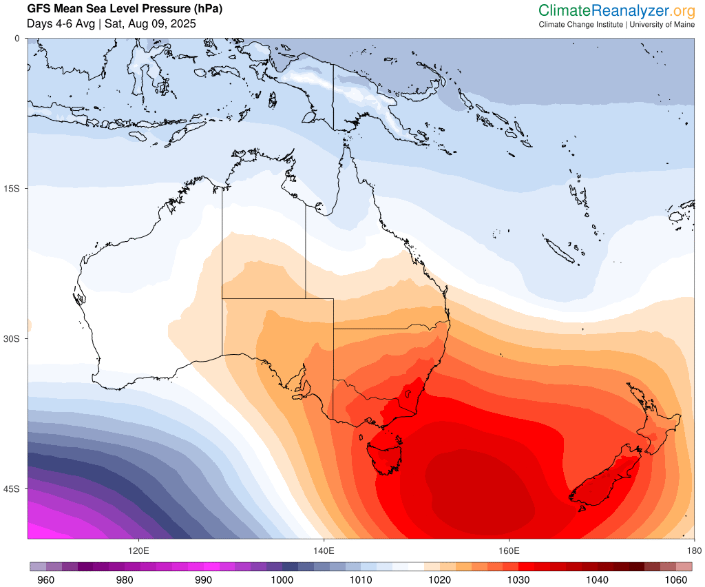
A strong positive phase of the Southern Annular Mode (SAM) is about to occur in the Southern Hemisphere, increasing the likelihood of wet weather in eastern Australia and reducing snow prospects in southern Australia over the coming week.
What is the SAM?
The SAM is an index that measures the north-south displacement of a belt of westerly winds that flows around the Southern Hemisphere, passing between Australia and Antarctica.
- When the SAM is in a negative phase, this belt of westerly winds – including the cold fronts and low pressure systems it carries – is located further north than usual for that time of year.
- When the SAM is in a positive phase, the westerly winds, cold fronts and low pressure systems are located further south than usual for that time of year.
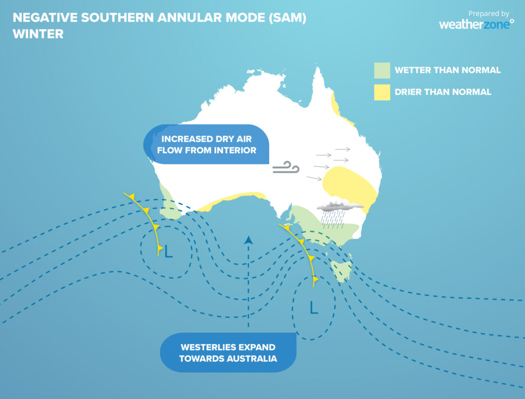
Image: Typical influences of a positive SAM during winter.
Unlike some other broad-scale climate drivers like La Niña and the Indian Ocean Dipole, the SAM can only be predicted out to about one or two weeks into the future. This makes in unreliable for predicting seasonal-scale climate patterns, but it can be used as a forecasting tool on shorter time scales of days to weeks.
Forecast models suggest that a positive SAM may emerge over the coming week, with some models predicting a strong positive SAM signal.
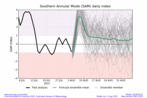
Image: SAM forecast from the Bureau of Meteorology, showing a positive SAM over the coming week.
At this time of year, a positive SAM typically suppresses rain and snow over parts of southern Australia and enhances the likelihood of rain in eastern Australia. This is due to the southward shift in high and low pressure systems across the Southern Hemisphere’s mid-latitudes, which often causes weaker cold fronts over southern Australia and more rain-bearing onshore winds for eastern Australia.
The map below shows the predicted rainfall over Australia during the next seven days. There are a few features on this map that are in line with what we would expect to see during a positive SAM, including:
- Widespread rain over eastern Australia with areas of moderate to heavy rain in NSW and Queensland.
- Patchier rainfall across southern Australia
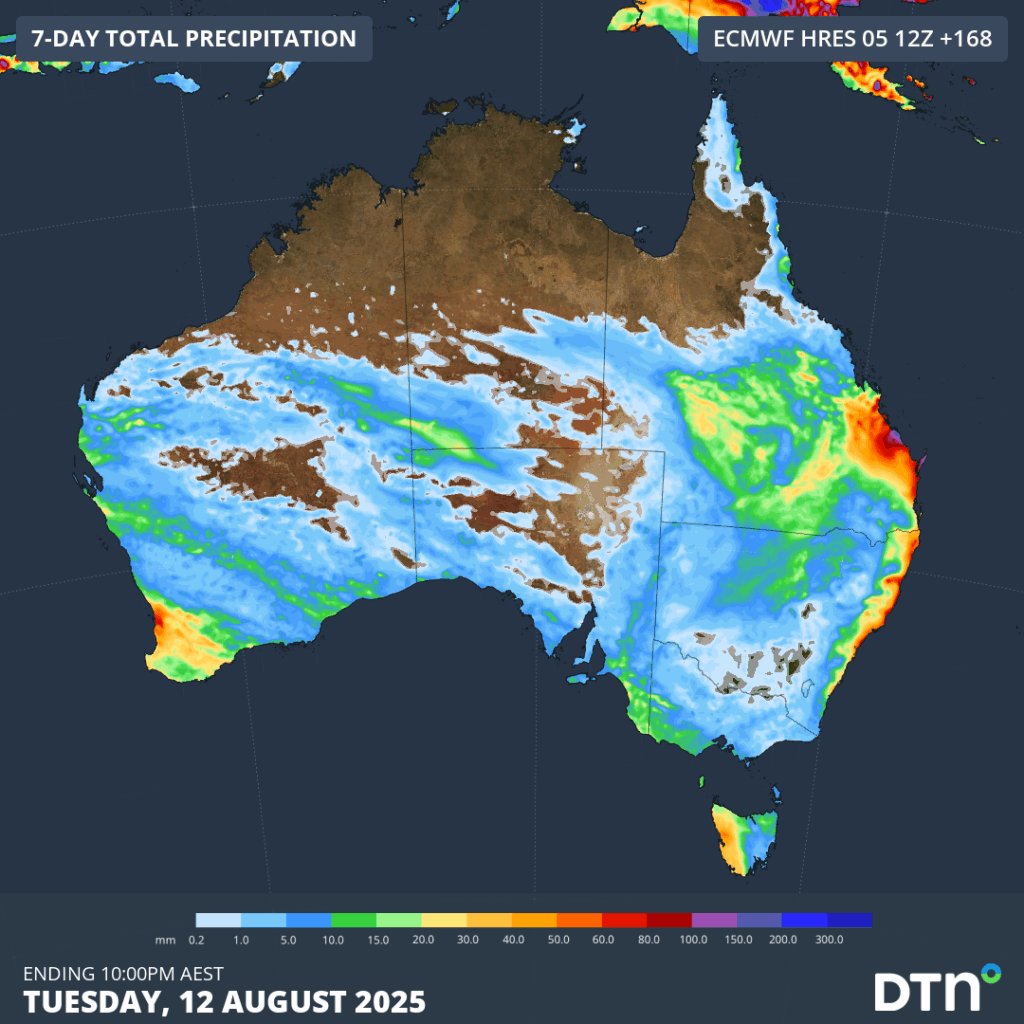
Image: Forecast accumulated rain during the seven days ending at 10pm AEST on Tuesday, August 12, 2025.
Another consequence of the impending positive SAM will be a quiet week for fresh snowfall in the Australian Alps. While the country’s snowy hydro has enjoyed numerous bouts of good snow so far this season, there’s not much on the forecast over the coming week due to the absence of any strong frontal activity.
Some of the rain in eastern Australia over the coming week may be heavy enough to cause flooding, possibly disrupting transport, mining and other East Coast industries.
How DTN APAC can help
We help businesses in Australia, Asia and the Pacific prepare for severe weather and storms, across sectors including Roads and Transportation, Emergency Services, Mining, Insurance and Energy.
The DTN APAC Flood Risk System (FRS)
DTN APAC, delivers the Flood Risk System (FRS) to provide flood risk visibility. You can now easily visualise precipitation, and access rapid-update forecasting, across multiple sections of your site with the FRS geofenced alerting system. Gain a more precise determination with DTN APAC’s advanced geospatial technology creating hundreds of virtual ‘weather stations’ for each monitored section or culvert.
Rainfall is measured across each of your established catchments, with alerting calibrated to their individual thresholds. Alerts are raised when thresholds for any section are approaching or have been breached. This gives you targeted risk visibility to inform your assessment, operational response and emergency management.
The FRS can be integrated into your existing DTN APAC interface, or your own monitoring and control systems. Real-time monitoring of each catchment’s predefined thresholds is coupled with forecasting of rain, so you can provide your team with the most up-to-date information on whether conditions will ease, continue, or worsen.
Learn more about our large range of industry leading products and services or email us at sales.apac@dtn.com
Thumbnail source: ClimateReanalyzer.org




