
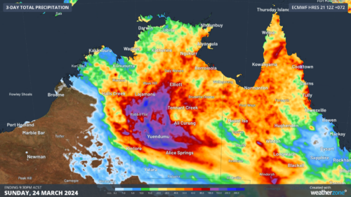
There are early signs that parts of SA, the NT, NSW and Qld could get soaked on the Easter long weekend, as moisture left behind by ex-Tropical Cyclone Megan spreads south. Tropical Cyclone Megan made landfall over the southwest Gulf of Carpentaria on Monday, March 18. The system then weakened to a tropical low […]

The Southern Annular Mode (SAM) has strongly negative for the first time in 2024, bringing the first cool spell and snowfall to parts of southeastern Australia this week. The image below shows a strong cold front sweeping across the region on Wednesday. Image: Himawari-9 satellite image for the three hours leading 1:20pm AEDT on […]
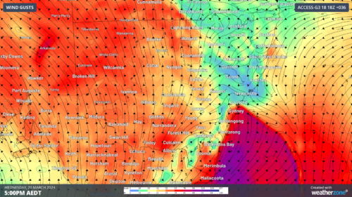
The infamous southerly buster will move up the NSW coast on Wednesday impacting port operations in the region. Southerly busters are an abrupt southerly change with wind gusts exceeding 54 km/h (29 knots) and a temperature drop of at least 5°C in three hours. Sydney typically receives five busters a year, with three already […]
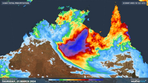
The remnants of Severe Tropical Cyclone Megan will carry heavy rain across the NT over the next few days as communities assess the damage in the powerful system’s wake. Megan made landfall as a category three severe tropical cyclone on Monday afternoon, crossing the coast to the southeast of Port McArthur. The tropical cyclone caused […]
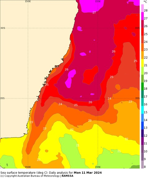
A tongue of water warm enough to support tropical cyclone development has been detected off the central NSW coast this month, breaking temperature records in the western Tasman Sea. Sea surface temperatures off the NSW coast have been running around 2 to 3°C above average in recent weeks, with some areas more than 3°C warmer […]

Record West Australian rainfall has closed the Eyre Highway that links Perth to the eastern states and flooded outback stations, including Australia’s largest sheep station Rawlinna. Just two days ago, we ran a story here at Weatherzone with the headline “Colossal rainfall over the Nullarbor“, and again, extremely heavy rain has fallen over the Nullarbor […]
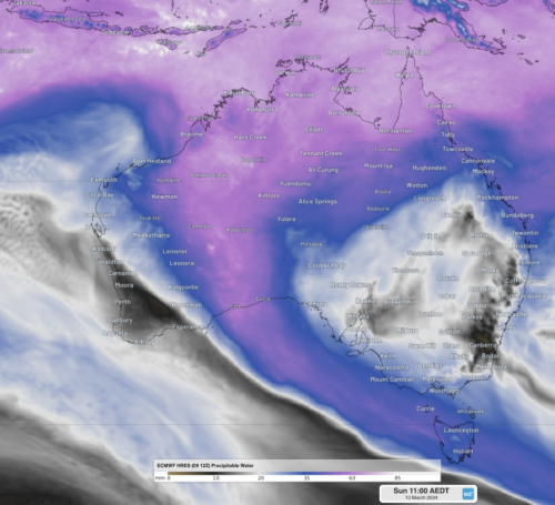
Over 4 months of rainfall has fallen in a single day in southeastern parts of WA, with the chance of over a years’ worth of rainfall falling by the end of the week. Eyre, along WA’s southern coast, experienced unprecedented heavy rainfall, with 141mm of rainfall was recorded in the gauge to 9am WST Sunday. […]
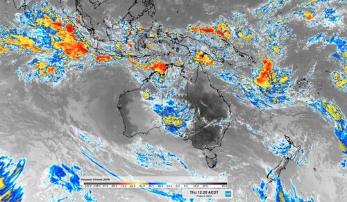
An active pulse of the Madden-Julian Oscillation will increase the risk of tropical cyclones and thunderstorms in the Australian region over the coming week. The Madden-Julian Oscillation (MJO) refers to a pulse of increased tropical cloud, rainfall and thunderstorm activity that moves through our planet’s atmosphere, from west to east, near the equator. The MJO […]
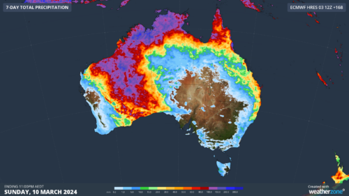
Rain and thunderstorms will replace extreme heat over large areas of WA this week, with some places in the state’s north likely to see enough rain to officially mark the start of the wet season. In Australia, the northern wet season is defined as the date after September 1 when at least 50 mm of […]

Australia’s tropical cyclone season is officially underway, but we may not see much activity for few months yet. The season runs from November to April, and for mining operators and businesses across northern Australia, 2026-27 is shaping up to be a season where the headline numbers and the real risk may not line up. On […]

A positive Indian Ocean Dipole is underway, but this one is unlikely to deliver the textbook dry spring and summer that businesses have come to expect from the pattern. The Bureau of Meteorology officially declared a positive IOD on Tuesday, October 27, which typically like El Niño can cause drier and warmer conditions over parts of […]

Waters off Indonesia have cooled in recent weeks, an indication that a positive Indian Ocean Dipole (IOD) event could be developing. It’s an important climate driver for Australia, and it could shape rainfall and temperatures heading into summer, with flow-on effects for farmers, energy and other industries. What is the Indian Ocean Dipole? The IOD […]

Leonora, WA, had its wettest September day on record earlier this month. Three weeks later, more than 1.3 million lightning pulses were detected within 800 km of the town in 48 hours. Why is a stalled trough delivering storms to mining country, and what it could mean for operations? The DTN Total Lightning Network detected […]
