
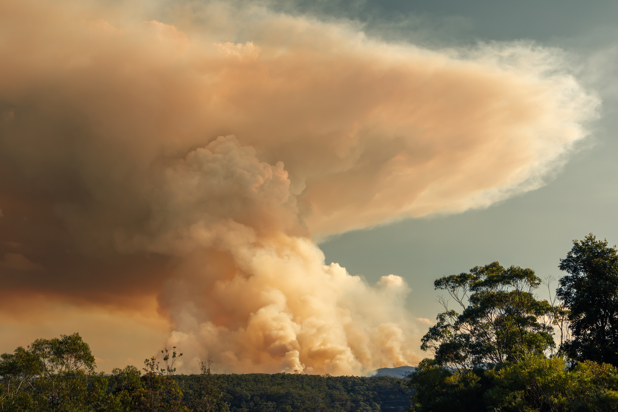
Bushfire risk doesn’t usually make headlines in June, but AFAC’s winter seasonal outlook is putting mining and resources operators on alert from the Kimberley to the NSW.
Australia’s official seasonal bushfire outlook for winter 2026 was released by AFAC on Thursday, May 28. The outlook predicts increased fire risk across the northern parts of the Great Sandy Desert and surrounds in WA and parts of central and northern NSW.
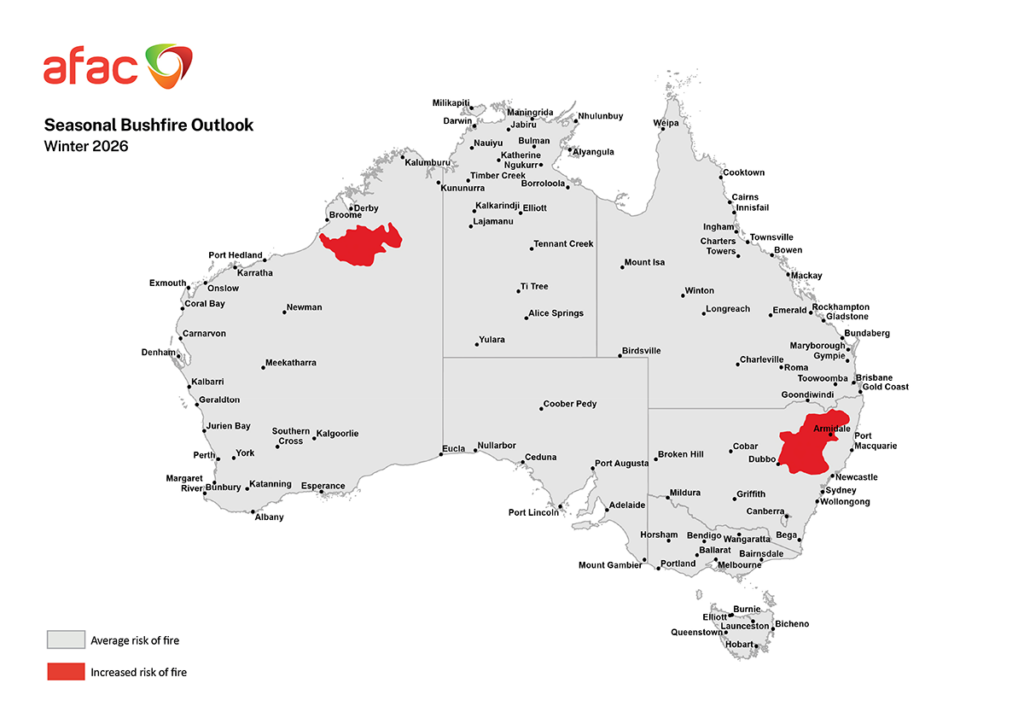
Image: Winter 2026 seasonal bushfire outlook. Source: AFAC
During the winter months, fire risk typically shifts to northern Australia as the region enters its dry season. This year however, the above-average risk extends further, reaching 1,500 kilometres south of the traditional northern fire zone into the mid-latitudes of NSW.
Dry Autumn Drives Above-Average Fire Danger in NSW this winter
Businesses operating across the Northern Tablelands and western slopes could be forgiven for looking out the window this week and dismissing any talk of bushfire risk. A rainfall event in late May delivered between 50 and 100 millimetres to parts of the region in the space of a week, with some areas recording more than 100 millimetres, forcing highway closures and leaving soils visibly saturated.
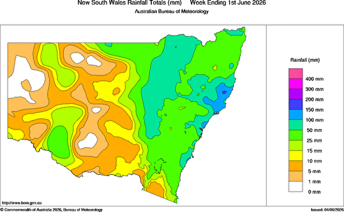
Image: Weekly rainfall map, week ending 1 June 2026, Source: BOM
While the rainfall event increased soil moisture, slowed the curing of fine fuels and will likely dampen fire risk for the next month or so, it was not enough to replace the long-term rainfall deficiencies that have been building across the region.
Across the five months to May 2026, parts of the Northern Tablelands and Northwest Slopes and Plains recorded rainfall at their lowest 10% of historical records, a deficit that a single weather event cannot undo.
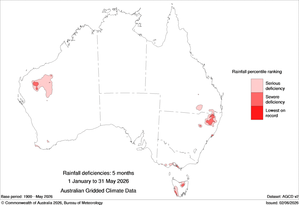
Image: 5-month rainfall deficiencies map between 1 January to 31 May 2026. Source: BOM.
Looking ahead, the outlook offers little relief. Warmer and drier-than-average conditions are forecast through winter, with climate drivers shifting toward El Niño which historically has amplified fire risk across much of Australia.
Above-average rains fuel WA fire risk as conditions dry
On the other side of the continent, above-average wet season rainfall across the Kimberley and northern parts of the Great Sandy Desert has produced elevated fuel loads across the region. As the dry season progresses and conditions dry out, that fuel will cure rapidly creating an increasingly elevated fire risk.
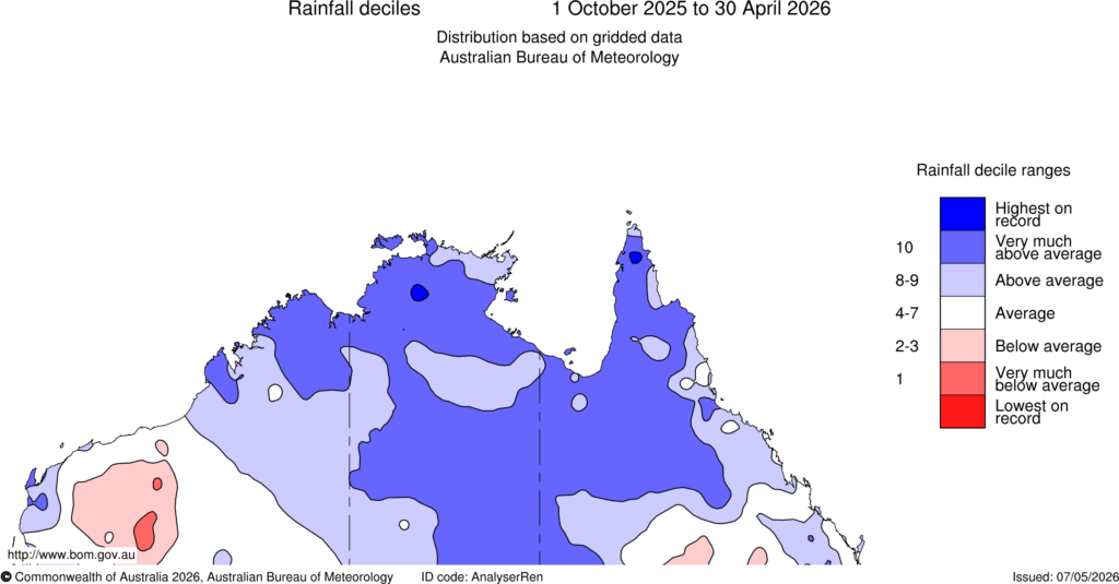
Image: Rainfall deciles between October 1, 2025, and 30 April, 2026. Source: BOM
For parts of the Pilbara, one of Australia’s busiest mining hubs, Ex-Tropical Cyclones Mitchell and Narelle brought above-average wet season rainfall, but the region’s sparse and discontinuous vegetation limits the fire risk compared to the Kimberley. While AFAC has assessed the region as carrying an average fire risk, dry, warm and windy conditions will still pose a significant threat.
For businesses operating across both regions, elevated fuel loads, warming temperatures and shifting climate drivers presents an elevated fire risk this season. Unplanned operational shutdowns, disrupted supply chains, grounded FIFO workforces and increased compliance obligations are among the challenges operators may face as conditions deteriorate through winter and into spring. For more information on how DTN can help, please visit our website at https://apac.dtn.com/




