Ex- Tropical Cyclone Lincoln should re-develop into cyclone off the Kimberley coast in WA on Friday night, before setting its sights on the Pilbara and northern Gascoyne in the next 48 hours.
Lincoln will be the first Tropical Cyclone to impact WA this season, but it is the second Tropical Cyclone to move into the Western region. Anggrek was the first to move into the Western Region this season in January, but she remained well offshore from the WA coast.
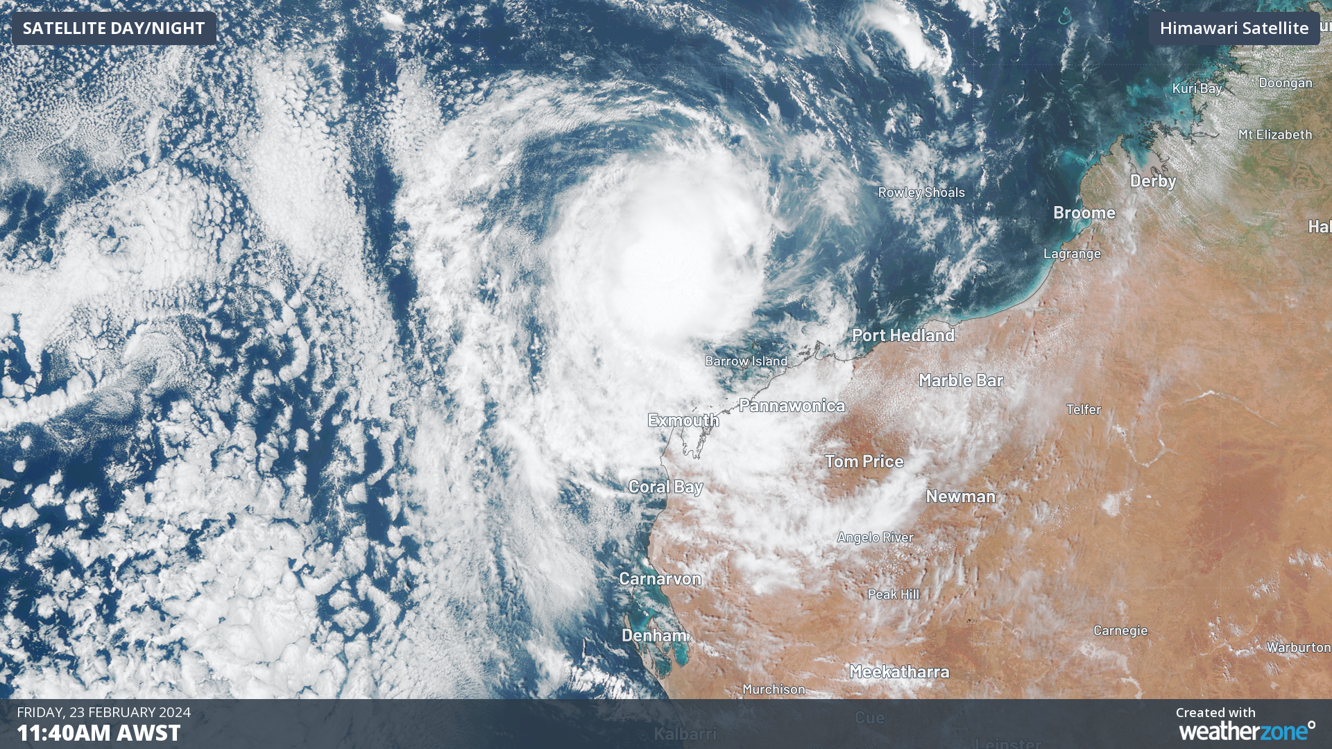
The satellite image below shows ex-Tropical Cyclone Lincoln 370 kilometres northwest of Karratha at 11am WST on Friday morning.
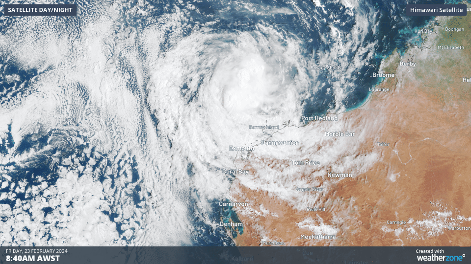
Image: Himawari satellite image showing the three hours leading up to 11:40am WST on Friday, February 23.
Ex- tropical Cyclone Lincoln has travelled 2600km to the west, originally forming in the Gulf of Carpentaria and crossing the NT coast near Borroloola last Friday, February 16.
Lincoln has now moved off the Kimberley coast in WA and strengthened on Thursday and Friday over favourable waters and environmental conditions.
These conditions should cause Lincoln to re-develop into a Tropical Cyclone on Friday night. When the tropical cyclone re-forms, it will keep its original name, Lincoln, the third cyclone named in the Australian region this season.
While Ex-Lincoln is currently well off the Pilbara coast, he is expected to turn to the southwest towards the Pilbara coast on Friday evening.
The map below shows the Bureau of Meteorology’s track map issued at 11:53am on Friday, February 23.
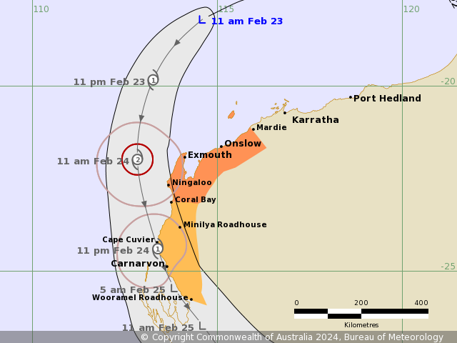
Image: Forecast track map issued by the Bureau of Meteorology at 11:53 am AWST on Friday, February 23. A more recent track map may be available. Source: Bureau of Meteorology
The map above indicated that Lincoln could strengthen further into a category two Tropical Cyclone Saturday morning, as it moves towards the WA coastline.
Tropical Cyclone Lincoln will most likely cross the northern Gascoyne coast later on Saturday, February 24, with destructive winds possible near the cyclone.
On Saturday, Lincoln should just miss the Exmouth and Mardie area, however gales and damaging wind gusts could develop overnight Friday into Saturday in the region. The gales could extend further south to Carnarvon by Saturday evening and then Wooramel on Saturday night.
Destructive winds are possible near Cyclone on Saturday. Abnormally high tides could also cause some flooding of low-lying areas between Mardie and Wooramel Roadhouse.
The map below shows one computer model’s wind gust forecast for 2pm AWST on Saturday, February 24.
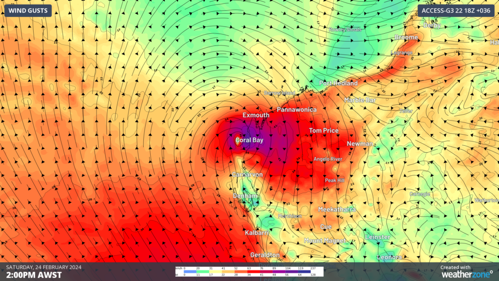
Image: Access G wind gust forecast at 2pm AWST on Saturday, February 24.
There is still some uncertainty with the timing of the onset of these winds on Saturday, so please keep an eye out for the latest warnings and advisories.
Heavy rain should be confined to the path of the cyclone but could develop later Friday in the western Pilbara and spread to the Gascoyne as it continues south on Saturday.
The cyclone should weaken quickly over land on Sunday, however the risk of heavy rain and flooding will continue in its path. Please keep an eye out for the latest warnings and track maps here. For information on Weathezone’s Tropical cyclone services, please contact us at apac.sales@dtn.com.


