Record West Australian rainfall has closed the Eyre Highway that links Perth to the eastern states and flooded outback stations, including Australia’s largest sheep station Rawlinna.
Just two days ago, we ran a story here at Weatherzone with the headline “Colossal rainfall over the Nullarbor“, and again, extremely heavy rain has fallen over the Nullarbor Plain in Western Australia.
The heaviest falls continue to be recorded in southeastern WA in the area centred around Eyre weather station – on WA’s southern coast approximately 300 km east of the SA Border.
Since the deluge began late last week, the Eyre weather station, located at the Eyre Bird Observatory, has now seen:
- 11 mm in the 24 hours to 9 am Saturday
- 141.2 mm in the 24 hours to 9 am Sunday
- 43.8 mm in the 24 hours to 9 am Monday
- 129 mm in the 24 hours to 9 am Tuesday
That makes a running total of 325 mm in the 96 hours ending at 9 am Tuesday, which has absolutely decimated their record for the heaviest rainfall in any single month, which was 203.8 mm in March 1912.
Incredibly, it also means that Eyre has exceeded its annual rainfall average within four days, having registered 325mm from this event so far. Its average annual rainfall is 315.9mm.
Just north of the Eyre weather station at Rawlinna Sheep Station, the pictures tell the story.
The million-hectare station stocking 60,000 Merino sheep is known as Australia’s largest sheep station and is roughly the size of the greater Sydney metropolitan region, but today it is starting to resemble a rapidly filling dry desert lake.
Station Overseer Craig Chandler took to the kayak to rescue the station’s chickens, paddling the poultry to safety.
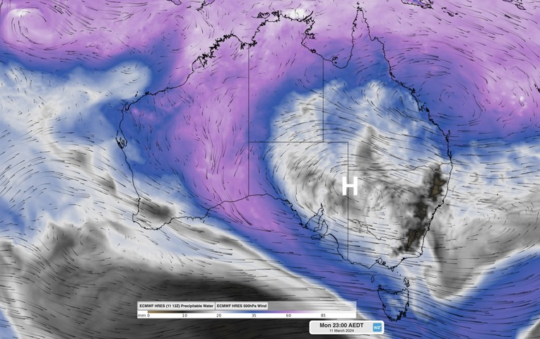
The cause of this unusually heavy rain in one of Australia’s driest regions is illustrated in the weather chart below which shows an upper-level high pressure system centred over the Camerons Corner area at the junction of the NSW/SA, and Qld borders.
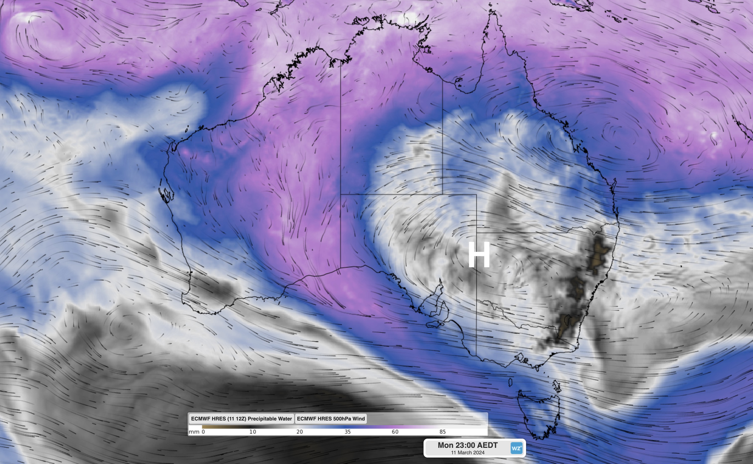
The upper level high is blocking the progression of systems from west to east, enabling a moisture-laden feed of air to flow from the tropics all the way across the interior of WA down towards the Great Australian Bight.
You can see the moist tropical flow indicated by the purply-pink colour on the map above, and rain continues to fall as we publish this story. For more information on Weatherzone’s transport forecasts, please contact us at apac.sales@dtn.com.


