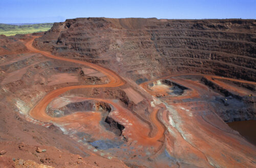
How hot can it get in an open cut mine?
Air temperatures are expected to reach into the forties in multiple states over the weekend. What can the temperature get to in a typical open cut mine? The temperatures we commonly report here at Weatherzone are the official air temperature readings for Bureau of Meteorology sites. The thermometers used are housed in special Stevenson […]
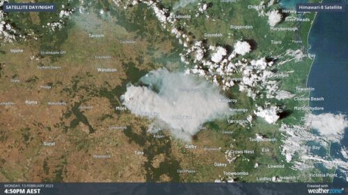
Smoke from massive QLD fires is visible from space
Several large fires continue to burn across southern Qld today, creating smoke plumes so large that they can be seen by satellites sitting more than 35,000 km above Earth’s surface. A wet spring followed by an unusually dry start to summer has caused a build-up of dry vegetation over the southeast inland of Qld […]
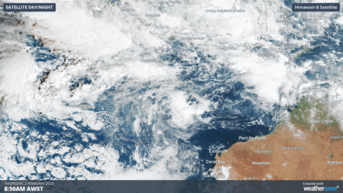
MJO and Tropical Cyclones heading back to Australian Waters
The Madden-Julian Oscillation and the monsoon are starting their second approach of the season towards Australia, along with their elevated risk of tropical cyclone development. The Madden-Julian Oscillation (MJO) is an eastward moving pulse of tropical activity that travels the Indian and Pacific Oceans. It affects Australia the greatest between November and April, but […]
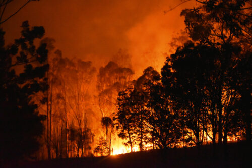
Days of serious bushfire risk ahead for eastern states
Dangerous fire weather is on its way for the eastern states from today (Wednesday) through to at least Saturday, as winds strengthen ahead of an approaching cold front. This will not be your classic super hot, 40-degree type fire weather, however two factors will nonetheless elevate the fire risk: WIND: Gusty westerly winds of around […]
Deluge at Port Hedland
Port Hedland received a quick deluge on Sunday afternoon after a pair of thunderstorms converged over the region. Port Hedland picked up 45mm in the rain gauge, including 11mm in 10 minutes at about 2:30pm WST on Sunday afternoon. This was its heaviest January rain in 9 years, and its wettest day in 8 […]
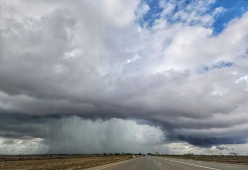
No cyclone but plenty more storms for the Pilbara
A tropical cyclone is no longer forecast to hit the region, but tropical moisture will still lead to another thunderstorm outbreak over the coming week in the Pilbara. After a slow and slightly delayed start to the wet season, thunderstorms have since been a regular feature over the Pilbara region over the last 11 […]
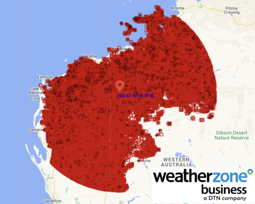
Tropical Cyclone heading towards WA
A tropical cyclone looks to form during the week and should make landfall over the Western Australian coast this weekend. A weak tropical low is currently just north of the Top End and is tracking to the west. While it will remain weak over the next few days, the monsoon is bringing rain and […]
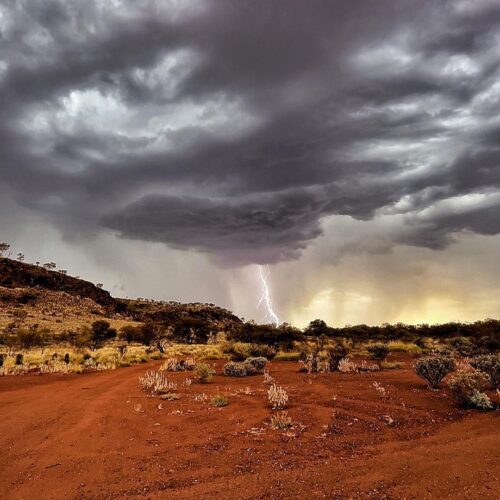
Build-up returns to the Pilbara
After narrowly avoiding the monsoon and ex-Tropical Cyclone Ellie, heat and thunderstorms are returning to the Pilbara. The build-up refers to the time between monsoon onsets, and features building heat, humidity and thunderstorms, particularly in the afternoon. The monsoon last arrived just before Christmas, heralded by the arrival of Tropical Cyclone Ellie, and lingered […]
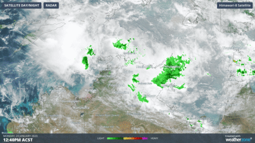
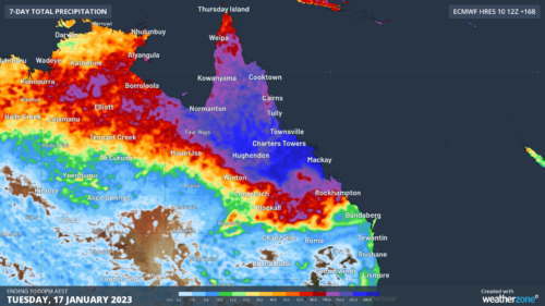
Heavy outback and coastal Qld rain
Parts of outback Queensland have received a really good soaking in the past 24 hours, with numerous falls in the range of around 50-80 mm recorded to 9 am Wednesday in the vicinity of the outback towns of Cloncurry, Longreach and Mt Isa. Other parts of the state have also seen significant falls, and further […]