
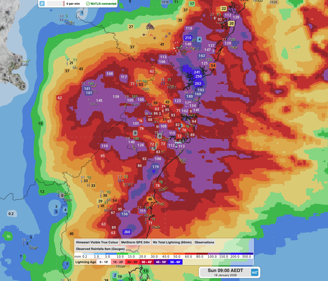
Transport, emergency, energy and port industries in eastern NSW and Sydney were impacted by significant flash flooding with intense and heavy rainfall this weekend.
Rainfall rates between 80 and 140mm in one to three hours were registered across parts of Sydney’s Northern Beaches and Central Coast on Saturday afternoon and evening. In some areas, these rainfall rates are comparable to the tropics and are equivalent to one in 200-to-500-year events. This intense rainfall was caused by a deep feed of moist easterly winds coming off the very warm Tasman Sea, directed over the region by a coastal trough. Parts of the Pacific Highway that connect Sydney to Brisbane, and the Central Coast train line that connects Sydney to Newcastle and beyond, was heavily disrupted by the localised flooding.
Video: 6-hourly rainfall estimates and rain gauge observations since 9am on Saturday morning, as seen on the DTN APAC Stormtracker dashboard.
Further heavy falls have continued overnight, with many locations experiencing their heaviest rain in one to two years. Notable 24-hour rainfall accumulations to 9am Sunday include:
- 346mm at Palm Beach Golf Club
- 264mm at Great Mackeral Beach
- 260mm at Wattamolla
- 250mm at Pearl Beach
- 242mm at Woy Woy
- 209mm at Ettalong
- 194mm at Avalon
- 180mm at Terrey Hills (wettest day on record for the station, with records since 2005)
- 129mm at Norah Head (wettest January day on record, with records since 1996, and wettest day since October 2020 – 5 years ago)
- 134mm at Wisemans Ferry (wettest day since March 2021 – nearly 5 years ago)
- 124mm at Sydney Obs Hill (wettest January day since 1988 – 38 years ago)
- 103mm at Bankstown (wettest January day since 2001 – 25 years ago)
- It was the wettest January day on record (records since year) for these stations: Camden Aiport (140mm – since 1943), Penrith (105mm – since 1996), Mount Boyce (142mm – since 1995), Campbelltown (126mm – since 2007) and Gosford (125mm – since 2014)
- Over 90 locations across NSW with over 100mm
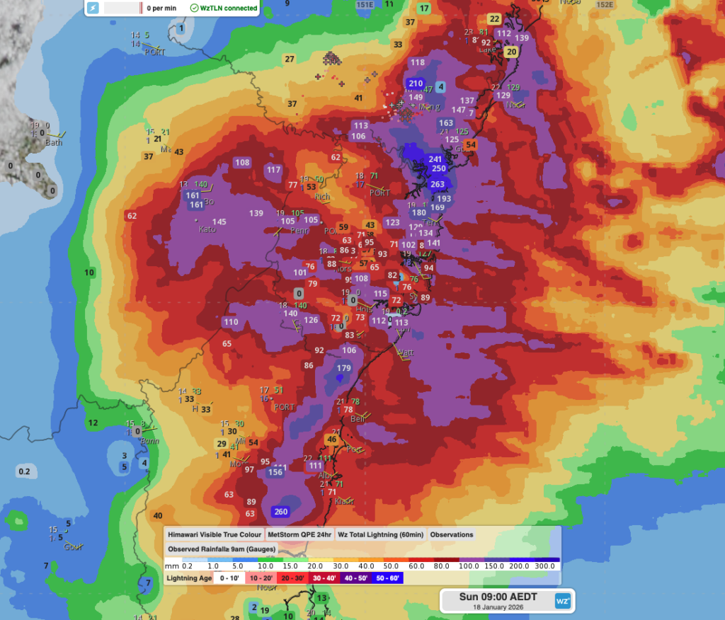
Image: Estimated 24-hour rainfall accumulations and rain gauge observations since 9am on Saturday across the Greater Sydney Metropolitan region, as seen on the DTN APAC Stormtracker Dashboard.
Road and train networks were disrupted by the flash flooding, with Sydney Trains having to halt rail movements between the Central Coast and Sydney, and the slowed the arterial Pacific Highway that connect Sydney to Newcastle and Brisbane. Flooding, combined with strong winds, has caused trees to fall across roads, houses and powerlines, with the SES and power networks responding to thousands of calls for help and outages. Flood prone areas like Narrabeen Lagoon in Sydney’s Northern Beaches have also been evacuated.
Over 19,000 lightning strikes have also been recorded within 100km of Sydney since midnight on Friday, most of which were over the northern suburbs and Central Coast areas.
Heavy rainfall continues to move into the Sydney Basin on Sunday morning, but conditions gradually improved into Monday. As seen in the animation from DTN APAC’s Stormtracker Dashboard below, the heaviest falls contracted north into Sunday afternoon, with showers and more isolated heavy rain extending into Monday.
Video: 6-hourly rainfall rates and 10m wind speeds according to the high-resolution ACCESS-C Sydney computer model.
How DTN APAC’s unique data sources are helping NSW businesses
We help businesses in Australia, Asia and the Pacific prepare for flooding rainfall and other severe weather, across sectors including Roads and Transportation, Emergency Services, Mining, Insurance and Energy.
Grounds are saturated around Sydney and eastern NSW, leaving businesses and industries vulnerable to flooding, toppling of trees and other weather risk hazards.
Our Long-Range Weather Forecasting spans from 14 day to 12 month forecasts.
These forecasts are produced by our meteorologists using raw data provided by international weather agencies.
These forecasts are produced using a combination of techniques, some in the public domain and others developed by DTN APAC.
Our Risk Communicators can then work closely with you to analyse how weather impacts your operations and communicate potential risks. We can then support your risk management planning, and provide situational awareness and post-event reporting when extreme weather events hit hard.
Find out more about our our large range of industry leading products and services or email us at sales.apac@dtn.com




