
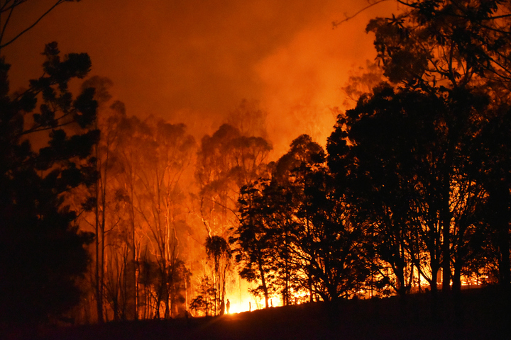
Dangerous fire weather is on its way for the eastern states from today (Wednesday) through to at least Saturday, as winds strengthen ahead of an approaching cold front.
This will not be your classic super hot, 40-degree type fire weather, however two factors will nonetheless elevate the fire risk:
- WIND: Gusty westerly winds of around 30-40 km/h will sweep across the east. Winds will likely be considerably stronger at higher elevations.
DRY VEGETATION: While Australia’s eastern coastal fringe had yet another soggy month in January, most of inland NSW, most of SA, most of inland Victoria, and southern inland Queensland was very dry.
Indeed some parts of western Victoria barely saw a drop of rain in January. That means we could see grassfires – a type of fire which we mentioned in our spring bushfire outlook story last year.
So how severe is the coming fire danger?
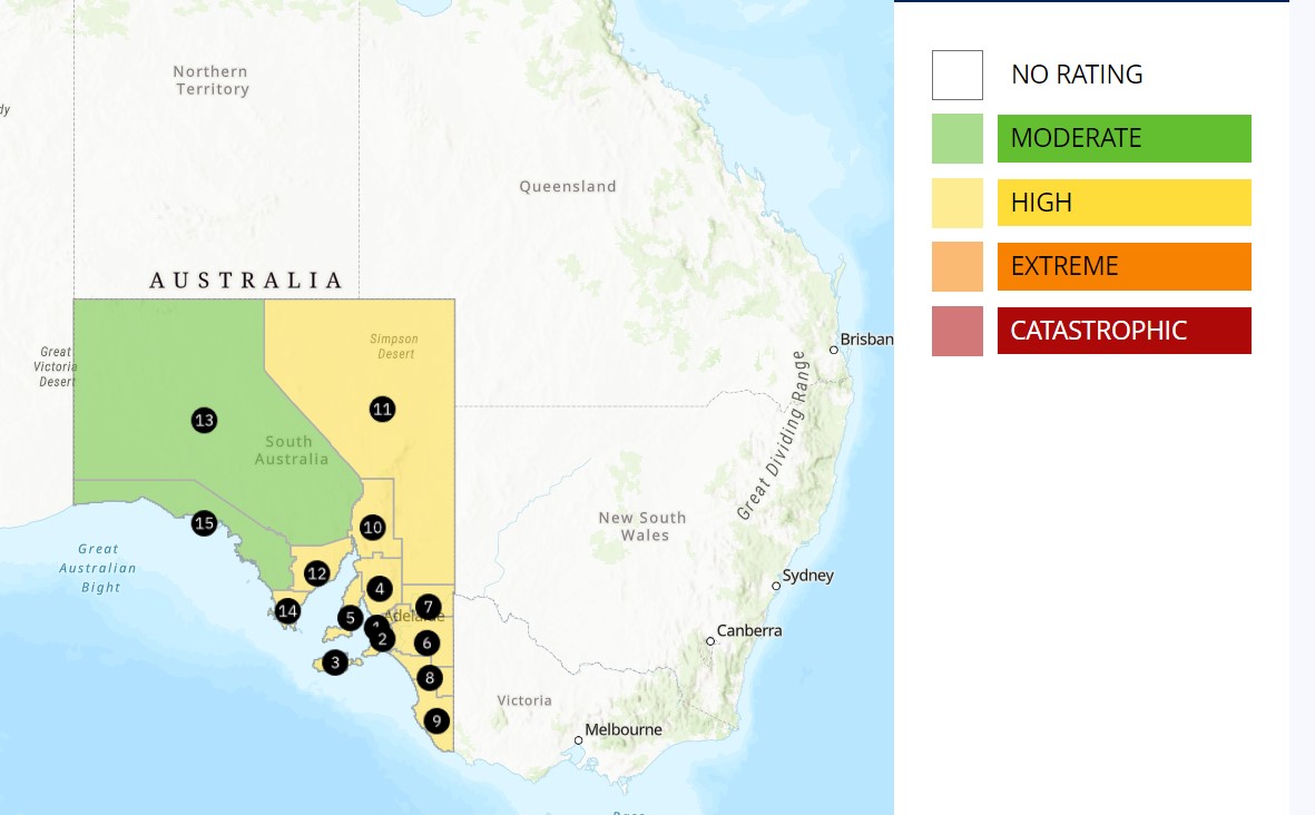
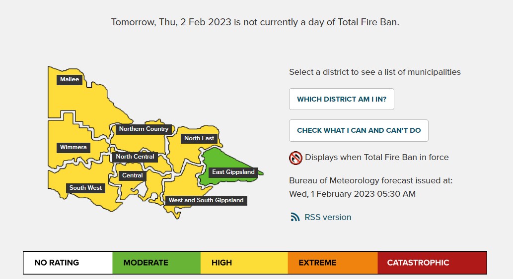
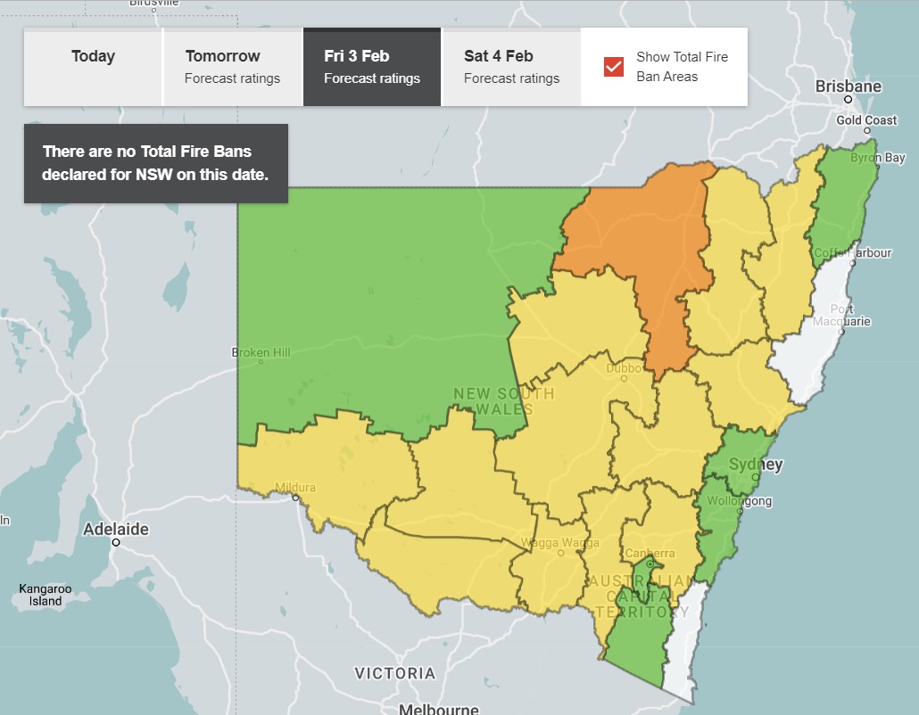
The maps below show the outlook for the day on which the fire danger is expected to be the most severe in coming days (hyperlinked text takes you to the relevant state bushfire authority).
For South Australia it’s Thursday.
For Victoria it’s also Thursday.
For NSW it’s Friday.
For Queensland, the danger peaks on Friday and Saturday, with the maps for both days looking like this.
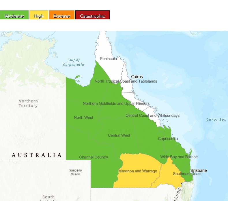
You might have noticed that that each of the above maps is using the same rating system. It didn’t used to be that way, until in September 2022, the National Council of Fire and Emergency Services (AFAC*) issued a new, nationally consistent bushfire danger rating system.
There are four danger levels: moderate, high, extreme, and catastrophic, with simple actions for the community to take at each level.
- Moderate (Green) – Plan and prepare
- High (Yellow) – Be ready to act
- Extreme (Orange) – Take action now to protect life and property
- Catastrophic (Red) – For your survival, leave bushfire risk areas
Fortunately, no locations are tipped to see catastrophic danger this week, but fires can still occur even under moderate fire danger conditions, so please be careful out there and keep checking our warnings page.
It’s also worth mentioning that there will be some very cold air for summer behind the front, so we could literally be seeing light snow falling in the mountains of Victoria and New South Wales on Friday morning, while fires burn not too far away. We’ll let you know if that happens.
READ MORE: SUMMER’S BUSHFIRE OUTLOOK
*If you’re wondering why the acronym for the National Council of Fire and Emergency Services is AFAC, it’s because the organisation was previously called the Australasian Fire and Emergency Service Authorities Council. The name changed but the acronym didn’t.
The Fire Behaviour Index (FBI) that drives the BoM and state fire agencies can be viewed on the Weatherzone Dashboard, allowing you to see where the highest values are expected as well as where they fall in relation to your assets.
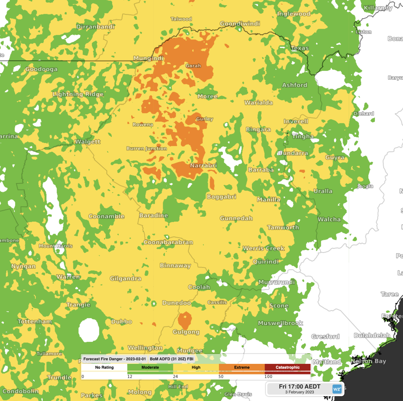
Image: Forecast Fire Behaviour Index at 5pm AEDT on Friday 3rd over the NSW Northern Tablelands, Slopes and Plains
To find out more about out fire prediction and alerting services, please explore our website or email us at apac.sales@dtn.com.




