Prosper in a dynamic world
Search

Smoke from massive QLD fires is visible from space


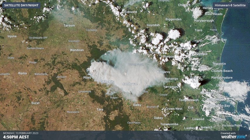
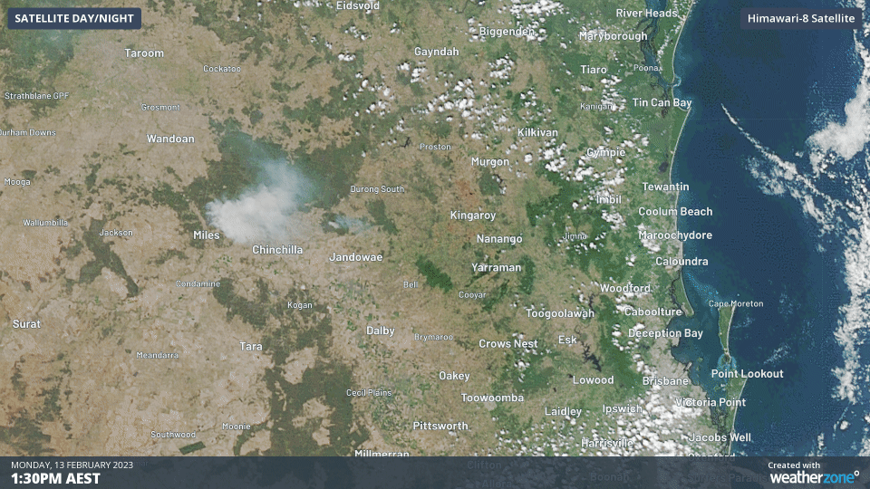
Several large fires continue to burn across southern Qld today, creating smoke plumes so large that they can be seen by satellites sitting more than 35,000 km above Earth’s surface.

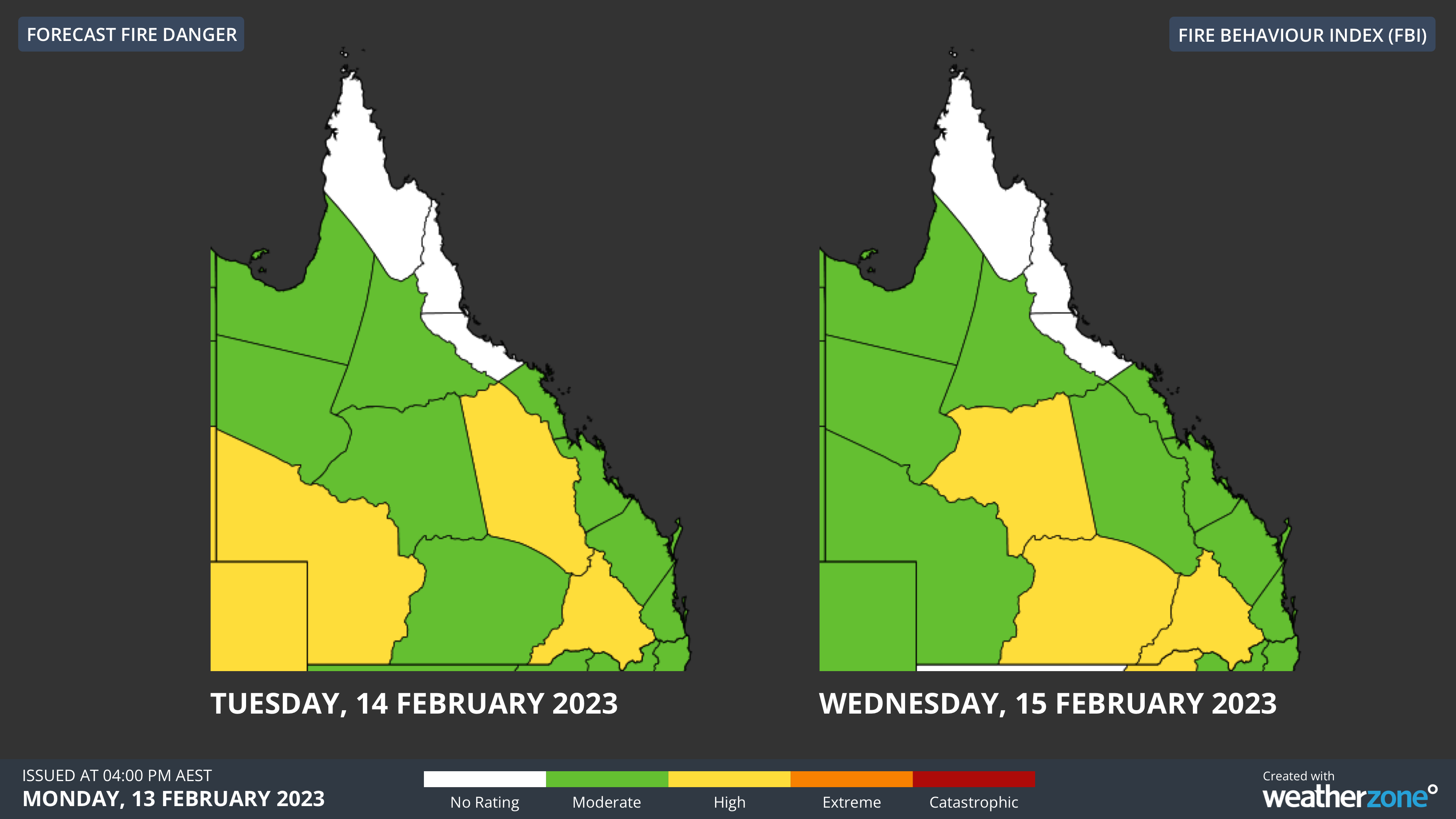
A wet spring followed by an unusually dry start to summer has caused a build-up of dry vegetation over the southeast inland of Qld in recent weeks.

This increased bush and grass fire fuel is now combining with a spell of hot, dry and windy weather, producing High Fire Danger Ratings in some central and southern parts of the state during the first half of this week.

The smoke plumes of several large fires could be clearly seen spreading across southern Qld on Monday and Tuesday. Some of these fires are threatening properties and lives, prompting Watch and Act and Emergency Warning alerts from the Qld Fire and Emergency Services.

In addition to the fires, parts of southeast Qld are likely to see severe thunderstorms on Tuesday. There have already been a few intense storms on Tuesday morning, and more are expected in the afternoon and evening.

Capping off Qld’s mix of dangerous weather this week is a threat of heavy rain, flooding and severe thunderstorms in the far north and northwest, thanks to an active monsoon trough and tropical low. The map below shows how much rain one computer model is predicting over the next three days.

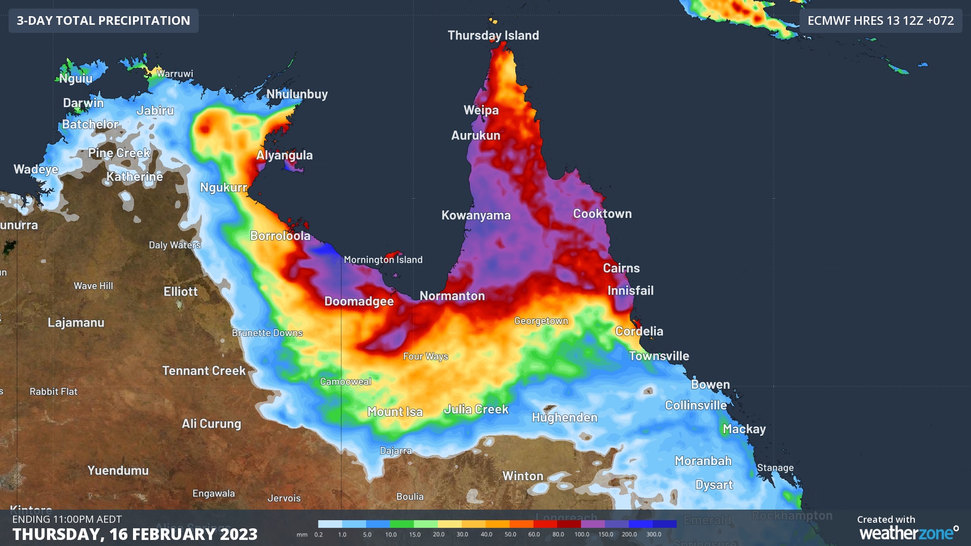
Image: Forecast accumulated rain between Tuesday and Thursday this week, according to the ECMWF-HRES model.

You can find the latest Qld fire warnings here and weather and thunderstorm warnings here.

DTN APAC uses Fire Behaviour Index (FBI) values to create a forecast of fire danger conditions up to 7 days in advanced. When fires are happening, our hotspot detection will alert you to nearby fires (even small ones) so you can take action to protect your personel and assets. To find out more please visit our website or email us at apac.sales@dtn.com.

Latest news

Satisfy your weather obsession with these news headlines from around the nation, and the world.

Rapid El Niño signal accelerating risk for Australian businesses

El Niño–favourable conditions are gathering pace across the tropical Pacific, with key ocean indicators approaching threshold levels and early atmospheric responses emerging.  While uncertainty remains around final El Niño strength, historical analogues show that even weak events can generate widespread impacts, including reduced rainfall, warmer daytime temperatures, increased frost risk, elevated fire danger, reduced tropical cyclone activity, and more. Industries including […]

Australia’s 2025–26 Cyclone Season: Slightly Above Average, Dominated by Severe Systems

Australia has just experienced a highly impactful tropical cyclone season, with more than 60% of systems reaching severe intensity, causing widespread disruption and damage to communities and multiple industries across northern Australia.  The 2025–26 Australian tropical cyclone season officially ran from 1 November 2025 to 30 April 2026. During this six-month period, Australia saw 11 tropical cyclones, with nine […]

What does a ‘super El Niño’ mean for Australia’s businesses?

There are signs that a very strong, or ‘super’ El Niño could develop in the tropical Pacific Ocean later this year. So, what does this mean for Australia’s weather during the second half of 2026? El Niño on the horizon The tropical Pacific Ocean is currently in a neutral state, meaning neither El Niño nor […]

How does DTN help businesses monitor bushfire induced pyrocumulonimbus thunderstorms that ignite more fires?

Intense heat from bushfires during elevated fire danger days can trigger fire-induced pyrocumulonimbus thunderstorms that ignite additional fires. In early January 2026, an extreme heatwave sweeping over southeastern Australia brought catastrophic fire danger to Victoria. Intensely hot bush and grass fires spread erratically and quickly in hot, dry and gusty winds, with pyrocumulonimbus generating lightning, […]