
A tropical cyclone is no longer forecast to hit the region, but tropical moisture will still lead to another thunderstorm outbreak over the coming week in the Pilbara.
After a slow and slightly delayed start to the wet season, thunderstorms have since been a regular feature over the Pilbara region over the last 11 days. The Total Lightning Network (WZTLN) has detected 1.28 million strikes over the region since Saturday 14th , an average of 114,000 strikes every day.
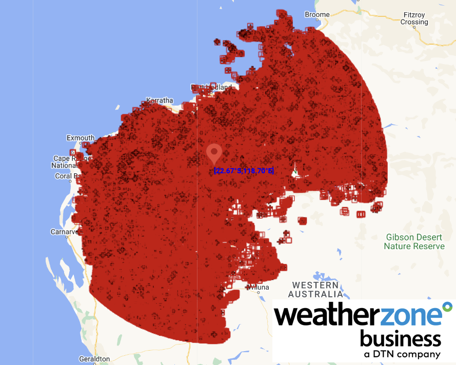
Image: The WZTLN detected 1,284,101 lightning strikes over the Pilbara region between Saturday 14th and Tuesday 24th inclusive.
Earlier this week, we warned about an impending tropical cyclone that was expected to make landfall over the region. A fortunately timed and powerful thunderstorm over the Top End proved to be the difference. This storm took moisture away from the low and allowed wind shear (wind changing speed and direction with height) to tear the tropical low apart. After this, forecast models made the abrupt but correct forecast change to show that this system would no longer become a tropical low.
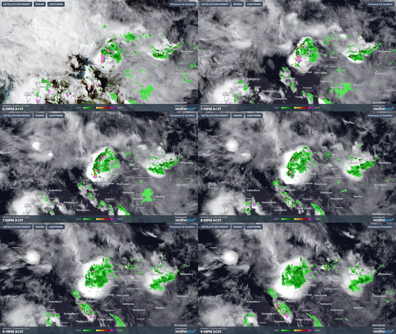
Image: The squally thunderstorm as it passed over Darwin that took energy away from the tropical low, causing it to not become a tropical cyclone.
Despite this tropical low being unlikely to become a tropical cyclone anymore, it will still provide an influx of tropical moisture to the Pilbara region once again. After a brief reprieve from thunderstorms on Australia Day when storms will contract to the west, scattered to occasionally widespread thunderstorms will spread through the region from Friday. Saturday is looking like the day where widespread thunderstorms are the most likely, aligning with the arrival of the tropical low.
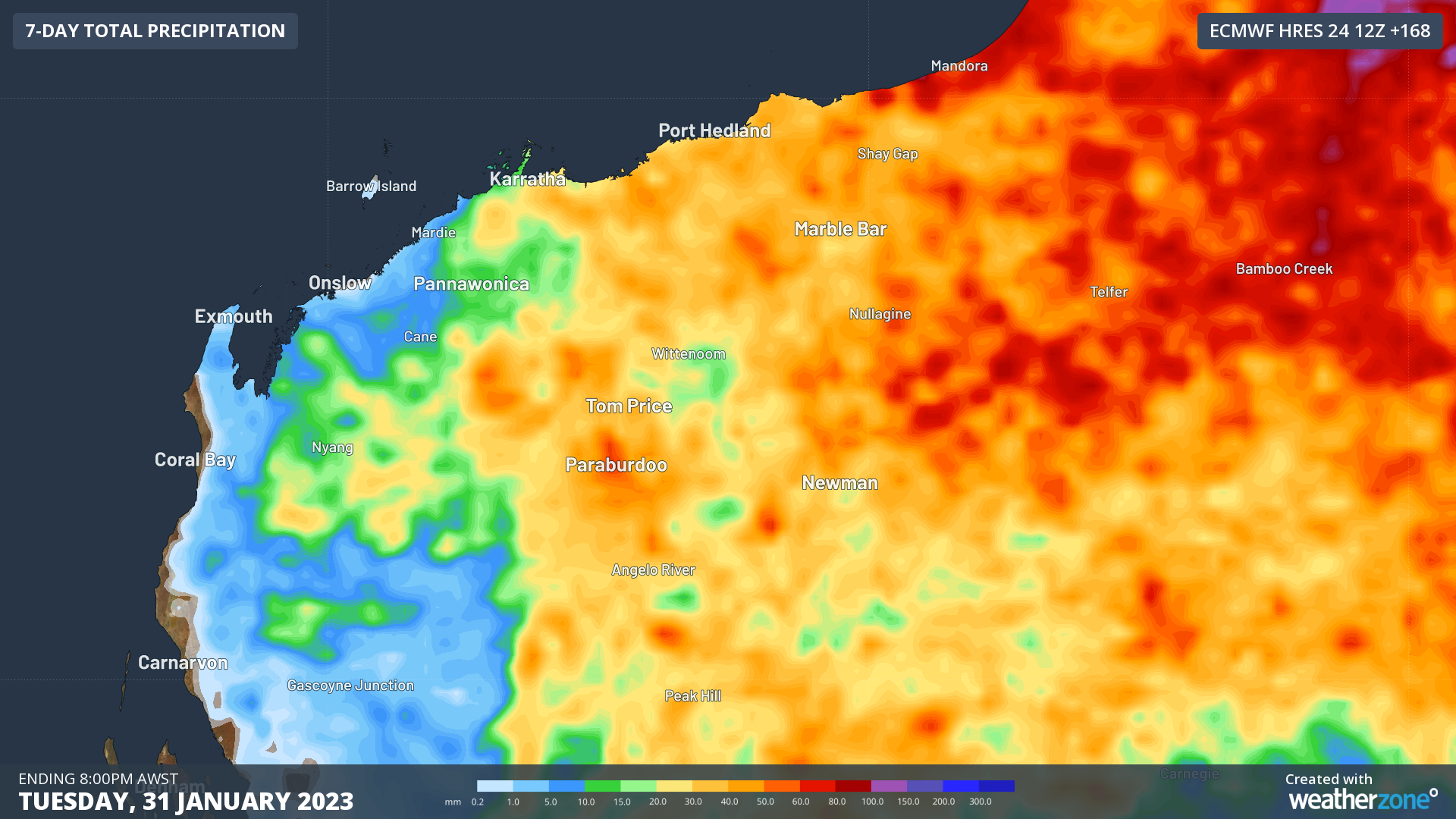
Image: 7-day forecast rainfall from ECMWF over the Pilbara.
Plenty of these storms will be severe with heavy rain the most likely, although damaging winds certainly can’t be ruled out. Some severe storms are breaking out just inland of Onslow on Wednesday afternoon. Severe thunderstorms warnings can be viewed on the Weatherzone website.
DTN APAC uses the WZTLN to provide lightning alerts when storms are near your assets. This starts a simple countdown procedure that makes sure employees know when a storm is nearby and when it is safe to return to work. This keeps expensive downtime to a minimum without sacrificing safety. To find out more about how the WZTLN can help your business, please email us at apac.sales@dtn.com.




