
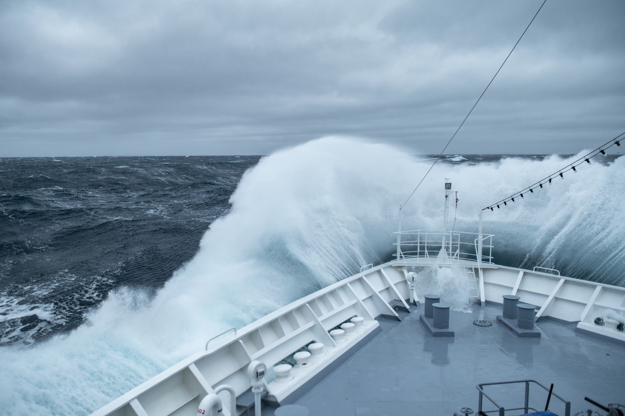
Seas to the north and east of Australia are experiencing periods of increased activity this week, leading to disruptions to port, maritime and offshore operations.
Intense and hazardous Tasman Sea
Ocean conditions across NSW’s South Coast rapidly deteriorated last Friday as a deep feed of easterly winds whipped up large and dangerous seas. The Batemans Bay Surfrider buoy recorded an increase of nearly 3 metres in significant wave heights in the 8 hours to 9pm on Friday.

Image: Significant wave height recordings from Surfrider buoys off the NSW coastline between Thursday and Tuesday, January 15-20, 2026. Source: Manly Hydraulics Laboratory.
The surge of large east-to-southeast swell moved up the coast throughout Friday and into the weekend, with maximum wave heights reaching over 9 metres off the Sydney coast on Saturday morning. A Coastal Hazard Warning for Damaging Surf was issued for coastal areas south of Seal Rocks around this peak period of swell activity.
Week of activity in the Tasman and Coral seas
Video: 10 metre wind speeds across the Tasman and Coral seas this week showing areas of swell generation directed towards Australia’s East Coast.
As seen in the video above, storms in both the Tasman and Coral seas have continued to blow strong easterly winds into this week, directing persistent swell towards the East Coast of Australia.
While the largest waves were experienced on Saturday, the swell is not expected to drop below 2 metres across much of coastal NSW between the weekend and much of this working week. Lengthy periods of significant swell can cause long lasting delays across shipping routes with port operations being impacted.
Video: Significant wave heights across the Tasman and Coral seas this week.
Coasts between Jervis Bay and Seal Rocks, including Sydney, will receive the highest energy across the period, with much of this energy coming from longer period swell from the east to southeast. This combination of size, period and direction is particularly notorious for causing significant coastal erosion, disruption to port, ferry and maritime operations, and bringing deceptively powerful surf and rip currents.
Video: Peak wave period across the Tasman and Coral seas this week.
Tropics buzzing with energy
Port, shipping and offshore operations across northern Australia are also on high alert with increased tropical activity currently affecting the region. Two potential tropical lows, 16U and 17U, are currently being monitored for potential tropical cyclone intensification this week
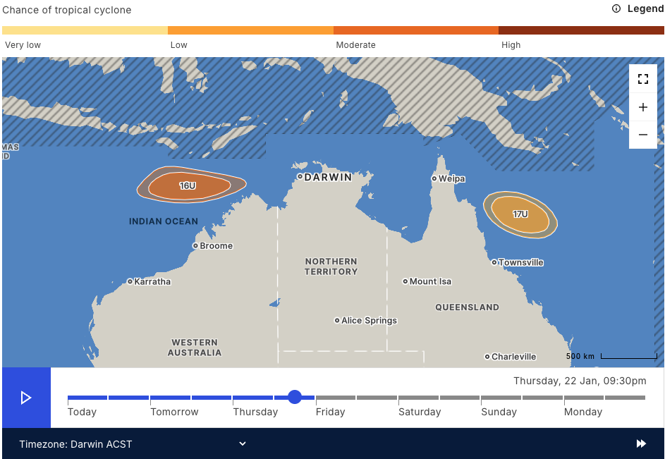
Image: Chances of Tropical Low 16U and 17U forming into tropical cyclones on Thursday afternoon. Source: BoM
DTN APAC is currently offering support through ongoing briefings and forecasts to port and maritime operations that may be impacted by either of these systems. By providing the latest meteorological forecasts, our customers are able to make informed decisions regarding deployment or harbouring of ships, tropical cyclone tie-down proceedures, or workload management, well ahead of the first signs of the system approaching.
How DTN APAC assists marine, ports and offshore industries
DTN APAC offers a comprehensive suite of services, refined through years of collaboration with the marine, ports and offshore industries, to optimise the safety and efficiency of your operations.
We work with you to understand your intrinsic operational challenges and customise high-precision forecasting, metocean and aviation services to your exact location and operational scope.
When working offshore, our solutions can underpin planning and safe execution for offshore oil and gas enterprises and wind farms. Our data can support your exploration, development, rig moving, shuttle tanker operations, and production and decommissioning phases. Whether your crews are on-site, being transported to shore, or diving to perform maintenance, we deliver tailored weather risk briefings to ensure you choose the optimal time to proceed.
DTN APAC’s trusted nowcasting and forecasting system, OpticastTM, allows you to rapidly respond to changing conditions offshore, en route and in port. We take your port topography and berth orientation into account, ensuring site-specific forecasts. For offshore oil & gas, wind farms, ports and logistics, we have your weather situational awareness covered, no matter where you are. We deliver real-time severe weather and lightning alerts to your team via your integrated dashboard: Portzone, and our Weatherguard app.
DTN APAC’s Total Lightning Network (TLN) ensures you avoid hours of unnecessary downtime by providing the most accurate technology in lightning detection and alerting. Safeguard your teams and assets with lighting and Dangerous Thunderstorm Alerts (DTAs), customised to your existing parameters and delivered in real-time across all devices in your network. You gain full spatial awareness of developing severe weather systems, allowing you to plan ahead and, where needed, execute your shutdown and evacuation procedures.
With extreme conditions slowing production and affecting infrastructure, safety and transport, trust us to deliver Australia’s most precise weather data and tailored insights, giving you decisive confidence when it’s most needed.
Learn more about our large range of industry leading products and services or email us at sales.apac@dtn.com
Thumbnail image source: iStock / Page Chichester.




