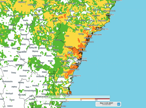
Extreme fire weather to hit NSW industries and businesses on Wednesday
A burst of record-challenging October heat and blustery winds will cause Extreme fire danger ratings and Total Fire Bans over parts of NSW on Wednesday, including Sydney. Clear skies and dry air have allowed intense heat to build over western NSW, southern Queensland and northern SA in the last few days. On Monday, the temperature […]
2025 southwest monsoon completes retreat from India
The 2025 Indian Southwest Monsoon that brings cooler temperatures and heavy flooding rainfall to Indian transport, mining and utility industries completed its retreat from India on October 16, 2025. As seen in the map below issued by the Indian Meteorological Department (IMD), the Indian Southwest Monsoon withdrew from the entirety of the Indian sub-continent on […]
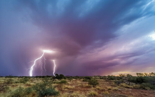
Northern Australia mining operations impacted by 4 million lightning strikes, severe heatwaves and fires
The north Australian build up period is in motion with a broad trough drawing intense heatwave conditions and triggering widespread thunderstorms across Australian mining areas. Intense thunderstorms have lit up the north Australian skies over the past week as a broad horseshoe shaped low pressure trough extended across the country. DTN APAC’s Total Lightning Network […]
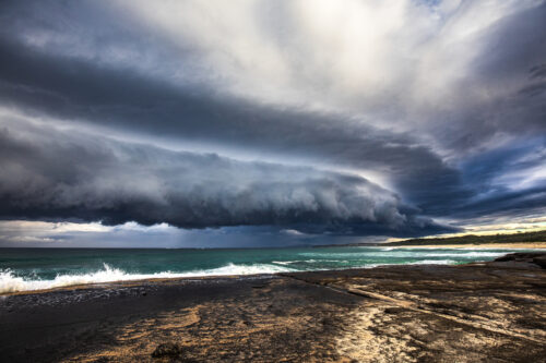
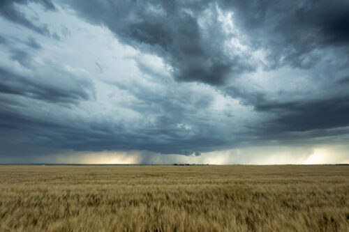
Severe thunderstorms to hit NSW businesses and industries on Friday
Intense thunderstorms are likely to pummel parts of NSW on Friday, with damaging winds, large hail and heavy rain all a risk for mining, transport, insurance and aviation sectors. A cold front and associated low pressure trough will sweep across NSW on Friday, causing a relatively cool air mass travelling from the south to clash […]
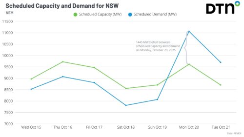
Springtime temperature see-saw threatens NSW with low energy reserves
Two bursts of heat will impact Sydney and NSW in the coming week, driving high energy demand and a forecast Lack of Reserve Level 2 (LOR2) issued by AEMO. Bursts of springtime heat moving east The DTN forecast for Sydney below, generated by our professional team of weather risk analysts, shows two spikes in heat […]
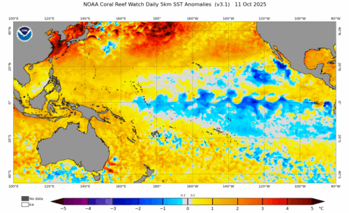
US Climate Prediction Center declares La Niña – what this means for Australian industries?
A La Niña advisory has been issued by the US Climate Prediction Center (CPC), indicating that La Niña conditions have emerged in the tropical Pacific Ocean and are expected to continue for the coming months. What is La Niña? La Niña is one of three phases of the El Niño-Southern Oscillation (ENSO), a coupled ocean-atmosphere […]
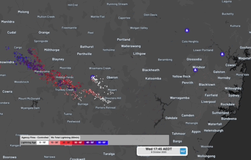
Severe thunderstorms, dry lightning and damaging winds spark fires over NSW
Fires were triggered in central NSW by dry lightning on Wednesday as high-based severe thunderstorms tracked over the region which also produced damaging winds. The satellite loop below shows a cloudband moving over NSW on Wednesday afternoon and evening. Clear skies through the earlier part of the day allowed ample surface heating, helping fuel and […]
Rain remains elusive for many Australian agricultural and forestry industries despite expectations of a wet spring
Australian agricultural, forestry and fire emergency agencies and industries that were hoping for a wetter than average spring have been left disappointed by a lacklustre start to the season, despite the emergence of a strong negative Indian Ocean Dipole in recent weeks. Official rainfall outlooks at the end of August were pointing to a good […]
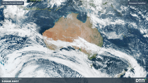
Vast northwest cloudband brings record rain to WA gold mining centre
A huge northwest cloudband stretching from Indonesia to waters east of New Zealand has delivered the heaviest October rainfall on record to the WA gold mining city of Kalgoorlie. Extending at least 8000km, the cloudband has brought rain over the past couple of days not just to WA, but all the way east to large […]