
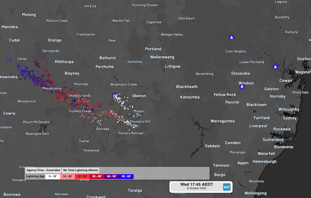
Fires were triggered in central NSW by dry lightning on Wednesday as high-based severe thunderstorms tracked over the region which also produced damaging winds.
The satellite loop below shows a cloudband moving over NSW on Wednesday afternoon and evening. Clear skies through the earlier part of the day allowed ample surface heating, helping fuel and trigger high-based thunderstorms embedded in the cloudband.
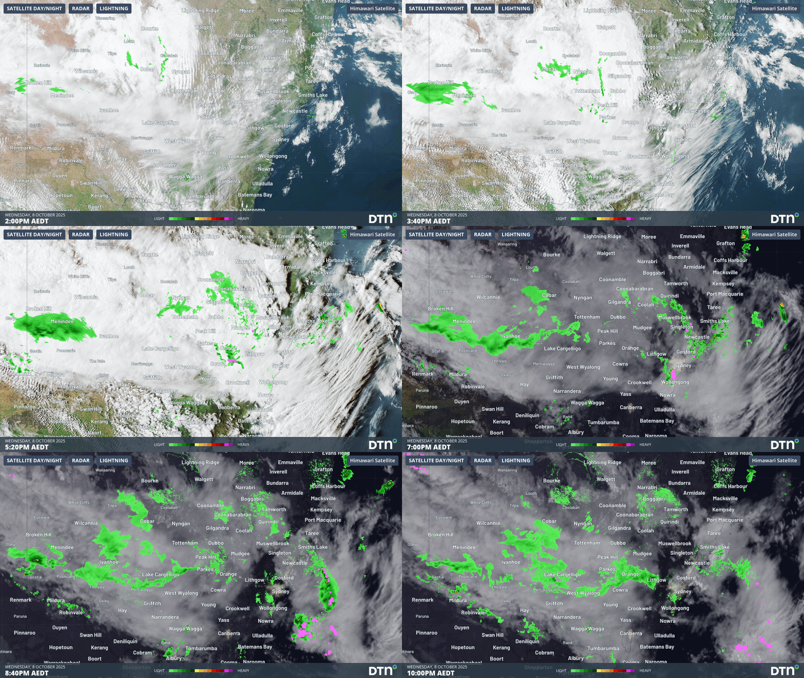
Image: Visible satellite imagery, radar (green) and lightning (purple) on the afternoon and evening of Wednesday, October 8, 2025.
Below the cloudband, hot and dry northwesterly winds made for a very dry sub-cloud layer that rapidly evaporated any precipitation from the cloudband and thunderstorms.
By the time the first round of thunderstorms had moved off into the Tasman Sea, the most rainfall accumulated in a rain gauge was about 3 mm at Shooters Hill, south of Oberon.
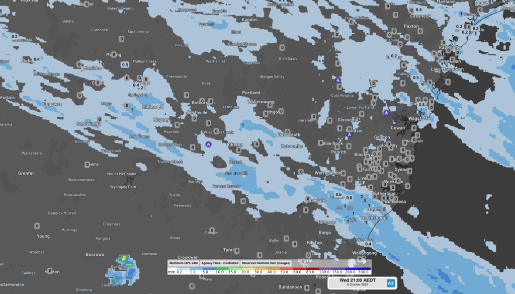
Image: DTN Quantitative Precipitation Estimate (QPE) and observed rainfall since 9am across the region to 9pm.
Wednesday’s mostly dry thunderstorms followed a relatively dry spell in the preceding 4-5 weeks, which resulted from a rare Sudden Stratosphere Warming (SSW) event above Antarctica in September and early October. This prolonged lack of rain has primed the vegetation in the region for fire.
DTN’s Total Lightning Network (TLN) recorded over 16,500 lightning strikes within 300km of Lithgow between 4pm and 10pm on Wednesday. Of these strikes, 2,545 were cloud-to-ground lightning capable of igniting fires, shorting power networks and striking people.
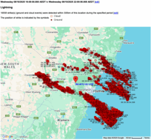
Image: DTN APAC’s TLN detected 16,558 lightning strikes within 300 kilometres of Lithgow between 4pm and 10pm AEDT on Wednesday, October 7, 2025.
The NSW Rural Fire Service was managing over 40 active fires across NSW when response to at least 2 additional bushfires was needed following the passage of the thunderstorms in the Oberon region.
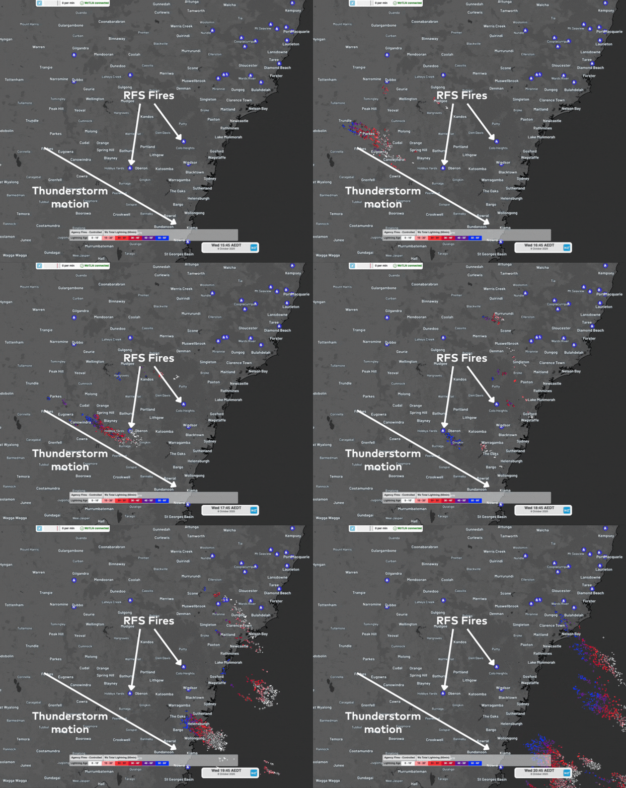
Image: NSW RFS fires and DTN’s TLN reporting lightning over a fire ground west of Oberon as seen on the DTN APAC Stormtracker dashboard.
The very dry layer below the cloudband, along with strong winds in the upper parts of the atmosphere also brought damaging wind gusts to the region. The strongest wind gusts reported were:
- 98km/h at Bellambi (Illawarra)
- 96km/h at High Range (Illawarra)
- 82km/h at Mudgee (Central Tablelands)
- 80km/h at Cessnock (Hunter)
- 78km/h at Orange (Central Tablelands) and Merriwa (Hunter)
Strong and gusty winds help fan bushfire flames and promote erratic, unpredictable fire behaviour, making it difficult for fire management agencies to contain them.
Active thunderstorm period in the coming days
Unfortunately for fire management agencies, thunderstorms are once again on the cards for central and northern NSW on Thursday, before moving into northeastern NSW and Queensland on Friday.
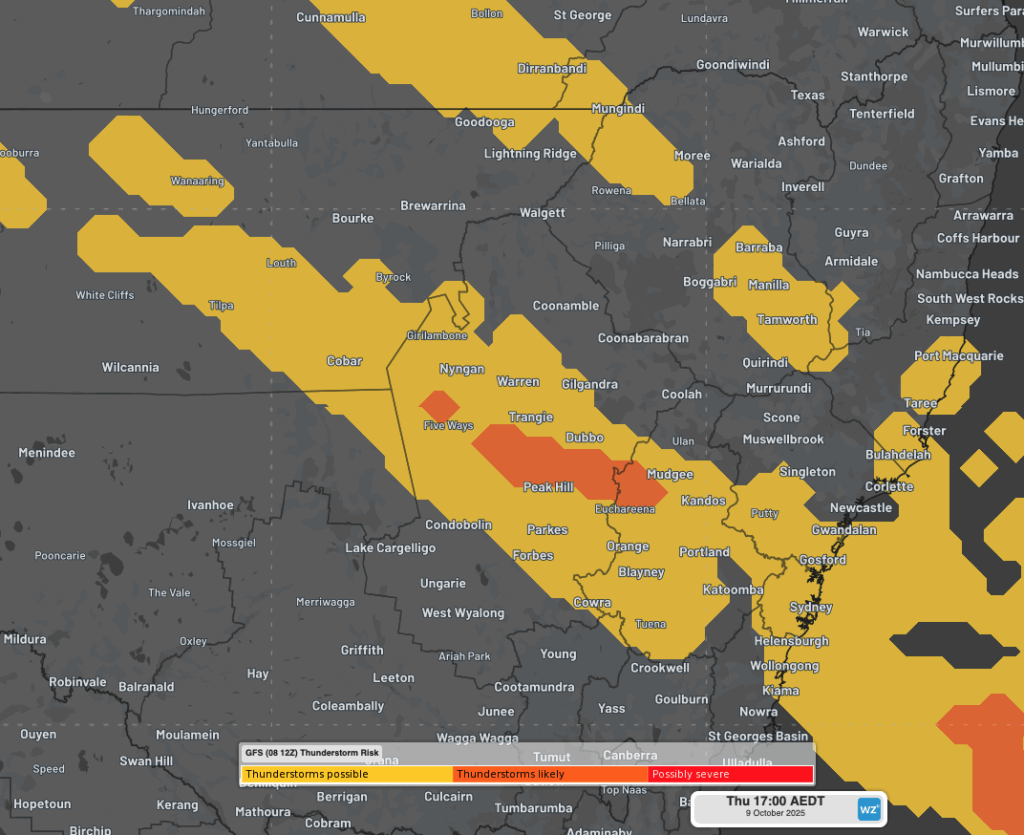
Image: GFS Thunderstorm forecast at 5pm AEDT on Thursday, October 9, 2025 as seen in the DTN APAC Stormtracker dashboard.
Widespread severe thunderstorms are expected to develop with a broad low pressure trough over the Northern Territory, northern South Australia, NSW and Queensland this weekend. Enhancing this thunderstorm activity will be very warm conditions across central and eastern Australia, bringing an elevated bushfire risk period lasting until early next week.
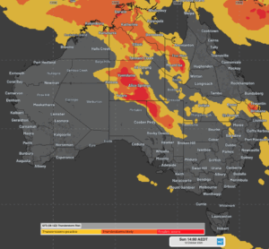
Image: GFS thunderstorm forecast at 2pm AEDT on Sunday, October 12, 2025.
How DTN APAC Services Fire-Prone Outdoor Industries
Working in often challenging conditions across high-risk outdoor operations including forestry, emergency services, mining, rail, and utilities, our consolidated weather services ensure full situational awareness for you and your team.
DTN APAC serves fire-prone outdoor industries, delivering trusted weather data and severe weather alerting to maintain safety, protect your assets and underpin your operational planning.
Reinforce your Prevention, Preparedness, Response and Recovery (PPRR) efforts with our tailored services.
Prevention: Utilise our seasonal outlooks and daily forecasting to identify and implement prevention measures. Understand the climate risks affecting your operations. Calculate optimal timing for maintenance activities, vegetation management, and scheduled shutdowns.
Preparedness: Gain understanding of bushfire risk in the days, weeks and months leading up to peak fire season. Use DTN APAC’s seasonal outlooks and 14-day forecasting to plan workforce deployment, equipment positioning, and preventative operations such as controlled burns or asset maintenance.
Response: We deliver fire danger forecasts and provide nowcasting and forecasting of severe weather events, including thunderstorm/lightning detection and alerting, to give you full situational awareness of emergency conditions likely to impact your operations and infrastructure.
Recovery: Assess the weather risks affecting post-incident recovery and restoration processes. Utilise post-event analysis reports to support insurance claims, evaluate operational response effectiveness, and inform future risk management strategies.
We work to bring you full situational awareness so you can mitigate risk, ensure workforce safety, and maintain operational continuity across your outdoor assets.
See our Case Study on how Tasmania Fire Service (TFS) improved lightning detection and continued optimising preparations for challenging fire seasons ahead with DTN APAC’s full suite of solutions.
Learn more about our large range of industry leading products and services or email us at sales.apac@dtn.com




