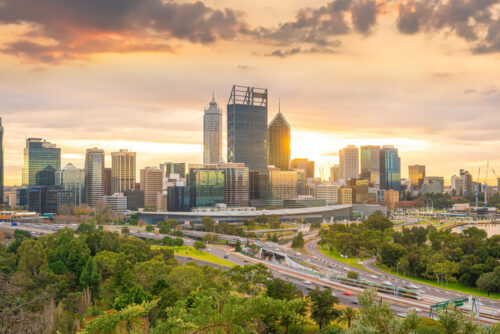
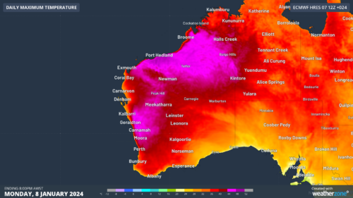
Another 40ºC day in Perth, afternoon storms possible
Temperatures are going to soar in Perth and other areas of southwestern Australia today, with thunderstorms also on the cards from this afternoon. A low pressure trough will draw a very hot air mass towards Australia’s west coast on Tuesday. The presence of this west coast trough will help delay the sea breeze in Perth, […]
Big week of weather ahead for Australia
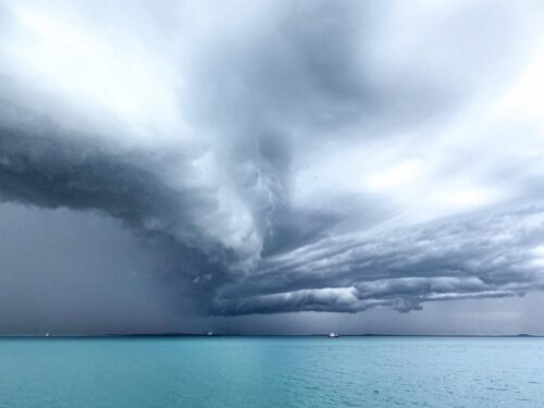
The Australian region is going to see a volatile mix of weather this week, including heavy rain, thunderstorms, flooding, heatwaves, bushfires and possibly a tropical cyclone or two. An active monsoon trough, a large pool of hot air, abnormally warm sea surface temperatures around Australia, and the passage of a cut-off upper-level low pressure system […]
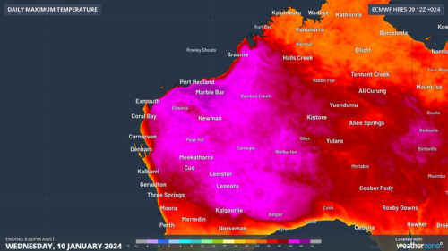
Four weeks above 43ºC in Marble Bar
Marble Bar is on track to register four straight weeks of daily temperatures above 43ºC, possibly setting a new extreme heat record in a town already world famous for its relentless summer temperatures. Marble Bar made international headlines in the 1920s when it registered 160 consecutive days above 37.7ºC (100ºF) in 1923-24, a world record […]
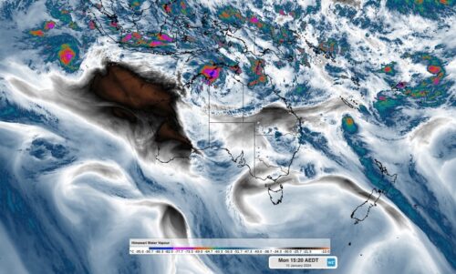
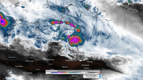
Could we see a tropical cyclone this week?
Australia’s northern tropics are awakening, with growing potential for tropical cyclone development later this week. The image below shows the cloud and thunderstorms impacting northern Australia on Wednesday morning. Image: Himawarri-9 satellite image at 11:20am on Wednesday, January 10. As we wrote yesterday, the monsoon trough is set to arrive in Australia on […]
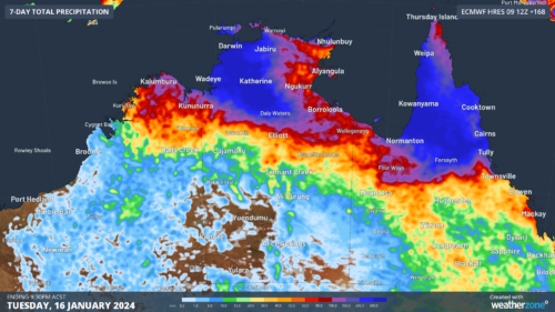
Monsoon arriving over northern Aus this week
The Northern Australian Monsoon will arrive over the tropics this week, bringing a possible tropical cyclone, wind, rain, storms, and welcome relief from the oppressive tropical heat and humidity of the last few weeks. Image: Cloudbands and thunderstorms building around the Top End and Arafura Sea as the monsoon builds. The monsoon is one of the […]
Extreme fire danger and heatwave warnings in WA
Scorching heat is set to impact WA this week, with extreme heatwave and fire weather warnings in place for several districts in the state. The satellite image below shows clear skies over most of WA on Monday morning, being caused by warm and dry winds being driven over the state from the east by […]
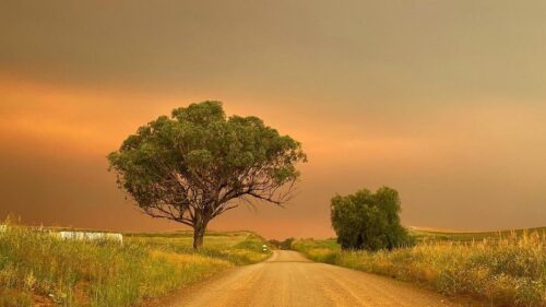
NSW fires generate thunderstorm and 1500 km smoke plume
A large fire near Narrabri in North Western NSW has produced a fire-generated thunderstorm and a smoke plume so large that it can be seen from space stretching around 1500 km across the Tasman Sea. An Emergency Warning was in place on Tuesday morning for the Duck Creek fire in the Pilliga Forest about 17km […]
Two Qld locations register Australia’s 3rd and 4th wettest day on record, provisional data shows
Some of the heaviest rain ever observed in Australia has hit Queensland’s North Tropical Coast during the last few days, resulting in widespread major flooding and landslips. Rainfall has been relentless over northeast Qld ever since Tropical Cyclone Jasper made landfall near Wajul Wajul on Wednesday, December 13. This 5-day spell of wet weather was […]
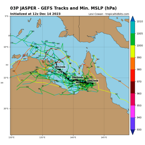
Will Jasper become a cyclone again next week?
The remnants of Tropical Cyclone Jasper could hang around northern Australia into next week, with some models suggesting it could re-intensify near the Top End. So, what can we expect to see from Ex-Tropical Cyclone Jasper next week? Tropical cyclone Jasper hit the north Queensland tropical coast on Wednesday evening as a category two system […]