
Scorching heat is set to impact WA this week, with extreme heatwave and fire weather warnings in place for several districts in the state.
The satellite image below shows clear skies over most of WA on Monday morning, being caused by warm and dry winds being driven over the state from the east by a high pressure ridge.
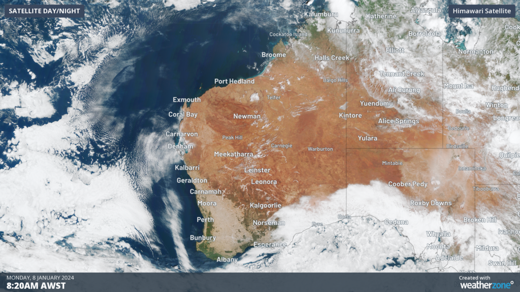
Image: Himawari-9 satellite image at 8:20am AWST on Monday, January 8.
These clear skies and easterly component winds are dragging an extremely hot air mass across northern and western parts of WA and elevating fire danger ratings in some areas.
Daytime temperatures will reach the low to mid-forties over the Pilbara, Northern Interior, the Gascoyne on Monday afternoon.
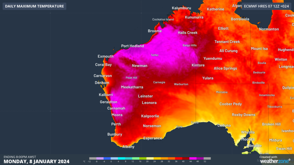
Image: Maximum temperature forecast for Monday, January 8, according to the EC model
This heat will extend into the Goldfields and South Interior early this week before moving into the Eucla district by Wednesday.
Unfortunately, there will be no little overnight, with the minimum temperatures failing to drop below the high twenties to low thirties across some parts of WA early to mid this week.
The map below shows the warm overnight temperatures forecast on Monday night.

Image: Minimum temperature forecast for Monday night, January 8, according to the ECMWF model
The warm daytime and night-time temperatures are behind the severe to extreme heatwave conditions forecast over the next three days in WA.
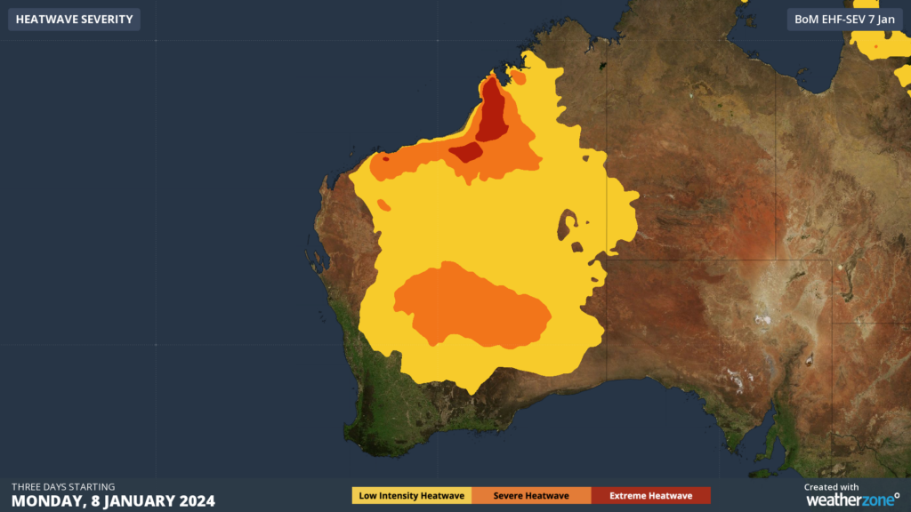
Image: Heatwave forecast for the three days starting on Monday, January 8, according to BOM.
The hot, dry and windy conditions are also going to elevate fire danger in the region this week.
Extreme fire danger is forecast for the Burrup, Yarra Yarra, Swan Inland North, Swan Inland South, Brockman, Blackwood, Mortlock, Stirling North and Stirling West on Monday.
A gusty southwesterly change will move into the region in the late afternoon and evening as a coastal trough moves east and over the land.
This wind change and afternoon seabreezes could prove difficult for firefighters in the extreme fire danger districts on Monday.
Looking ahead, the hot airmass will spread further south from Wednesday, with the heat easing slightly across parts of northern WA on Thursday. However, heat could return to northern WA on the weekend as the potential arrival of the monsoon trough over the NT moves another hot airmass across northwestern Australia.


