Welcome rain returning to WA this week
A series of cold fronts will deliver much-needed rain to southwestern Australia this week, easing a drought that has broken records over the past seven months. The animation below shows cloud streaming over WA on Tuesday morning ahead of an approaching cold front. This is the first in a series of cold fronts and low […]
Northwest cloudband to bring welcome rain
There’s a feature on this week’s weather charts which we haven’t seen for many months in Australia and which is a sign that winter is almost upon us: a northwest cloudband. Northwest cloudbands are vast layers of cloud that flow over Australia from the northwest. Once fully developed, the cloudband stretches across the country like […]
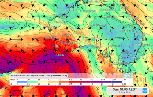
5 cold fronts bearing down on WA
A series of cold fronts are setting their sights on southern WA in the next 10 days, bringing fierce winds, showers, thunderstorms and cooler temperatures. The stubborn high-pressure system that has sat over the Bight for weeks, preventing cold fronts from making it to WA, will finally move east this week. This will cause an […]
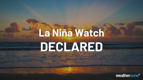
Australia officially on La Niña alert
The BoM has officially placed Australia on a La Niña watch, less than a month after El Niño was officially declared over. “There are some early signs that a La Niña might form in the Pacific Ocean later in 2024,” the BoM reported in its May 14 update. “As a result, the Bureau’s ENSO [El […]
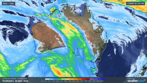
More rain and storms for WA
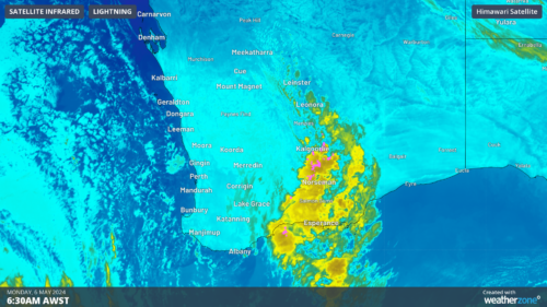
Days of rain and thunder are on the cards for some western and central parts of WA, with the potential for some decent falls in the region. The map below shows showers and thunderstorms approaching the Gascoyne and Upper West districts on Monday morning. Image: Himawari-9 satellite image combined with Weatherzone radar and lightning data, […]
500km line of storms sweeping across the Goldfields, WA
Total Lightning Network captured over 32 thousand lightning strikes in the Kalgoorlie region on Sunday and Monday, with more rainfall to come at the end of this week for the state’s southwest. The image below shows a 500km line of thunderstorms stretching between Leinster and Salmon Gums on Monday morning as the sun rises. Image: Himawari-9 […]
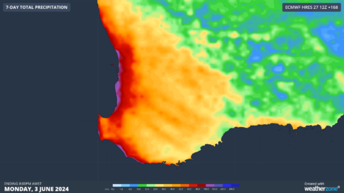
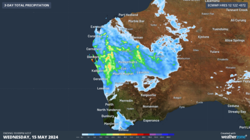
Heaviest May rainfall in 82 years recorded in WA town
Parched areas of southwest WA have finally seen some rain this week, with Wandering recording its highest May rainfall in more than 82 years and the most rainfall the town has seen in 13 months. The rain event began on Wednesday, with Bunbury recording a 2-day total of 55 mm to 9am on Friday, […]
Will another positive Indian Ocean Dipole brew in 2024?
Signs are pointing to the second consecutive positive Indian Ocean Dipole (IOD) developing in the next few months. However, May is shaping up to be a time to make-or-break this event. What is a positive IOD? The IOD is a coupled ocean-atmosphere climate driver that changes the circulation patterns over the Indian Ocean. A positive […]
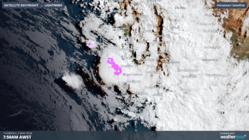
400km line of severe thunderstorms lashing southwest WA
A line of severe thunderstorms is moving onshore towards the southwest of WA, which could produce heavy rainfall and large hail on Thursday morning. These thunderstorms are forming on a trough offshore ahead of an approaching cold front and sweeping across the region. The image below shows a shelf cloud over Bunbury on Thursday morning. […]