A series of cold fronts will deliver much-needed rain to southwestern Australia this week, easing a drought that has broken records over the past seven months.
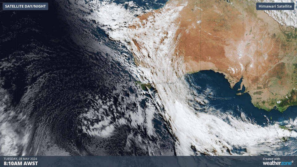
The animation below shows cloud streaming over WA on Tuesday morning ahead of an approaching cold front. This is the first in a series of cold fronts and low pressure systems that will bring rain to the southwest of WA this week.
The first cold front will arrive on Tuesday, bringing a burst of showers and thunderstorms to parts of the state’s west, southwest and Interior.
This will be followed up by more widespread rain and storms on Wednesday and Thursday as an associated low pressure system sends a pool of cold air across the state’s southwest, while an injection of tropical moisture sweeps over the state from the north.
This combination of cold air and tropical moisture will generate a northwest cloudband, which will deliver rainfall to a large proportion WA’s north and Interior over the next 72 hours.
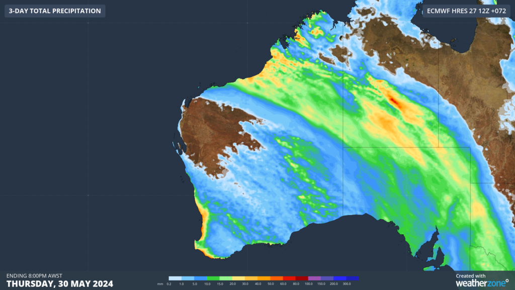
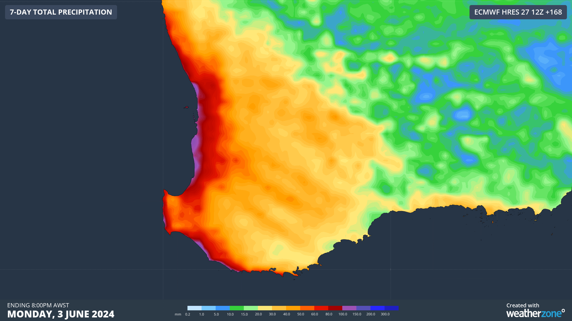
Image: Forecast accumulated rain between Tuesday and Thursday this week, according to the ECMWF-HRES model.
More than half of WA should pick up some rain over the next three days, with the heaviest falls in the southwest and north. Some parts of the lower west coast, including the region around Perth, could see about 20 to 40 mm of rain between Tuesday and Thursday.
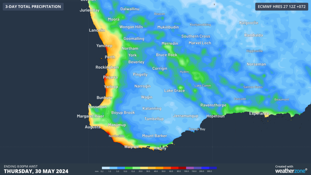
Image: Image: Forecast accumulated rain over the southwest of WA between Tuesday and Thursday this week, according to the ECMWF-HRES model.
Drier weather will return to most of WA by Friday as a high pressure system moves over the state. However, this break from the rain will be short-lived.
Another strong cold front is expected to bring rain, thunderstorms and blustery winds to a broad area of WA this weekend. There is some uncertainty regarding how strong this front will be, so it is difficult to predict how much rain is expected on the weekend. At this stage the heaviest rain should be in the southwest.
Forecast models suggest more than 90% of WA could see wet weather this week, which is a stark contrast to the past 6 to 12 months.
The map below shows rainfall deficiencies in WA for the 12 months ending in April 2024. The red areas show serious to severe rainfall deficiencies, while the darkest red shading highlights areas where rainfall has been lowest on record for this 12-month period.
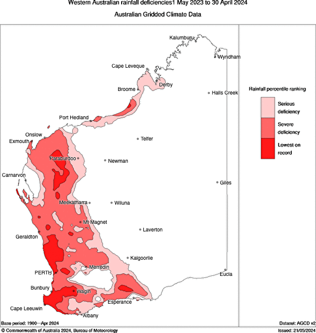
Image: Rainfall deficiencies between May 2023 and April 2024. Source: Bureau of Meteorology
Perth only received 23 mm of rain in the seven months ending in April 2024. This was less than 15% of its long-term average and the city’s driest seven-month period on record.
Perth has the potential to pick up more about 50 mm over the coming week, which would be twice the rain it has seen in the past seven months.
While this week’s rain won’t completely make up the deficiencies that have built up over the past 6 to 12 months, it will help reduce them.
Miningzone, by DTN APAC, is the only weather tracking and alerting solution purpose-built for the resources sector. To find out more, please visit our website or email us at apac.sales@dtn.com.


