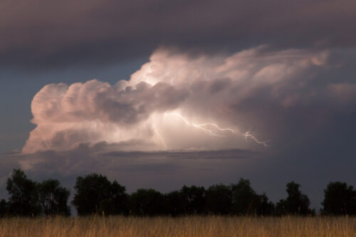
Stormy week ahead for Australia
Spring is in full swing in Australia, with a warm and humid environment set to bring thunderstorms to several states and territories in the next week. A series of low pressure troughs and low pressure systems interacting with abundant atmospheric moisture will trigger daily showers and thunderstorms over Australia in the coming week. This persistent […]
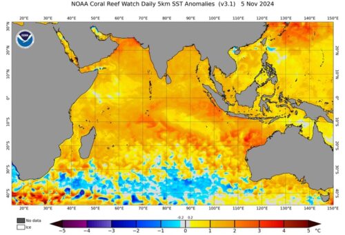
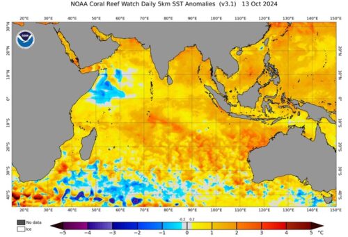
Warm seas boosting risk of strong tropical cyclones near WA
A large pool of unusually warm water to the northwest of Australia will increase the risk of strong tropical cyclones near WA this season. The map below shows that sea surface temperatures near Australia’s northwest coast are currently more than 2°C above average for this time of year. Some pockets are even more than 3°C […]
Climate change in Australia 2024
Australia’s climate is changing, with shifts in temperature, rainfall, wind, extreme fire weather and tropical cyclone activity being observed across the continent, according to the new State of the Climate report published this week. The State of the Climate 2024 report was issued by the Bureau of meteorology and the CSIRO, which communicates the […]
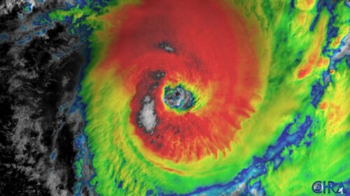
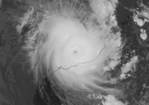
Australia’s 2024-25 tropical cyclone season is here
Today, November 1, marks the beginning of Australia’s 2024-25 tropical cyclone season. Here’s what to expect over Australia’s tropics this season and what each cyclone will be named. The Australian tropical cyclone season runs from the start of November to the end of April. While tropical cyclones can occur in the Australian region at any […]
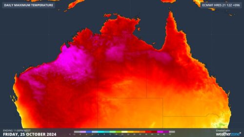
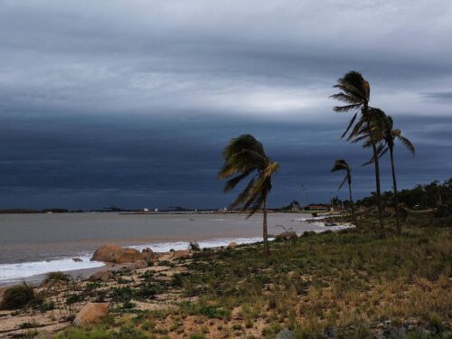
Heatwave gripping northern Australia this week
A burst of unusually hot weather will cause severe to extreme heatwave conditions across parts of three states and territories in northern Australia this week, with the heat also elevating fire danger ratings in some places. Northern Australia is certainly no stranger to heat at this time of year. The country’s highest temperature ever recorded […]
How hot oceans affect the upcoming Australia tropical cyclone season
Globally, ocean temperatures are at record levels for the second consecutive year, and this has played a part in creating one of the costliest hurricane seasons on record in the North Atlantic. Forecasts are suggesting a similar impact of the hot oceans here in Australia for the coming tropical cyclone season. Link between hot oceans […]
Negative IOD signal emerging in Indian Ocean
Sea surface temperatures in the Indian Ocean suggest that a negative phase of the Indian Ocean Dipole (IOD) may be emerging, which could influence Australian weather patterns in the coming months. What is the Indian Ocean Dipole? The IOD is an index that measures the difference in sea surface temperatures across the tropical Indian Ocean. […]
Another round of storms impacting WA
Spring has been a stormy season for large areas of WA, with another few big storm days ahead in the Pilbara and Kimberley region. Merely a week ago, widespread thunderstorms lashed the interior of WA, with Total Lightning Network detecting 605,166 lightning strikes on Wednesday, October 2. Thunderstorms are again forecast over the coming days […]
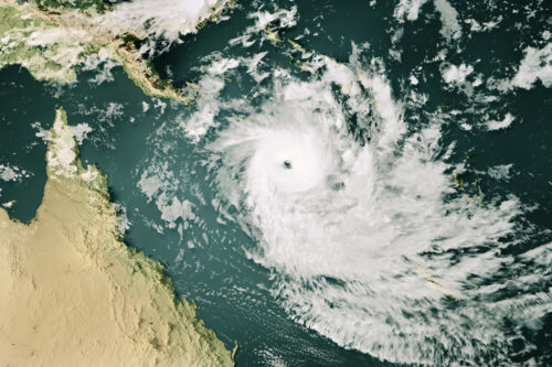
2024/25 tropical cyclone season outlook and names
The number of tropical cyclones in the Australian region is expected to be close to the long-term average in the official season which runs from the start of November to the end of April, according to the Bureau of Meteorology. But the BoM cautions that the likelihood of severe tropical cyclones of Category 3, 4, […]