
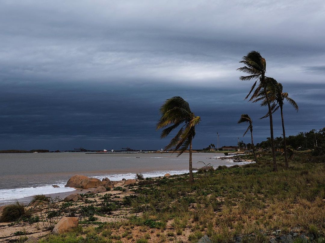
Spring has been a stormy season for large areas of WA, with another few big storm days ahead in the Pilbara and Kimberley region.
Merely a week ago, widespread thunderstorms lashed the interior of WA, with Total Lightning Network detecting 605,166 lightning strikes on Wednesday, October 2.
Thunderstorms are again forecast over the coming days across northern Australia in response to a low pressure system and an unstable airmass and cloud band.
The map below shows widespread lightning strikes already impacting northern WA and parts of the interior early Thursday morning, October 10.

Image: Himawari-9 satellite image at 7:15am AWST on Thursday, October 10.
Thunderstorms are set to continue over the next 48 hours over the Kimberley and Pilbara regions, particularly offshore and by the coast where a humid atmosphere is feeding the thunderstorms.
These thunderstorms have the potential to grow into large thunderstorms bringing intense bursts of rain, small hail and gusty winds.
The storms will be very slow moving due to weak steering flow with the potential for large totals in some areas.
The cloudband during the next three days could bring widespread falls of 5 to 10mm to parts of WA, while isolated falls of 20 to 40mm could fall in thunderstorms.
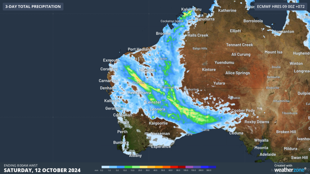
Image: Accumulated rainfall for the three days leading up to 8am on Saturday, October 12, according to ECMWF.
Meanwhile a severe heatwave warning has been cancelled for parts of northern Australia after temperatures reached the 40s for several days. While the heatwave has passed its peak, maximum temperatures will reach the high 30s to low 40s on Thursday, before easing on Friday. Perth should also reach 30°C on Friday in response to warm northeasterly wind, before temperatures drop into the low 20s on the weekend.
This heat combined with the low pressure trough and humidity is triggering these thunderstorms over the coming days. However, there is another factor behind the stormy start to spring, the unusually warm Sea Surface Temperatures (SSTs) offshore northern WA.
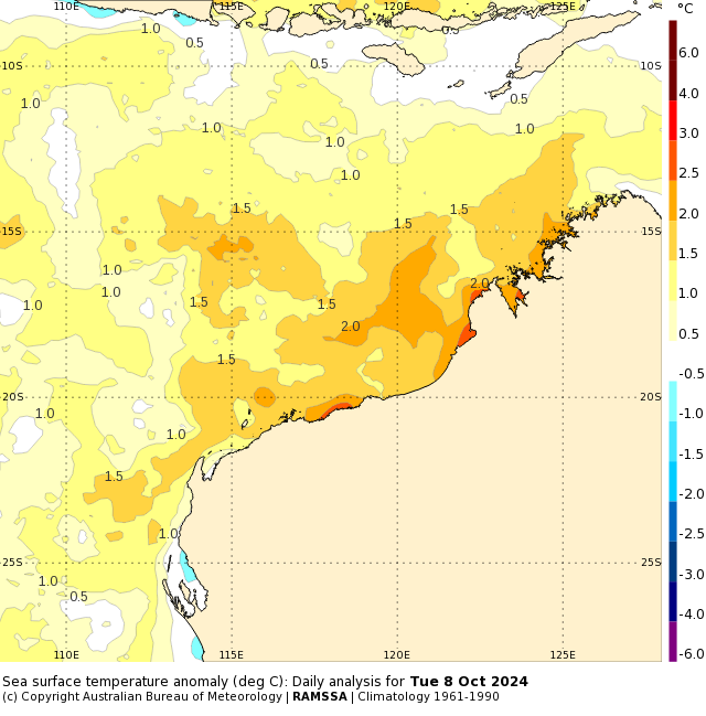
Image: Sea Surface Temperature daily analysis for Tuesday, October 8. Source: BOM
The waters offshore are around 1 to 2°C above average with some near shore waters reaching 3 to 4°C above average. The unusually warm oceans are injecting moisture laden air into WA, which is fuelling the rain and storm activity that we have seen in recent weeks. This could help fuel thunderstorms in the coming months, bringing an above average risk of thunderstorms to WA.
Are you protecting your mining business from the threat of extreme weather?
Miningzone, by DTN APAC, is the only weather tracking and alerting solution purpose-built for the resources sector.
As the climate shifts into unchartered territory, weather events could affect your mine with increasing force.
Miningzone is the proven and trusted turnkey solution –deployed at over 400 mines globally – offering you tailored forecasting and alerting systems to protect your valuable staff and assets.
Weatherzone’s integrated services are intuitive and user-friendly, providing you with the specific weather and blast data needed to gain a complete environmental picture.
You will have access to our lightning and severe weather tracking and alerts, EPA-approved blast dispersion modelling, thunderstorm tracking and high precision and site-specific forecasting, along with comprehensive reporting capacity.
Precise, market-leading data is delivered via multiple platforms including Weatherguard – our easy-to-use app – and can be fully integrated into your operational control or SCADA systems.
The tailored solution to drive your decisions. For more information, please visit our website or email us at apac.sales@dtn.com.
Thumbnail: @an.other.perspective/Instagram




