A burst of unusually hot weather will cause severe to extreme heatwave conditions across parts of three states and territories in northern Australia this week, with the heat also elevating fire danger ratings in some places.
Northern Australia is certainly no stranger to heat at this time of year. The country’s highest temperature ever recorded in October came from the Pilbara town of Port Hedland, where the mercury soared to a searing 46.9°C back in 2002.
But even hot places can have heatwaves, and the Bureau of Meteorology defines a heatwave in Australia as: “When the maximum and minimum temperatures are unusually hot over 3 days. This is compared to the local climate and past weather.”
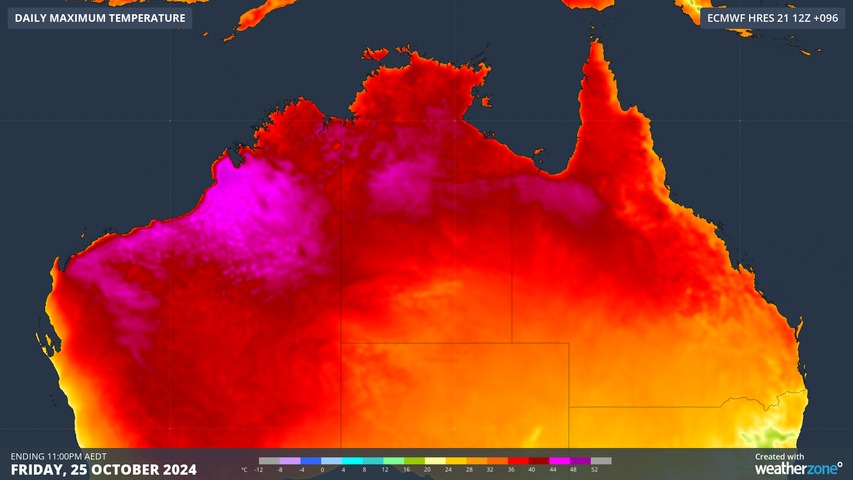
Temperatures will be unusually hot for several days and nights in northern Australia this week thanks to a high pressure ridge lingering over southern Australia, which will help trap a hot and dry air mass over the country’s north.
The highest absolute temperature this week are likely to occur in the north of WA, although parts of the WA, the NT and Qld will experience a heatwave.
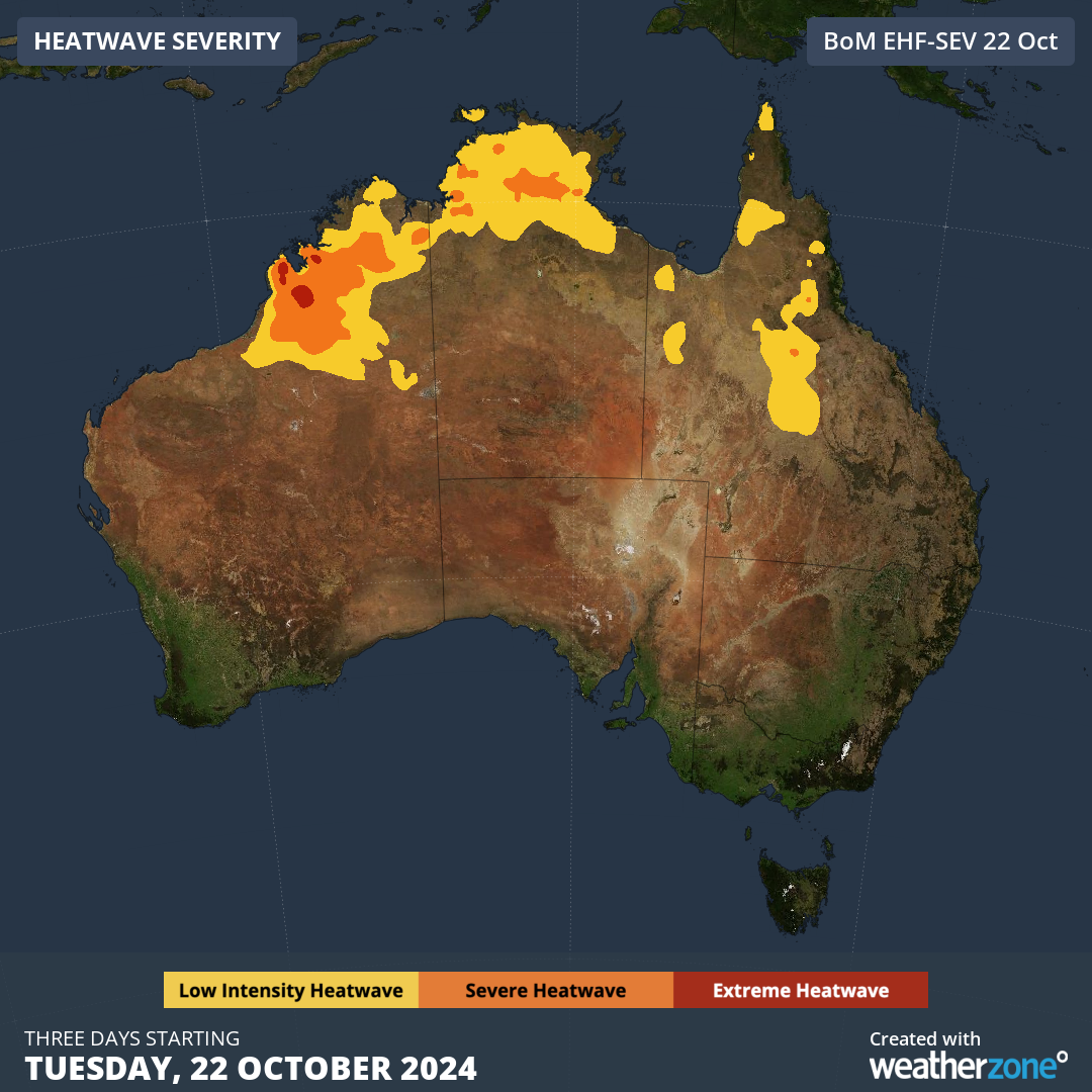
Image: Heatwave severity forecast for the three days starting on Tuesday, October 22.
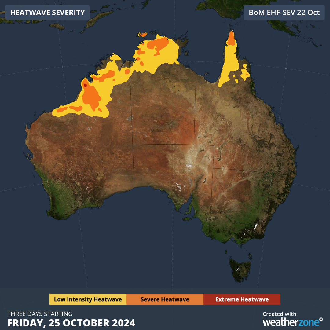
Image: Heatwave severity forecast for the three days starting on Friday, October 25.
The hot weather in northern Australia this week will be associated with surges of dry air being pushed towards the north from the interior. This hot, dry and windy weather will elevate fire danger ratings in some areas throughout the week.
On Monday, smoke from numerous fires could be seen across the NT, including a vast area of smoke that was capture by the afternoon sea breeze along the southwest coast of the Gulf of Carpentaria.
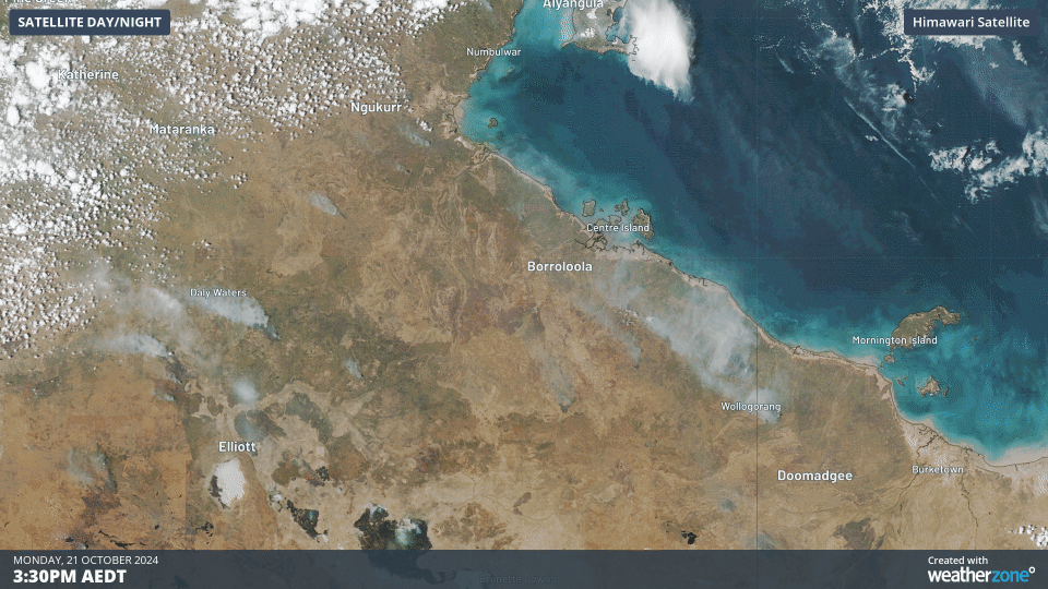
Image: Smoke being pushed inland by a sea breeze from the Gulf of Carpentaria on Monday, October 12, 2024.
A fire weather warning is in place for the Exmouth Gulf Coast in WA on Tuesday due to predicted extreme fire danger ratings. Forecast models also suggest that extreme fire danger could occur in parts of the NT’s Barkly region on Friday.
As the climate shifts into unchartered territory, weather events could affect your mine with increasing force.
Miningzone is the proven and trusted turnkey solution –deployed at over 400 mines globally – offering you tailored forecasting and alerting systems to protect your valuable staff and assets.
Weatherzone’s integrated services are intuitive and user-friendly, providing you with the specific weather and blast data needed to gain a complete environmental picture.
You will have access to our lightning and severe weather tracking and alerts, EPA-approved blast dispersion modelling, thunderstorm tracking and high precision and site-specific forecasting, along with comprehensive reporting capacity.
Precise, market-leading data is delivered via multiple platforms including Weatherguard – our easy-to-use app – and can be fully integrated into your operational control or SCADA systems.
The tailored solution to drive your decisions. To find out more visit our contact page or email us at apac.sales@dtn.com.


