
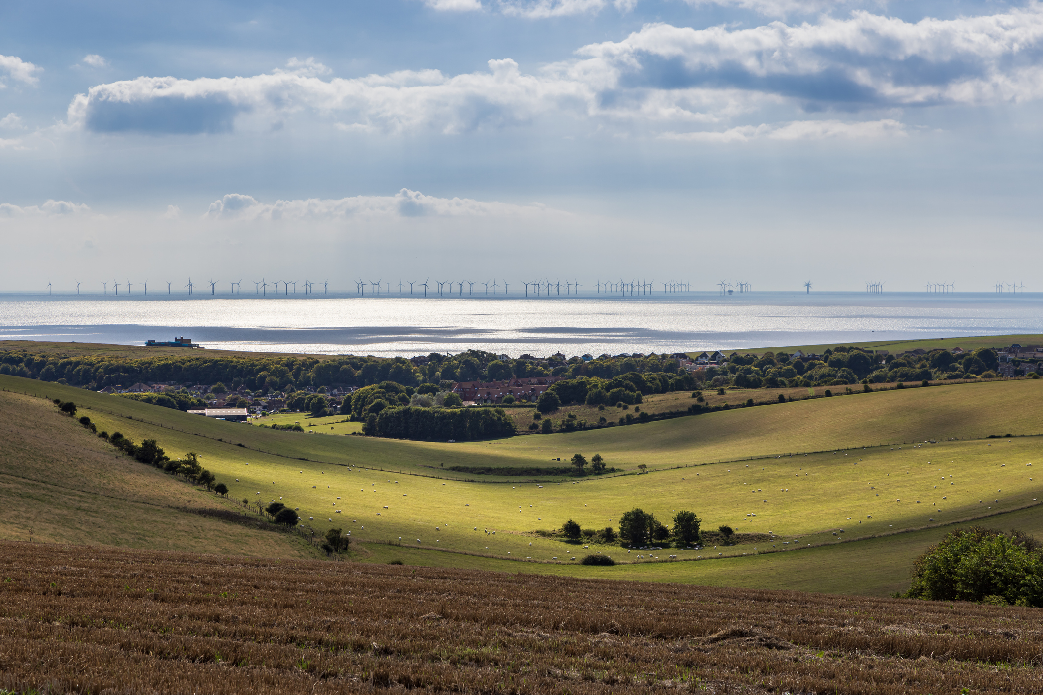
Wind turbines are usually pictured on rolling hills far from cities and people, but what if they were on rolling swells off the coast of populated areas?
Australia’s National Electricity Market (NEM) and WA renewable power network currently harnesses wind power from 115 wind farm facilities and a capacity of 15,617 MW, according to OpenNEM.
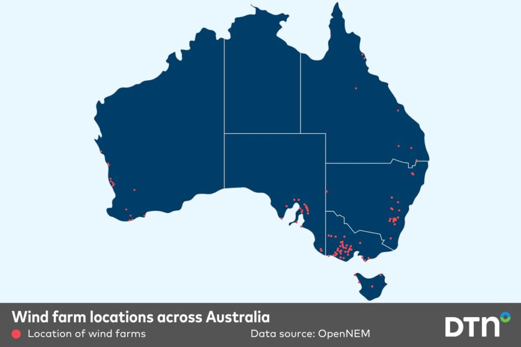
Image: Wind farm locations across Australia.
All these currently operating facilities are land-based wind farms. These are easier to install and maintain, and Australia has ample land to offer for turbines, making early investments into renewable energy sources more accessible. But is it time for Australia to venture off its over 30,000-kilometre-long coastline into an even more reliable wind source?
Offshore wind farms
Driving along coastal roads of the United Kingdom or northern Europe, hundreds of wind turbines can be seen offshore. China also harnesses offshore wind power to feed its massive and growing energy demand.
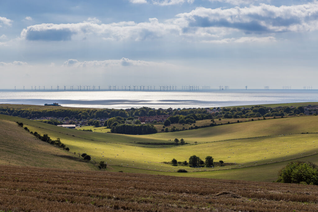
Image: Wind turbines off the coast of Sussex, UK. Source: iStock / Lemanieh
The biggest advantage of putting wind turbines over water is that winds are stronger and more consistent more often with less resistance from land masses.
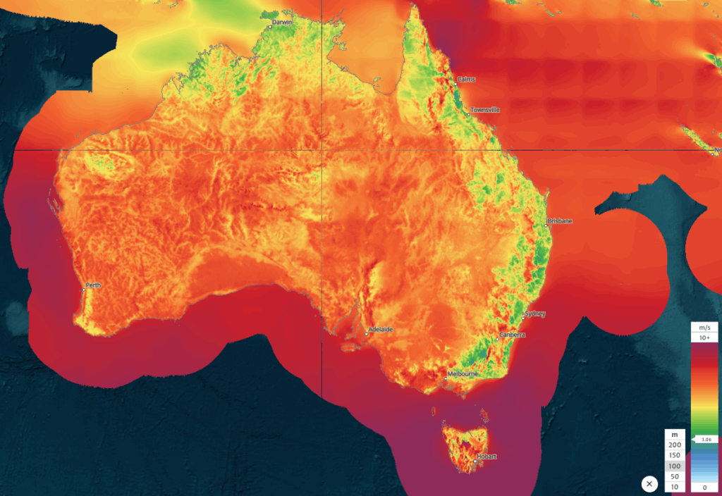
Image: Mean wind speed across Australia and nearby offshore areas. Source: Global Wind Atlas
For example, the NEM saw periods of low wind generation between Friday, June 27 and Monday, June 30, 2025, as a result of a broad high pressure system settling over southeastern Australia. The hourly forecast produced by the DTN APAC Opticast wind generation dashboard show’s production across the region plummeting in the early afternoon of Friday, June 27, to about 926 MW at 1pm.
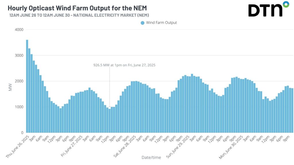
Image: Hourly Opticast wind generation dashboard between June 26 and June 30, 2025.
Below is a snapshot of the forecast winds at the lowest wind production time, around 1pm on Friday, June 27. Winds of less than about 5 knots can be seen across the land-based wind farms (in green), whereas areas off the coast are seeing winds of at least 10 knots (proposed offshore wind farm locations in blue).
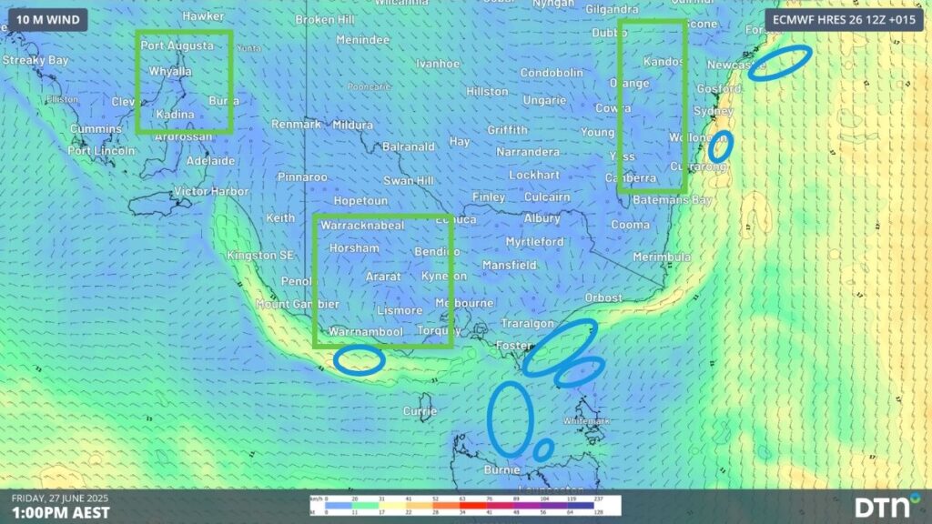
Image: Forecast 10m winds at 1pm on Friday, June 27, 2025, across southeastern Australia with current land wind farm regions (in green) and proposed offshore wind farm regions (in blue).
Offshore wind farms can also be installed closer to major load regions (cities and industries), reducing the power loss from long-distance transmission.
How DTN APAC can help with the challenges of working offshore
Proposed areas for offshore wind development around Australia are located 10-20 kilometres off the coast, which brings increased accessibility issues.
Installation and maintenance of offshore wind turbines requires suitable weather and ocean conditions. DTN APAC offers a comprehensive suite of services, refined through years of collaboration with the marine, ports and offshore industries, to optimise the safety and efficiency of your operations out in the ocean.
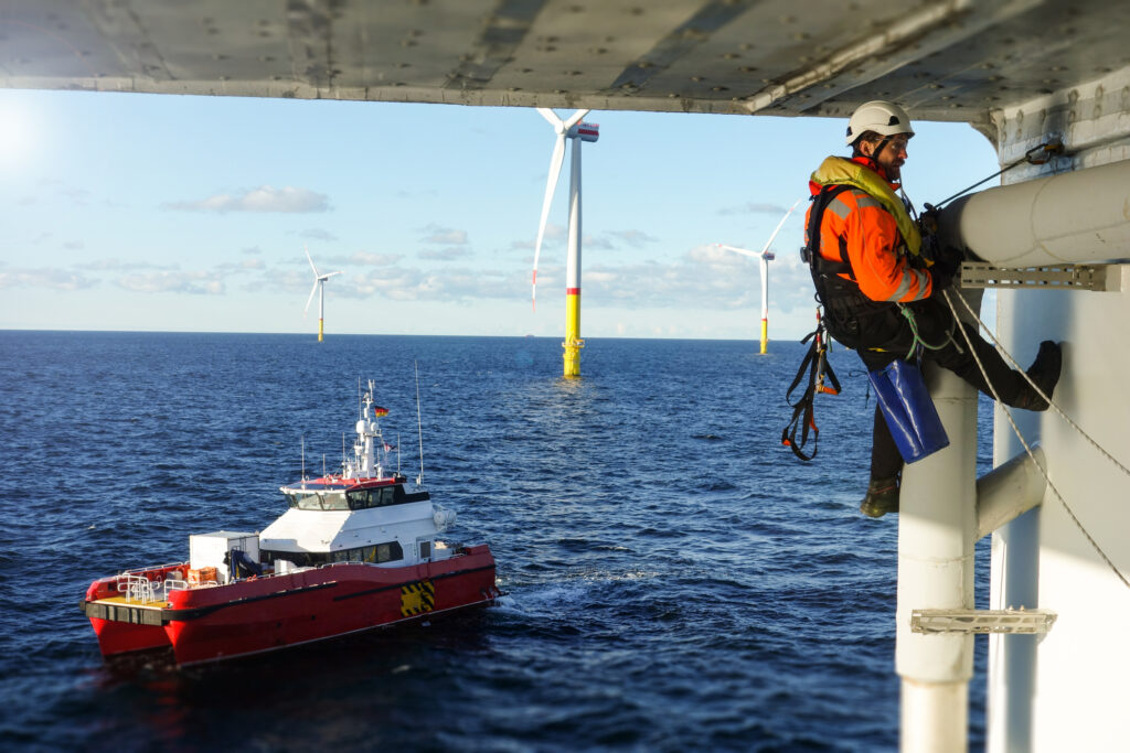
Image: Be confident accessing your offshore wind farms with the best metocean forecast. Source: iStock / CharlieChesvick
We work with you to understand your intrinsic operational challenges and customise high-precision forecasting and metocean services to your exact location and operational scope.
When working offshore, our solutions can underpin planning and safe execution for offshore wind farms. Our data can support your exploration, development, and production and decommissioning phases. Whether your crews are on-site, being transported to shore, or diving to perform maintenance, we deliver tailored weather risk briefings to ensure you choose the optimal time to proceed.
DTN APAC’s trusted nowcasting and forecasting system, OpticastTM, allows you to rapidly respond to changing conditions offshore, en route and in port. For offshore wind farms, we have your weather situational awareness covered, no matter where you are. We deliver real-time severe weather and lightning alerts to your team via your integrated dashboard: Portzone, and our Weatherguard app.

For example, the powerful East Coast Low that impacted eastern NSW in the Tasman Sea this week has generate large and unruly waves, and storm force winds, making access and maintenance of an offshore wind turbine nearly impossible. Avoid the costly and harmful risks of poor planning with our easy-to-use wind and wave forecasts.
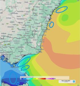
Image: OneFX significant wave heights at 10am on Wednesday, July 2, 2025, showing large waves of 4-5 metres across proposed NSW offshore wind farm locations, with more manageable swell across Victorian and Tasmanian locations.
DTN APAC’s Total Lightning Network (TLN) ensures you avoid hours of unnecessary downtime by providing the most accurate technology in lightning detection and alerting. Safeguard your teams and assets with lighting and Dangerous Thunderstorm Alerts (DTAs), customised to your existing parameters and delivered in real-time across all devices in your network. You gain full spatial awareness of developing severe weather systems, allowing you to plan ahead and, where needed, execute your shutdown and evacuation procedures.
Video: Satellite imagery and the Total Lightning Network (TLN) detecting lightning (blue heat strikes) in a cloudband moving off the southern NSW coast on Tuesday, June 24, 2025.
With extreme conditions slowing production and affecting infrastructure, safety and transport, trust us to deliver Australia’s most precise weather data and tailored insight, giving you decisive confidence when it’s most needed.

DTN APAC is a proud Gold sponsor of Australia Wind Energy 2025 Conference & Exhibition in Melbourne. Visit our Exhibition Booth A74, where our team of experts will walk you through our industry-leading weather solutions powering the Wind energy sector, as well as solutions that also support decarbonisation in the Mining industry.




