
It has been quite an eventful week with the first tropical cyclone of the season, Paddy, developing near Christmas Island, off the northwest shelf of Australia. Paddy developed early in the cyclone season, the average date for cyclone development in Australia is around January. La Nina also was officially declared on Tuesday, November 23, which typically brings a wet, cloudy and mild summer […]
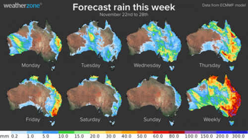
More heavy rain is on the horizon for already saturated areas in central and eastern Australia this week, with flooding and severe thunderstorms likely. Large areas of central and eastern Australia have already seen 2 to 4 times their average November rainfall and another month’s worth is on the way this week. Image: Observed November rainfall percentages, after the first […]
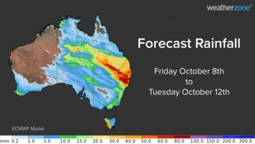
Australia’s wet October will continue over the next four days as a northwest cloud band delivers widespread rain and thunderstorms in parts of six states and territories. The map below shows how much rain one computer model is predicting between today (Friday) and Tuesday next week. Rainfall totals of 5-15mm are likely over a broad area in central and eastern Australia, covering parts of the NT, SA, […]

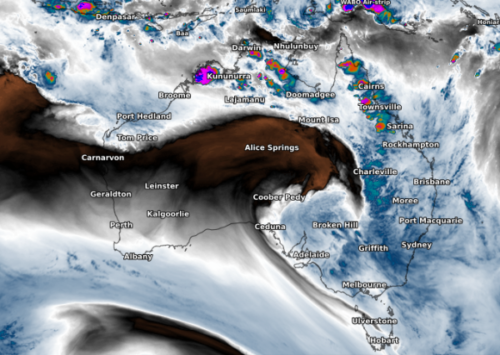
A northwest cloud band will deliver widespread rain and thunderstorms over central and southeastern Australia during the next four days. The cloud band is developing as moisture-laden air from the tropics moves south and interacts with a cold front passing over southern Australia. The satellite image below shows the cloud band developing over WA and SA on Thursday morning. […]

For the first time in 163 years of records, Sydney just registered 15 consecutive winter days above 20ºC. The temperature at Sydney’s Observatory Hill weather station, located next to the Harbour Bridge, has climbed above 20ºC every day since Monday, August 9. This makes today, August 23, the 15th day in a row to get this warm. […]
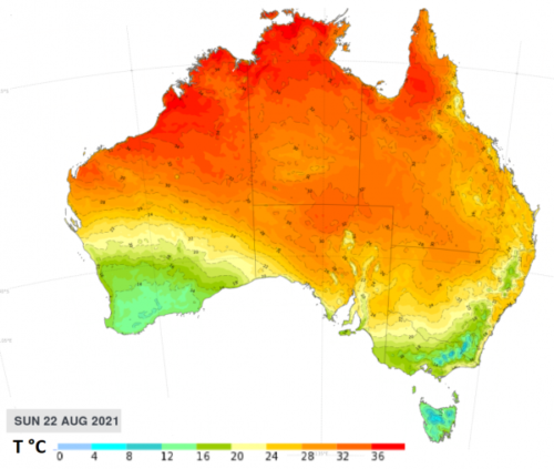
The eastern states of Australia have had an incredibly warm and sunny winter and this trend is set to continue. The daytime temperatures in Sydney are set to soar, by winter’s standard, for 4-5 days from Friday. Maximum temperatures in the Sydney Basin during this period are forecast to be a whopping 5-8 degrees above normal (figure 1). Sunday night in Sydney […]

Renewable energy is booming in Australia and it is showing no signs of slowing down in 2021. More than a quarter of Australia’s electricity generation came from renewables last year. Australia has come a long way since 2016, when renewable energy made up 17 percent of the country’s electricity. Back in 2016, hydro power in New South Wales and Tasmania was […]

This week’s IPCC Report, “Climate Change 2021: The Physical Science Basics”, is a big deal which you’ll be hearing plenty about here at Weatherzone and in the wider media – so what’s it all about? Let’s start at the beginning. What is the IPCC? The IPCC, or Intergovernmental Panel on Climate Change, was established in 1988, right around the time the dangers of human-caused climate change […]

It has been a cracking snow season for NSW and Victorian Alps where major hydro power operations take place. The latest snow depth reading from Spencers Creek came in on Thursday, July 29 at a whopping 183.6cm, that’s over a metre more than this time last year (figure 1). Figure 1: Spencers Creek snow depth, 2020 (light green) vs 2021 to date (dark green). Source: Snowy Hydro. […]
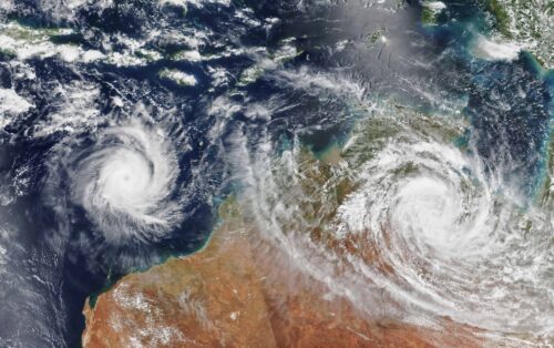
Australia’s tropical cyclone season is officially underway, but we may not see much activity for few months yet. The season runs from November to April, and for mining operators and businesses across northern Australia, 2026-27 is shaping up to be a season where the headline numbers and the real risk may not line up. On […]
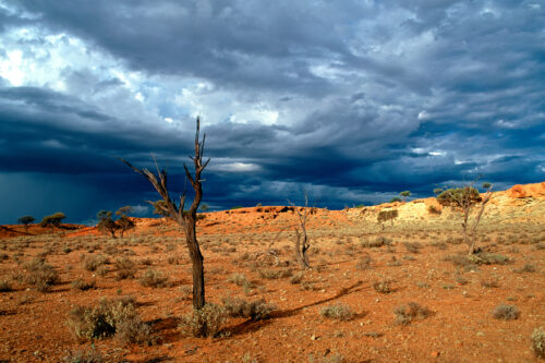
A positive Indian Ocean Dipole is underway, but this one is unlikely to deliver the textbook dry spring and summer that businesses have come to expect from the pattern. The Bureau of Meteorology officially declared a positive IOD on Tuesday, October 27, which typically like El Niño can cause drier and warmer conditions over parts of […]
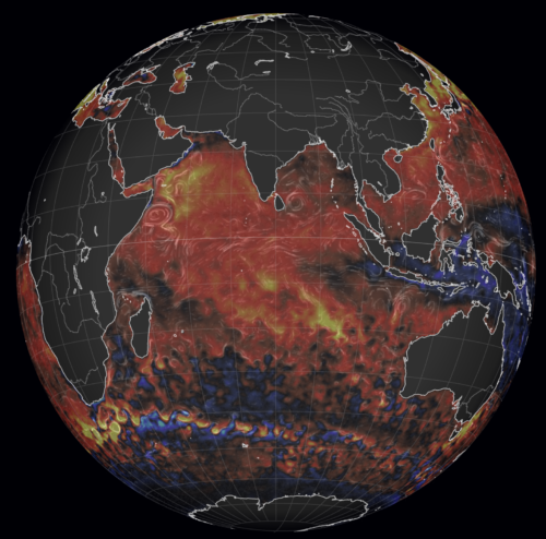
Waters off Indonesia have cooled in recent weeks, an indication that a positive Indian Ocean Dipole (IOD) event could be developing. It’s an important climate driver for Australia, and it could shape rainfall and temperatures heading into summer, with flow-on effects for farmers, energy and other industries. What is the Indian Ocean Dipole? The IOD […]

Leonora, WA, had its wettest September day on record earlier this month. Three weeks later, more than 1.3 million lightning pulses were detected within 800 km of the town in 48 hours. Why is a stalled trough delivering storms to mining country, and what it could mean for operations? The DTN Total Lightning Network detected […]