
It has been a cracking snow season for NSW and Victorian Alps where major hydro power operations take place. The latest snow depth reading from Spencers Creek came in on Thursday, July 29 at a whopping 183.6cm, that’s over a metre more than this time last year (figure 1).

Figure 1: Spencers Creek snow depth, 2020 (light green) vs 2021 to date (dark green). Source: Snowy Hydro.
Spencers creek is at an elevation of 1830m approximately halfway between the NSW ski resorts of Perisher and Thredbo, and it’s the deepest July snowpack in 21 years. The best season since the 2000 season, when 189.2cm was measured on July 27.
While the snowpack depth at Deep creek is also healthy given its lower elevation and location near Cabramurra, away from the major NSW resorts. Deep Creek saw a reading of 60.6cm on July 29, about 50cm more than the 2020 season (figure 2).

Figure 2: Deep Creek snow depth, 2020 (light green) vs 2021 to date (dark green). Source: Snowy Hydro.
And there’s more to come, with another healthy layer of snow expected to fall across resorts today, as a low-pressure system makes its way across the southeast. Today’s snowfall will be the most significant of the week, with further falls on Wednesday meaning around 15-30cm could be lying on the slopes in 48 hours’ time.
Why has so much snow fallen this year?
Snow in southern Australia is most commonly caused by cold fronts which sweep northwards over the southeast corner of the mainland from the Southern Ocean. And in July, there were several strong fronts and low pressure systems, each of which delivered heavy snow (figure 3).
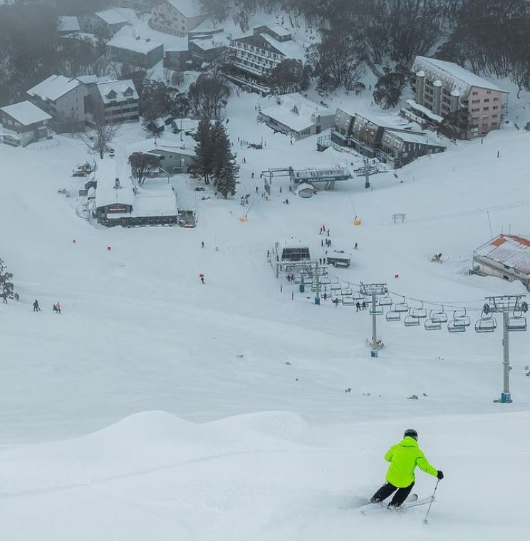
Figure 3: Source Falls Creek (@fallsaustralia) Instagram.
When cold fronts or low pressure systems arrive, snow usually falls at temperatures between -1°C and -4°C. And while average temperatures were half a degree or so above normal in NSW and VIC across the whole month, it was still more than cold enough in the southeast on the days and nights when the fronts crossed the region.
While there is a healthy snowpack in NSW and VIC, the TAS Alps have missed out on some of the biggest snow events, with low pressure systems andfronts moving further north over the mainland.
Snow events can occur in any winter, but conditions conducive to mainland Australian snow are generally considered more likely with a negative Indian Ocean Dipole (IOD). This is when waters off the northwest shelf of Australia or eastern Indian ocean are warmer than normal increasing winter spring rainfall across parts of southern Australia.
The negative IOD was officially declared during July and will most likely continue until at least mid-spring. Most climate models suggest that the negative IOD will return to neutral phase by December.
This means that above average rainfall and snowfall is predicted until at least mid-spring, depending on the number of fronts that make it up to the NSW Alps.
What does this mean for the spring snowmelt?
During spring, temperatures begin to warm after the winter lull, which melts the snowpack created in winter. The snowmelt may be accelerated by additional rainfall if the temperature is not cold enough for snow, with the runoff consisting of both snowpack melt water and the rainfall.
The snowmelt and above average rainfall during spring may lead to healthy hydro lake levels. Hydro lakes hold water until its needed to make power, at a point that it will be released from the dam.
Hydroelectricity is produced by passing large amounts of water turning a turbine or electricity generator and creating power.
Weatherzone provides 14-day forecasts across the National Electricity Markets (NEM) for many variables, for more information, please contact us at apac.sales@dtn.com.




