

Summer in Tasmania can see above average temperatures and drier than normal conditions, leading to many areas of the state becoming increasingly vulnerable to fire. When lightning strikes dry vegetation, there is a greater likelihood of ignitions and increased fire risk everywhere – from the world-renowned Tasmanian Wilderness World Heritage Area (TWWHA) to the suburbs. […]
A negative Indian Ocean Dipole event is a near certainty to develop in 2025 as both the oceans and atmosphere show strong signs of coupling. What is the Indian Ocean Dipole? The Indian Ocean Dipole (IOD) is a climate driver that involves the movement and location of warmer and colder waters along the equator in […]
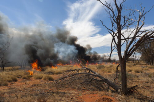
The latest seasonal bushfire outlook from Australian Fire and Emergency Service Authorities Council (AFAC) warns of elevated fire risk for northern Western Australia, eastern South Australia and much of western Victoria this spring. In WA, a large portion of the Kimberley and inland Pilbara are highlighted as areas at an increased risk of fires this […]
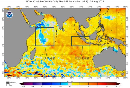
One of Australia’s key climate drivers is gaining strength over the Indian Ocean, firming up the odds of a wet spring for large parts of the country. The Indian Ocean Dipole (IOD) refers to an index that measures the difference in sea surface temperature anomalies across the tropical Indian Ocean. It’s an index watched closely […]
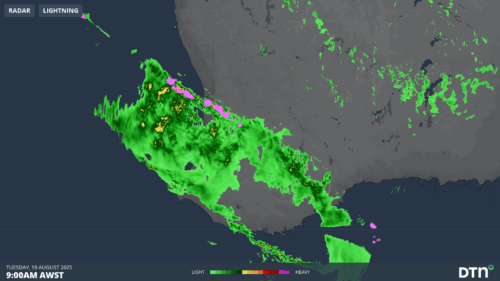
A vigorous cold front is unleashing wild wintry weather on the southwest corner of WA, with storms, heavy showers and strong wind gusts battering the region this Tuesday. The severe weather has so far stayed south of Perth as it pushes in from the Indian Ocean in a northwesterly stream – and indeed the WA […]
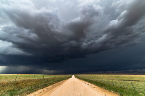
Abnormally warm oceans surrounding Australia and a developing negative Indian Ocean Dipole will increase the likelihood of abnormally wet weather across large parts of the country this spring, along with an increased risk of flooding and severe thunderstorms disrupting businesses and industries. Spring in Australia runs for three months from the start of September to […]

After a period of prolonged rainfall deficiencies, large parts of South Australia have finally enjoyed a much wetter-than-average month, with July 2025 being the wettest in 27 years. South Australia’s statewide July average rainfall of 30.5mm doesn’t sound like a huge amount in raw terms, but it includes relatively low totals from the state’s far […]
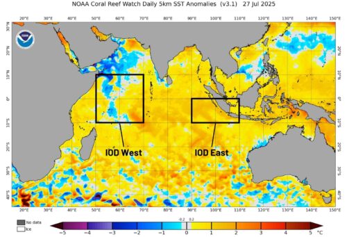
The Indian Ocean Dipole (IOD) index has dropped below -0.4°C – the critical threshold for a negative IOD event if sustained. Could Australia see its first negative IOD event since 2022? What is the Indian Ocean Dipole (IOD)? The IOD is a measure of the difference in Sea Surface Temperatures (SST) across the equatorial Indian […]
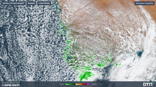
Significant rain has fallen across the southwest of WA, with Perth recording 41mm in the 24 hours to 9am Monday, making it the city’s wettest day in just over a year. This latest soaking means that Perth has now exceeded its average monthly rainfall, with 174.2mm in the gauge for July 2025 to date, compared […]

Australia’s tropical cyclone season is officially underway, but we may not see much activity for few months yet. The season runs from November to April, and for mining operators and businesses across northern Australia, 2026-27 is shaping up to be a season where the headline numbers and the real risk may not line up. On […]

A positive Indian Ocean Dipole is underway, but this one is unlikely to deliver the textbook dry spring and summer that businesses have come to expect from the pattern. The Bureau of Meteorology officially declared a positive IOD on Tuesday, October 27, which typically like El Niño can cause drier and warmer conditions over parts of […]

Waters off Indonesia have cooled in recent weeks, an indication that a positive Indian Ocean Dipole (IOD) event could be developing. It’s an important climate driver for Australia, and it could shape rainfall and temperatures heading into summer, with flow-on effects for farmers, energy and other industries. What is the Indian Ocean Dipole? The IOD […]

Leonora, WA, had its wettest September day on record earlier this month. Three weeks later, more than 1.3 million lightning pulses were detected within 800 km of the town in 48 hours. Why is a stalled trough delivering storms to mining country, and what it could mean for operations? The DTN Total Lightning Network detected […]
