
Significant rain has fallen across the southwest of WA, with Perth recording 41mm in the 24 hours to 9am Monday, making it the city’s wettest day in just over a year.
This latest soaking means that Perth has now exceeded its average monthly rainfall, with 174.2mm in the gauge for July 2025 to date, compared to the average of 147mm.
In good news for the city, hydroelectric power and neighboring agricultural industries, Perth has exceeded its monthly rainfall average in both June and July this winter, after the previous nine months all saw below-average totals.
Meanwhile similarly heavy falls occurred at numerous coastal locations across the South West Land Division, with totals topping out closer to 10mm further inland in the Central Wheat Belt and Great Southern forecast districts.
Noteworthy 24-hour rainfall totals included:
- 76mm at Cowaramup (near Margaret River).
- 54mm at Swanbourne (a coastal Perth suburb), the highest reading in the Perth metro area and the site’s highest daily fall in any month for two years.
- 52.8mm at Gingin Airport (about an hour north of the Perth CBD) which was the site’s highest daily fall in any month in six years.
- 41mm at the official Perth weather station in the CBD, the highest fall since July 18, 2024, when 44mm was recorded.
- 29mm At Jurien Bay (about halfway up the coast between Perth and Geraldton) which brought the town’s running July tally to a healthy 196.6mm, nearly doubling the monthly average of 110.5mm.
This was an event during which rain fell steadily across most of the areas mentioned from Sunday morning into Monday morning, as a cold front and associated low pressure system crossed the southwest.
Image: Eight-hour radar loop on DTN APAC’s Stormtracker showing a sustained period of heavy rainfall across southwest WA overnight, from 7:30pm Sunday to 3:30am Monday (AWST).
The cold front is now moving east, with showers persisting in coastal districts. A drying trend will set in from later today through much of the working week across the southwest, before another front moves in over the weekend, promising more significant rainfall.
It’s also worth noting that the airmass over southwest WA is very cold in the wake of the front, with Perth heading for a Monday maximum of just 14°C, causing energy demand to increase. The city’s coldest day of 2025 to date was last Thursday, July 24, when the mercury peaked at exactly 14°C.
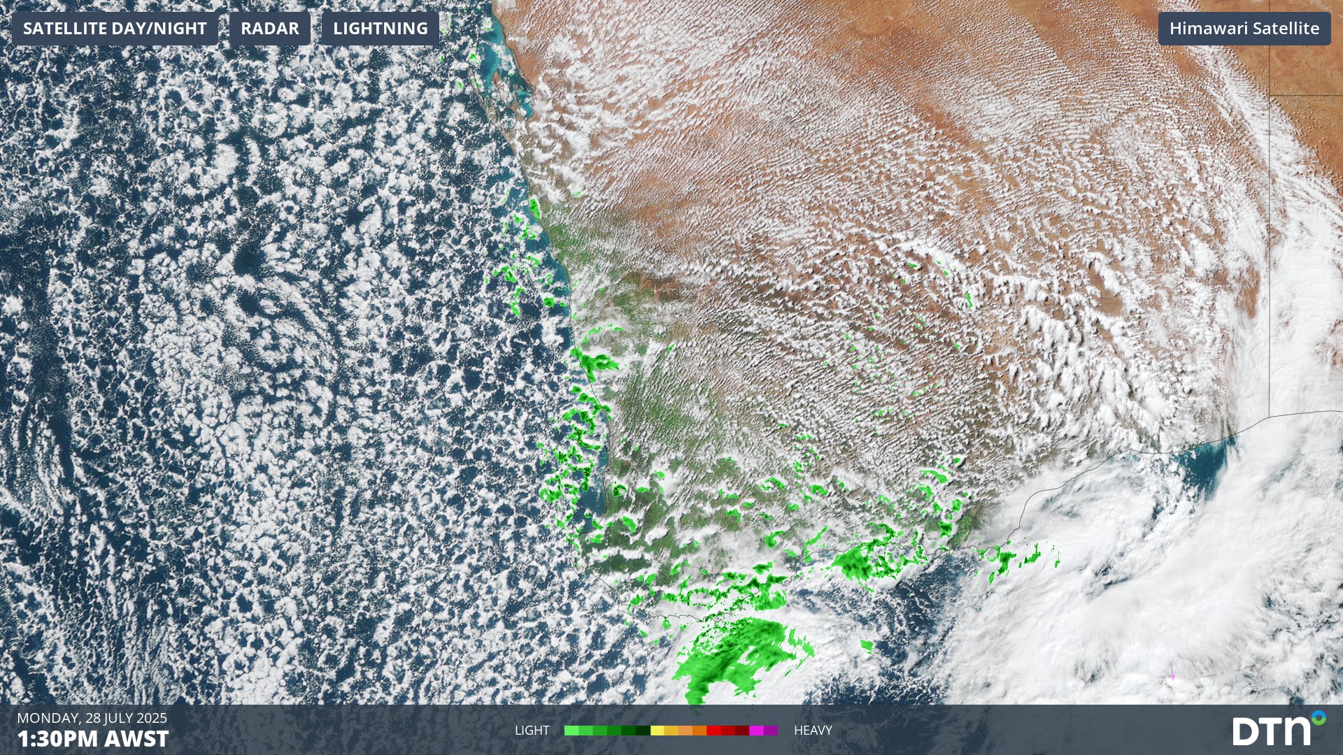
Image: Combined radar and satellite image at 1:30pm AWST on Monday, July 28, 2025, showing the tell-tale speckled cloud pattern typically associated with frigid airmasses with polar origins.
Several towns across southwest WA have only warmed to the low-teens as of 1:30pm on Monday.
How DTN APAC’s Risk Communicators can help you business with seasonal forecasts
From Forestry to Agriculture across Australia, Asia Pacific, and globally, you can strengthen your business’ response to long-term weather impact when you work with our diverse team, bringing you global forecasting, product development, and analytics expertise.
We work hard to identify your operational pressures and tailor our services and products to meet your needs. Concise communication, giving you full situational awareness exactly when you need it, is our focus. We want to reduce weather risk in your operations, every day.
Whether it’s preparing for next seasons sowing, irrigation or harvesting, or simply ensuring your operations team is equipped to confidently make decisions ahead of severe weather, our weather Risk Communicators are here for you.
Our weather risk communicators deliver short- to long- term guidance from:
- hourly-event weather monitoring (alerting you of impending thunderstorms and heavy rain).
- week to month operational planing based on likely timing of increased rain or persistent dry periods.
- seasonal long term planning based on climate drivers and the likely trends across the coming months.
As seen below, long range forecasts provided by our weather risk communicators at the start of autumn allowed drought affected industries to prepare for continued rainfall deficiencies over the coming months.

Early indications on rainfall, temperature and wind patterns through our seasonal briefings can save your business millions of dollars, and help effective long-term planning of operations.
We deliver clear and comprehensive weather data, personalised risk assessments and briefings to you and your team, so that your critical decisions can be made with confidence.
We are available 365 days a year, so you always have the timely guidance you require, especially when severe conditions hit.
You have our insights to rely on to see you through complex situations, minimising potential loss of profit and maximising the safety of your staff and assets.
Learn more about our large range of industry leading products and services or email us at sales.apac@dtn.com




