
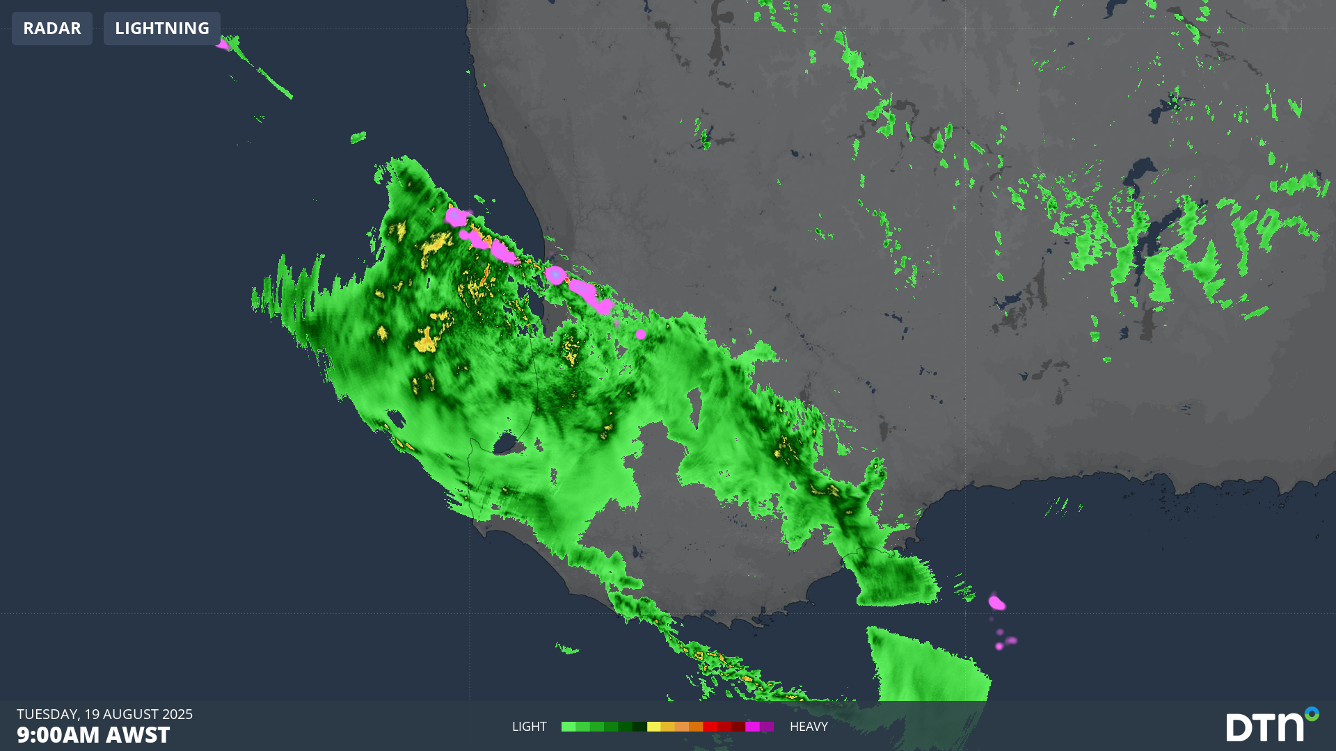
A vigorous cold front is unleashing wild wintry weather on the southwest corner of WA, with storms, heavy showers and strong wind gusts battering the region this Tuesday.
The severe weather has so far stayed south of Perth as it pushes in from the Indian Ocean in a northwesterly stream – and indeed the WA capital had recorded no rain to 9am (AWST) – however showers are increasingly likely in the city as lunchtime approaches.
Video: DTN APAC’s Stormtracker dashboard showing radar, Total Lightning Network and BoM warning areas across southwest WA on the morning of Tuesday, August 19, 2025.
The combined radar and Total Lightning Network video above shows the stormy weather pushing onshore into the southwest corner. A line of thunderstorms can be seen approaching, having formed along the boundary of the cold front, as cold air forced the warmer, more humid air ahead of the front to rise.
This narrow band of storms with strong wind gusts is a good example of the meteorological phenomenon known as a squall line.
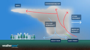
Image: Graphic showing how storms fall in a squall line at the boundary between a cold front and warmer air ahead of it.
While Perth has thus far missed out on the early Tuesday rainfall, plenty of places further south had received good falls by 9am local time, with totals in the vicinity of 20mm at numerous locations in the Margaret River area.
The notoriously windy Cape Leeuwin – Australia’s most southwesterly point – saw a gust of 111 km/h just after 2am.
Looking ahead, a second front approaches the southwest on Wednesday, delivering another burst of showers. Combined with the rain that is likely to fall on Tuesday, Perth’s running monthly rainfall total should push above the August average of 122.7mm. It’s currently 110.8mm.
As mentioned in our story last week, that would make it the first time since 1996 that Perth has seen above-average rainfall totals in each of the three winter months – traditionally the wettest time of year.
READ MORE: Perth approaching winter rainfall streak not seen in 3 decades
In terms of temperatures, the twin-cold fronts impacting the southwest over the next 24 hours won’t usher in the most frigid airmass of the year. But the mercury will still drop a few degrees with widespread maximums in the mid-teens by midweek.
Perth’s coldest day this week should be Thursday with a high of 18°C expected, although the cool air will be accompanied by mostly sunny skies.
How DTN APAC’s Stormtracker can help your business
Embedded in DTN APAC’s industry interfaces, the system gives you a time advantage when monitoring conditions developing over your infrastructure and location.
Stormtracker is our Global Information System (GIS) tracking tool, providing multiple weather layers and zoom controls overlaid on a map of your location and infrastructure. You can choose a snapshot or full screen view, depending on your requirements. The maps allow you to monitor all weather, and specifically any systems likely to cause risk for your business. You also have the capacity to observe:
- real time lightning and thunderstorm alerts
- localised lightning strike frequency
- official warnings for storm, cyclone, wind, flood and fire
- sentinel hotspot fires and fire agency current incidents
Stormtracker’s radar imagery updates every 5 minutes, so you are always able to respond rapidly to changing conditions. You can customise alerting to notify you when your staff or infrastructure are under threat. With increased situational awareness, your ability to make informed decisions quickly is optimised.
DTN APAC’ experience and intelligence gives you a clear path through complex situations. Let us assist you, offering actionable insight when extreme weather poses risk to your business.
Learn more about our large range of industry leading products and services or email us at sales.apac@dtn.com




