
New data released by the Copernicus Climate Change Service has confirmed that 2023 was Earth’s warmest year on record, with an annual mean temperature close to 1.5ºC above pre-industrial levels.
According to the highly-regarded ERA5 dataset, Earth’s global average temperature during 2023 was 14.98ºC. This was 1.48ºC warmer than the 1850-1900 ‘pre-industrial’ average and 0.17ºC above the previous warmest year on record, 2016.
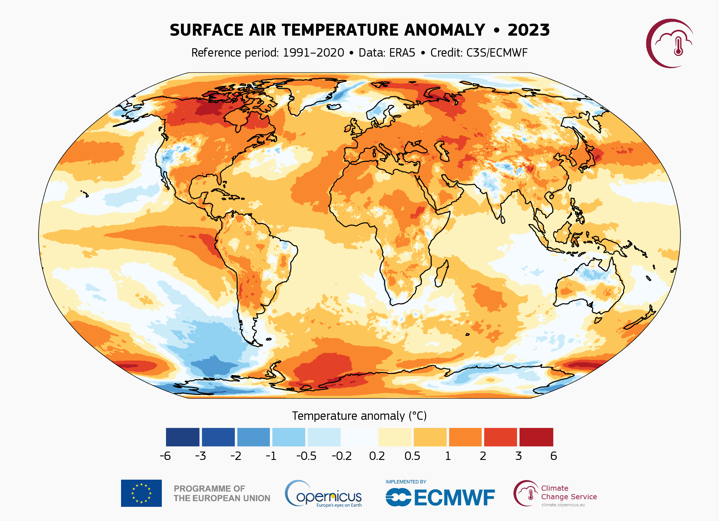
Image: Surface air temperature anomaly during 2023, according to the ERA5 dataset. Source: Copernicus Climate Change Service / ECMWF
This new record won’t come as a surprise to those who have been tracking the pulse of our planet’s climate over the last 8 to 10 months.
Since the breakdown of La Niña early last year, global sea surface temperatures have been running at record high levels since March 2023. In the atmosphere, each of the past seven months (June to December 2023) ranked as the warmest respective months on record.
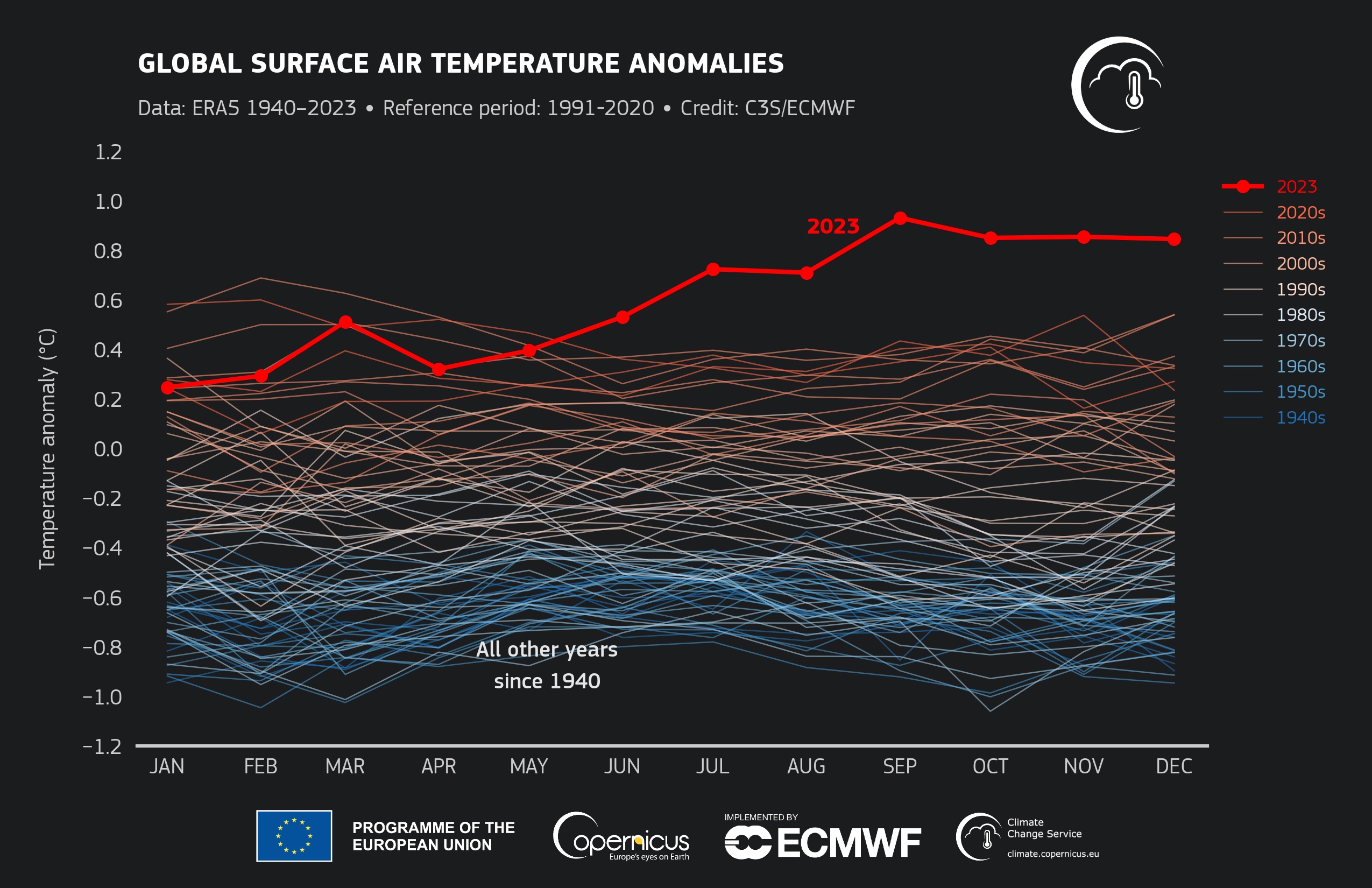
Image: Monthly global average temperatures from 1940 to 2023, according to the ERA5 dataset. Source: Copernicus Climate Change Service / ECMWF
Exceptionally warm oceans played a big role in driving Earth’s mean global temperature to new heights in 2023. This included the warming effect of El Niño in the Pacific Ocean, but also abnormally high sea surface temperatures in most ocean basins, including widespread marine heatwaves.
The Copernicus Climate Change Service also reports that Antarctic sea ice extent reached record low monthly levels for 8 out of 12 months in 2023.
The record-breaking global warmth in 2023 coincided with record high concentrations of carbon dioxide and methane in the atmosphere. According to the Intergovernmental Panel on Climate Change (IPCC), greenhouse gas emissions due to human activities have been the principal cause of global warming in recent decades.


