
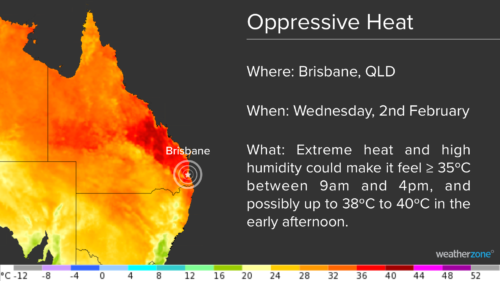
An extremely hot and humid airmass has begun spilling into southeastern Queensland today, with the stage now set for several uncomfortable days and nights in Brisbane. While bursts of heat are common in southeast Queensland during summer, the next few days and nights are going to feel oppressive in Brisbane. A combination of extreme heat and […]
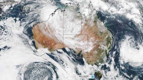
A burst of monsoonal rain, wind and storms is lashing northern Australia this week, while the threat of multiple tropical cyclones lingers in the east and west. The satellite image below shows clouds covering a vast area of central and northern Australia on Monday morning. Image: Satellite image at 11am EDT on Monday, January 31 […]
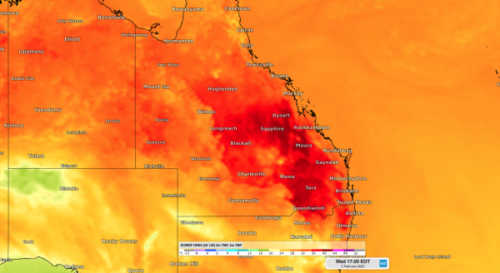
A mass of extremely hot and humid air will cause oppressive conditions in southeast Queensland in the middle of next week. A pool of hot air originating over western Queensland will be pushed over the state’s southeast in the middle of next week. While bursts of hot weather are common in southeast Queensland during summer, next […]
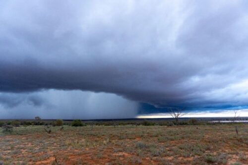
There are ongoing disruptions across South Australia this week following record-breaking rainfall across the state. A slow-moving low pressure trough being fed by copious tropical moisture has been producing rain and thunderstorms in SA during the last five days. This prolonged spell of wet and stormy weather has produced rainfall rates rarely seen in South Australia, due to unusually high quantities […]
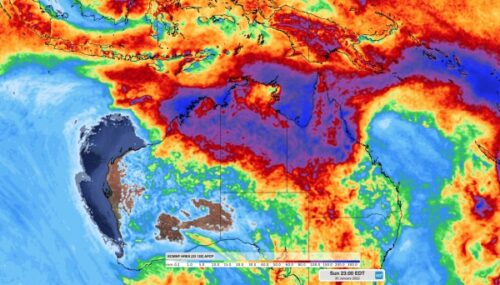
The monsoon trough is deepening over northern Australia and is set to bring heavy rainfall and frequent gusty thunderstorms across this week. The deepening monsoon trough and associated convective activity have already caused and increase in rain and allowed a couple of low pressure systems to develop. One of these low pressure systems developed to the north of the Kimberley late last week. While there were indications that this low could become a tropical cyclone, this now […]
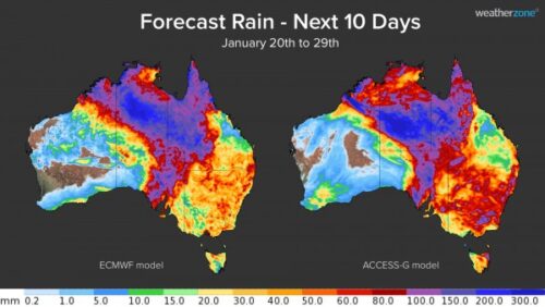
There are signs that rain and thunderstorms will increase over northern Australia during the next week, raising the likelihood of tropical cyclone development in the region. A monsoon trough is expected to move over northern Australia during the next few days, causing rain and storm activity to increase in parts of QLD, the NT and WA. This increase in […]

A cloud of volcanic ash and gas can be seen passing over QLD today, turning the sky red and disrupting flights in the region. A large plume of ash and gas was ejected into the atmosphere on Saturday when the Hunga Tonga Hunga Ha’apai erupted near Tonga. Since then, the volcanic cloud has been travelling […]
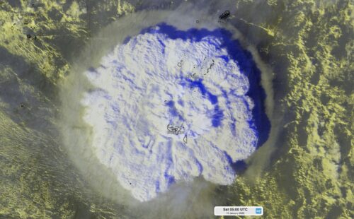
Tsunami waves have been observed in eastern Australia over the last two days following the eruption of an underwater volcano near Tonga on Saturday. So, how big were the tsunami waves and how rare are tsunamis in Australia? The Hunga Tonga–Hunga Haʻapai volcano erupted shortly after 3pm AEDT on Saturday, January 15. The explosive eruption sent a […]

The remnants of Tropical Cyclone Tiffany will cause heavy rain, thunderstorms and thick clouds to spread across central and south-eastern Australia during the next week. Tropical Cyclone Tiffany made landfall over the NT’s eastern Top End as a category one cyclone on Wednesday. Since then, the system has weakened to a Tropical Low and caused heavy rain to spread across Top End and spread into WA’s Kimberley district. During the 72 […]
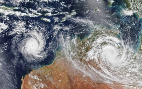
Australia’s tropical cyclone season is officially underway, but we may not see much activity for few months yet. The season runs from November to April, and for mining operators and businesses across northern Australia, 2026-27 is shaping up to be a season where the headline numbers and the real risk may not line up. On […]

A positive Indian Ocean Dipole is underway, but this one is unlikely to deliver the textbook dry spring and summer that businesses have come to expect from the pattern. The Bureau of Meteorology officially declared a positive IOD on Tuesday, October 27, which typically like El Niño can cause drier and warmer conditions over parts of […]
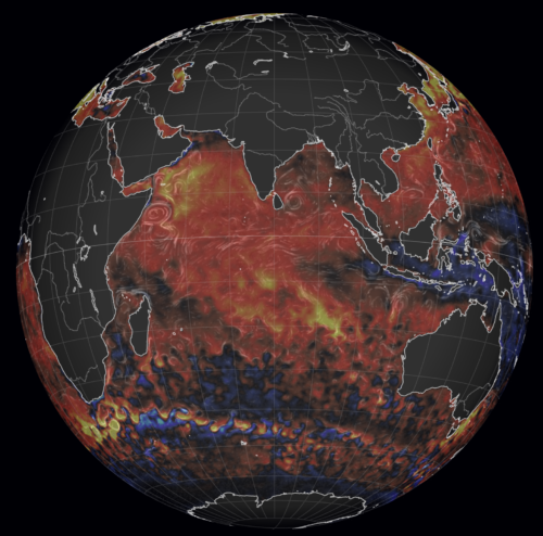
Waters off Indonesia have cooled in recent weeks, an indication that a positive Indian Ocean Dipole (IOD) event could be developing. It’s an important climate driver for Australia, and it could shape rainfall and temperatures heading into summer, with flow-on effects for farmers, energy and other industries. What is the Indian Ocean Dipole? The IOD […]

Leonora, WA, had its wettest September day on record earlier this month. Three weeks later, more than 1.3 million lightning pulses were detected within 800 km of the town in 48 hours. Why is a stalled trough delivering storms to mining country, and what it could mean for operations? The DTN Total Lightning Network detected […]