
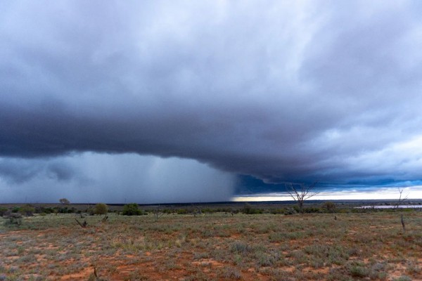
There are ongoing disruptions across South Australia this week following record-breaking rainfall across the state.
A slow-moving low pressure trough being fed by copious tropical moisture has been producing rain and thunderstorms in SA during the last five days.
This prolonged spell of wet and stormy weather has produced rainfall rates rarely seen in South Australia, due to unusually high quantities of atmospheric moisture lingering over the state.

Image: Thunderstorm and heavy rainfall in outback near Roxby Downs, SA on Saturday, January 22, Credit: @kdphotoau
Some places in the state’s north and west picked up 6 to 10 months’ worth of rain in the space of 2 to 3 days.
Kimba, in the Eastern Eyre Peninsula District, registered 200.8 mm of rain during the 72 hours ending at 9am on Monday. This is more than 10 times the monthly average for January and more than half its annual average. It is also more rain than any full calendar month since records commenced in 1920.

This unprecedented deluge has cut off transport routes across the state’s outback, with a number of roads and railway lines closed on Monday.
There are also reports that railway lines across the state’s north and west have been damaged or cut off by flooding, including the line between Adelaide and Kalgoorlie, and between Port Augusta and Tarcoola. This is likely to cause some delays in transporting freight.

Image: Road closure map on Monday. Source: Department for Infrastructure and Transport / dpti.sa.gov.au
Rain will continue over the eastern half of SA on Monday into Tuesday as the low pressure trough gradually moves towards the east. While there may still be localised areas of heavy rain on these two days, it will be lighter than the flooding falls that we saw over the weekend.
Another trough will move across SA on from the west on Wednesday and Thursday, bringing another round of showers and thunderstorms. Some of these storms are likely to be severe, with damaging winds, large hail and heavy rain all a risk.

Image: Forecast accumulated rain between Monday and Thursday this week, according to the ECMWF model.
Prior to the past week’s rain, large areas of SA had been missing out on the wet weather than La Niña has been delivering to large parts of northern and eastern Australia this summer.
However, some long-range forecast models had indicated that central Australia and northern parts of SA would start to see above-average rainfall as the season progresses. This outlook has abruptly come to fruition over the past week.
Weatherzone operates a Network Monitoring and Alerting tool, which uses gridded observational and forecast information to alert of potential impacts on rail lines and roads due to various weather threats, including heavy rainfall, high winds, storms and extreme temperatures. For more information contact Weatherzone at apac.sales@dtn.com.




