
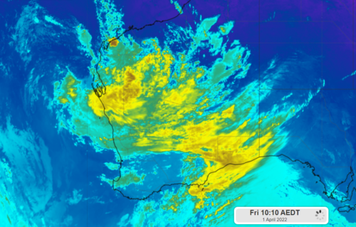
Heavy rainfall and damaging winds will continue to lash parts of western WA on Friday as a deep tropical low lingers off the coast. The satellite image shows thick cloud encompassing the low and WA on Friday morning at 7:10am AWST. Image: Himawari-8 Infrared satellite image at 7:10am AWST, April 1. While the […]
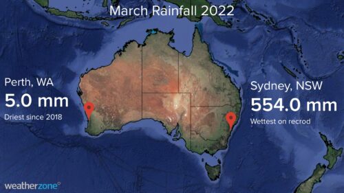
Perth only picked up 5 mm of rain during March as the city continues one of its driest starts to a year on record. While large areas of eastern Australia were being inundated with heavy rain and flooding during March, Perth and many other areas of the country’s west coast were very dry. The […]
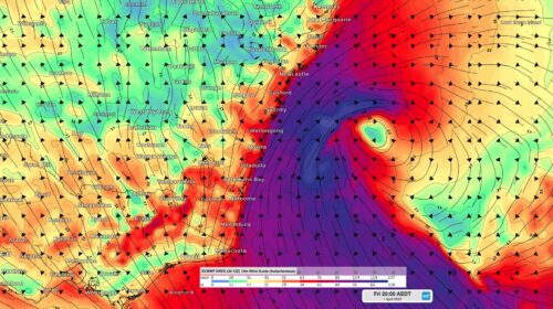
A deepening Tasman Low will bring damaging winds and surf along a broad area of the NSW coast during the next 24 to 48 hours. The satellite image below shows the low pressure system sitting around 280 kilometers off the northern NSW coast at 11am AEDT Thursday, March 31. This low pressure […]
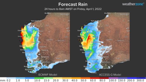
A tropical low is moving towards the Pilbara and Gascoyne coasts, which will enhance shower and thunderstorm activity in the region from Thursday. The tropical low developed south of Christmas Island earlier this week and should approach the Pilbara or Gascoyne coast late Thursday evening or early Friday morning. At this stage, the low is […]

Major flooding redeveloped at Lismore overnight after severe thunderstorms dumped heavy rain into the already inundated Wilsons River and other areas of northeast NSW. A low pressure system located off the far north coast of NSW caused heavy rain and embedded severe thunderstorms to push across the state’s Northern Rivers region on Tuesday night. […]
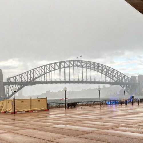
Sydney is now having its wettest March since 1956 as the city continues its wettest start to a year in record. Like much of eastern NSW, Sydney hasn’t seen much sun or dry weather this month. This persistent run of wet and gloomy weather has been caused by relentless onshore winds drawing moisture from […]
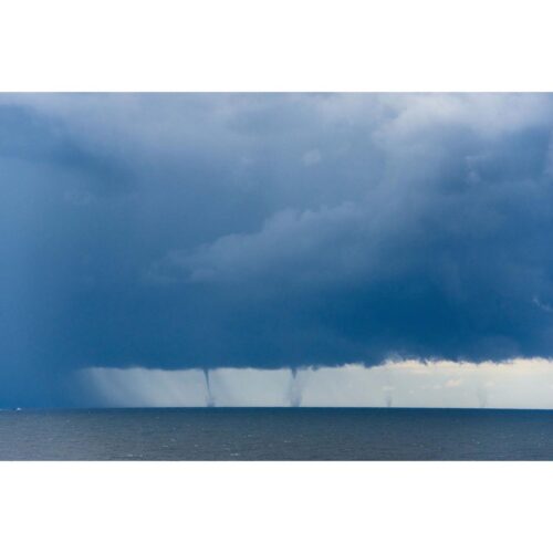
At least six waterspouts were spotted near Port Kembla on Saturday, as a heavy line of rain came close to one of NSW’s busiest ports. The waterspouts lingered off the coast between Wollongong and Shellharbour for more than five minutes clearly visible to onlookers ashore. The video below captures the surreal sight of the six […]
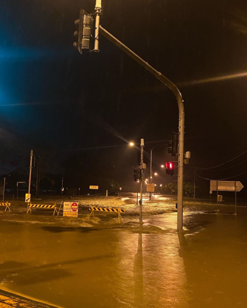
More than 300 mm of rain has drenched parts of southeast QLD and northeast NSW during the last 24 hours, inundating rivers and prompting evacuation orders in areas still recovering from the last big flood. The sequence of satellite images below shows a persistent stream of rain hitting southeast QLD and eastern NSW on […]
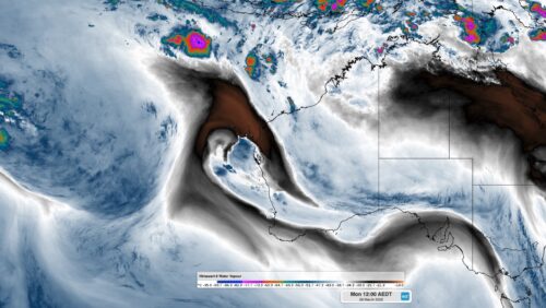
Ex-Tropical Cyclone Charlotte is bringing some much-needed rain to parts of WA, with more potentially heavy falls on its way. Moisture associated with Ex-Tropical Cyclone Charlotte caused widespread showers across the western inland and parts of the western and southern coasts in WA on the weekend. The Wheat Belt saw the largest totals over […]
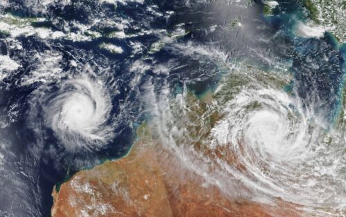
Australia’s tropical cyclone season is officially underway, but we may not see much activity for few months yet. The season runs from November to April, and for mining operators and businesses across northern Australia, 2026-27 is shaping up to be a season where the headline numbers and the real risk may not line up. On […]

A positive Indian Ocean Dipole is underway, but this one is unlikely to deliver the textbook dry spring and summer that businesses have come to expect from the pattern. The Bureau of Meteorology officially declared a positive IOD on Tuesday, October 27, which typically like El Niño can cause drier and warmer conditions over parts of […]
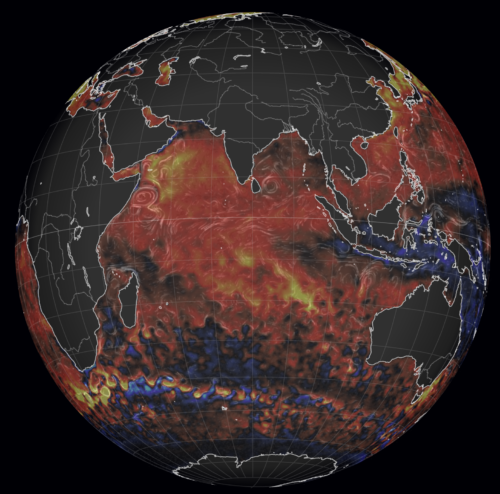
Waters off Indonesia have cooled in recent weeks, an indication that a positive Indian Ocean Dipole (IOD) event could be developing. It’s an important climate driver for Australia, and it could shape rainfall and temperatures heading into summer, with flow-on effects for farmers, energy and other industries. What is the Indian Ocean Dipole? The IOD […]

Leonora, WA, had its wettest September day on record earlier this month. Three weeks later, more than 1.3 million lightning pulses were detected within 800 km of the town in 48 hours. Why is a stalled trough delivering storms to mining country, and what it could mean for operations? The DTN Total Lightning Network detected […]