
A tropical low is moving towards the Pilbara and Gascoyne coasts, which will enhance shower and thunderstorm activity in the region from Thursday. The tropical low developed south of Christmas Island earlier this week and should approach the Pilbara or Gascoyne coast late Thursday evening or early Friday morning.
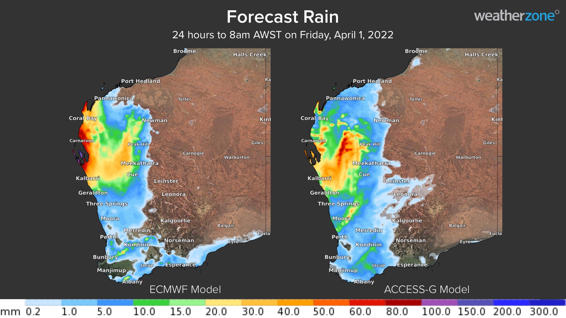
At this stage, the low is unlikely to reach tropical cyclone strength as it moves into an unfavourable environment. However, the system could still produce strong winds, heavy rain and thunderstorms in the western Pilbara, Gascoyne and Central West regions on Thursday and Friday. The maps below show two computer models’ 24-hour accumulated rainfall forecasts for the 24-hours leading up to 8am AWST on Friday, April 1.

Image: Two computer models’ 24-hour accumulated rainfall forecasts for the 24-hours leading up to 8am AWST on Friday, April 1, ECMWF (left) and ACCESS-G (right)
The maps above highlight the uncertainty in where and how much rain will fall, however there is model agreement that the largest totals will be observed in the 24-hours leading up to 8am on Friday, April 1. A broad area of the western Pilbara and Gascoyne could see 30-40mm in this period, while pockets of 50-100mm are possible in some areas. One model is suggesting that 24-hour totals could exceed 100mm along the coastal fringe near the low and in thunderstorms.
The low is expected to weaken as it tracks south along the WA coastline on Friday and Saturday, possibly dragging rain and storms further south into the Central West forecast district. In addition to the rain. damaging winds should also develop early Friday morning across parts of western Pilbara, Gascoyne and Central West district as the low nears the coast.
The map below shows one model’s forecast wind gusts at 8am Friday, April 1, with the peak winds along the Gascoyne coast.

Image: ECMWF wind gust forecast at 5am AWST on Friday, April 1.
Thunderstorms that develop in the coming days could also become severe, most likely producing heavy rainfall and damaging winds on Friday and potentially Saturday. Our meteorologists will be watching closely as this system evolves and approaches WA over the next 48 hours, for more information, please contact us at apac.sales@dtn.com.




