
Heavy rainfall and damaging winds will continue to lash parts of western WA on Friday as a deep tropical low lingers off the coast.
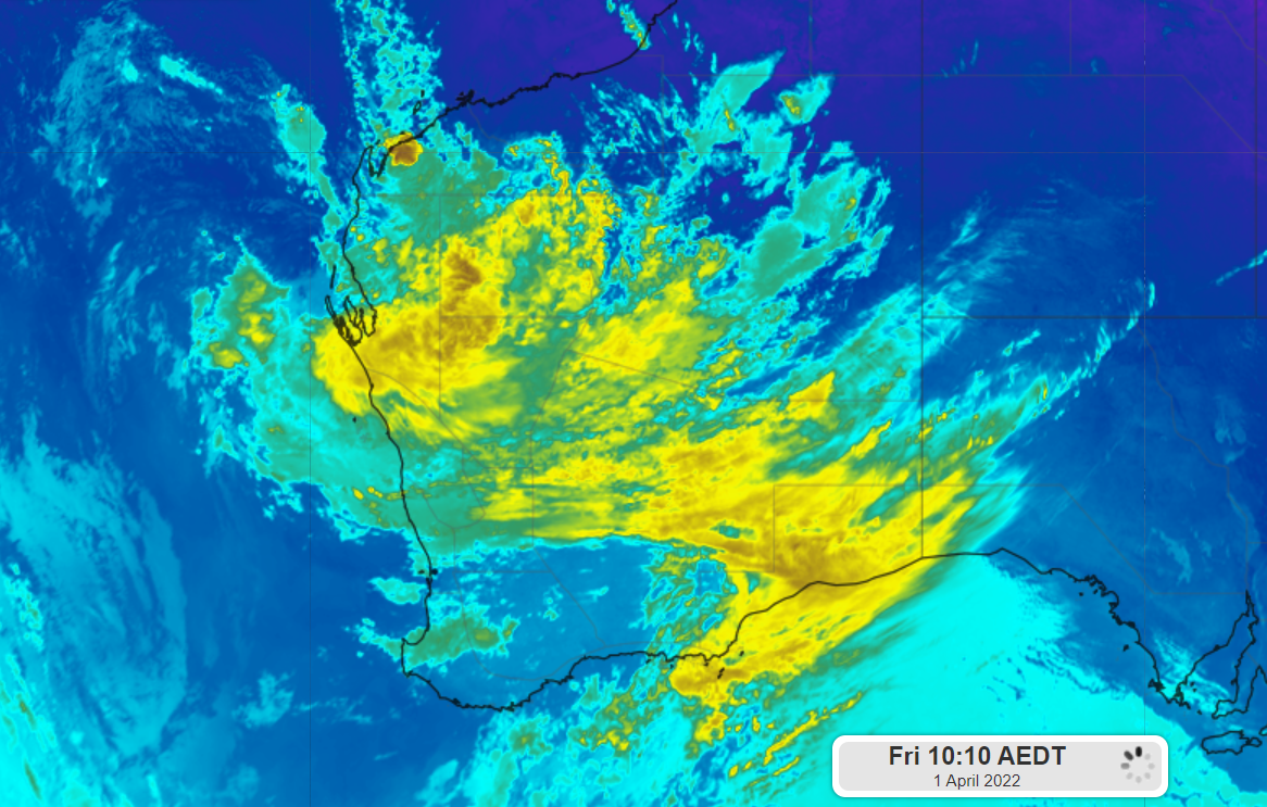
The satellite image shows thick cloud encompassing the low and WA on Friday morning at 7:10am AWST.

Image: Himawari-8 Infrared satellite image at 7:10am AWST, April 1.
While the low remained offshore, damaging winds and heavy rainfall impacted parts of the Pilbara and Gascoyne districts on Thursday and Friday morning.
The low whipped up damaging winds across parts of the Pilbara district on Thursday afternoon, with gusts reaching up to 95 km/h at Varanus Island, 87 km/h at Barrow Island as of 12:04pm and 12:39pm local time.
The system has also generated heavy rainfall across parts of the Gascoyne and Pilbara during the 23 hours since 9am AWST on Thursday, with falls of 104.4mm recorded at Learmonth and 60.6mm at Carnarvon.
This heavy rain will continue over the western Pilbara, Gascoyne and the far northwest corner of the Central West on Friday, with six hourly totals of 50 to 90mm possible in these regions.
The map below shows 24-hour accumulated rainfall total to 8am AWST on Saturday, April 2 could exceed 90mm along parts of the Pilbara and Gascoyne coasts.

Image: ECMWF 24-hour forecast accumulated rainfall to 8am AWST on Saturday, April 2.
This forecast rainfall has prompted a flood watch to be issued for parts of the Pilbara and Gascoyne coast after a dry summer.
In addition to the heavy rain, damaging wind gusts are possible with thunderstorms over in the Pilbara and Gascoyne districts on Friday.
Damaging wind gusts in excess of 90km/h could impact areas between Onslow and Billabong Roadhouse on Friday.
The map below shows the predicted instantaneous 10-minute wind gusts on Friday morning, with powerful winds expected in the Pilbara and Gascoyne regions.

Image: ECMWF 10-m instantaneous wind gusts at 11am AWST on Friday, April 1.
Both the wind and the rain should ease over the weekend as the low weakens and tracks south away from the region.
Weatherzone provides our clients with heavy rainfall, thunderstorm and damaging wind forecasts and risk analysis out to 7 days, which enables our clients to plan and prepare for severe weather. For more information, please contact us at apac.sales@dtn.com.




