
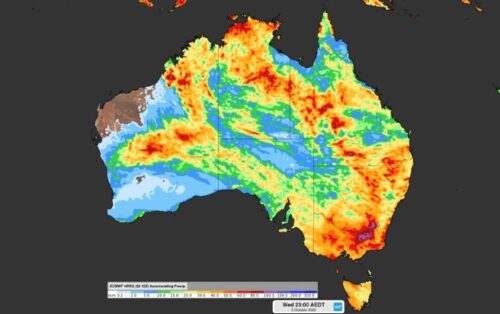
It’s not going to rain everywhere, every day, let’s be clear about that. But a series of weather systems will deliver rain to virtually all parts of Australia over the coming 10 days. The graphic below shows the total accumulated rainfall which we can expect between today (Monday, September 26) and next Wednesday, October 5. […]
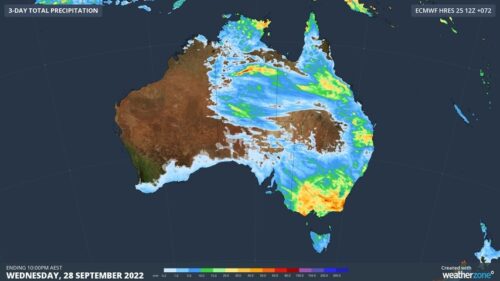
Rain and thunderstorms will spread over southeastern and eastern Australia during the next three days, dumping more water into already flooded rivers across several states. Since the beginning of September, a series of rain and storm-bearing low pressure troughs have delivered two-to-four months’ worth of rain in parts of eastern Australia. This frequent and substantial […]

Today marks the Southern Hemisphere’s spring equinox, which means days will now be longer than nights in Australia for the next six months. Well, technically speaking, each day will still be roughly 24 hours long. But there will be more daylight than darkness in Australia between now and late-March 2023. What’s making days longer than […]
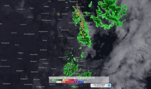
Parts of northeast NSW and southeast QLD were inundated by torrential rain on Thursday night, with some places collecting more than 300 mm during a barrage of thunderstorms. A deepening low pressure system interacting with copious moisture and an unstable atmosphere produced a sustained period of heavy rain and thunderstorms over northeast NSW and southeast […]
La Niña is a natural phenomenon that has a significant impact on weather and climate all over the world. So let’s find out what La Niña is and how it affects the weather in Australia. What is La Nina? La Niña is a broad-scale circulation in the Pacific Ocean that is characterised by warmer-than-average […]
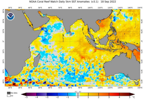
Australia is continuing to feel the impact of a strong negative Indian Ocean Dipole, with a band of thick rain and thunderstorms likely to cause flooding in parts of NSW during the next two days. A low pressure trough and associated cut-off low pressure system will cause widespread rain and potentially severe thunderstorms over […]
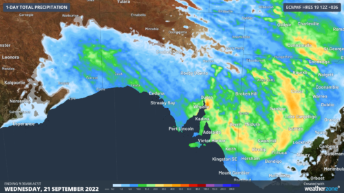
A cold front crossing South Australia today will produce a dangerous mix of damaging winds, rain and potentially severe thunderstorms. The animation below shows thick cloud passing over SA on Tuesday morning, causing rain and thunderstorms to spread over central and western parts of the state. This rain and thunderstorm activity is being caused […]
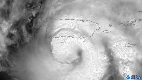
The entire population of Puerto Rica was left without electricity on Sunday night after Hurricane Fiona made landfall and crippled the island’s already fragile energy infrastructure. Hurricane Fiona made landfall on Puerto Rico’s southwest coast at roughly 3:20 pm local time on Sunday afternoon. At landfall, Fiona was a category one hurricane generating one-minute […]
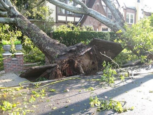
Damaging winds are a common feature in Australian severe weather and thunderstorm warnings. But did you know that some types of wind are more dangerous than others? There are three things that can make the wind dangerous: strength, duration and direction. The most obvious damaging feature of wind is its strength, which is typically […]
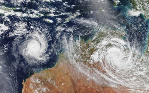
Australia’s tropical cyclone season is officially underway, but we may not see much activity for few months yet. The season runs from November to April, and for mining operators and businesses across northern Australia, 2026-27 is shaping up to be a season where the headline numbers and the real risk may not line up. On […]

A positive Indian Ocean Dipole is underway, but this one is unlikely to deliver the textbook dry spring and summer that businesses have come to expect from the pattern. The Bureau of Meteorology officially declared a positive IOD on Tuesday, October 27, which typically like El Niño can cause drier and warmer conditions over parts of […]
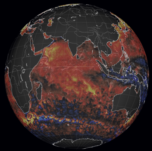
Waters off Indonesia have cooled in recent weeks, an indication that a positive Indian Ocean Dipole (IOD) event could be developing. It’s an important climate driver for Australia, and it could shape rainfall and temperatures heading into summer, with flow-on effects for farmers, energy and other industries. What is the Indian Ocean Dipole? The IOD […]

Leonora, WA, had its wettest September day on record earlier this month. Three weeks later, more than 1.3 million lightning pulses were detected within 800 km of the town in 48 hours. Why is a stalled trough delivering storms to mining country, and what it could mean for operations? The DTN Total Lightning Network detected […]