The entire population of Puerto Rica was left without electricity on Sunday night after Hurricane Fiona made landfall and crippled the island’s already fragile energy infrastructure.
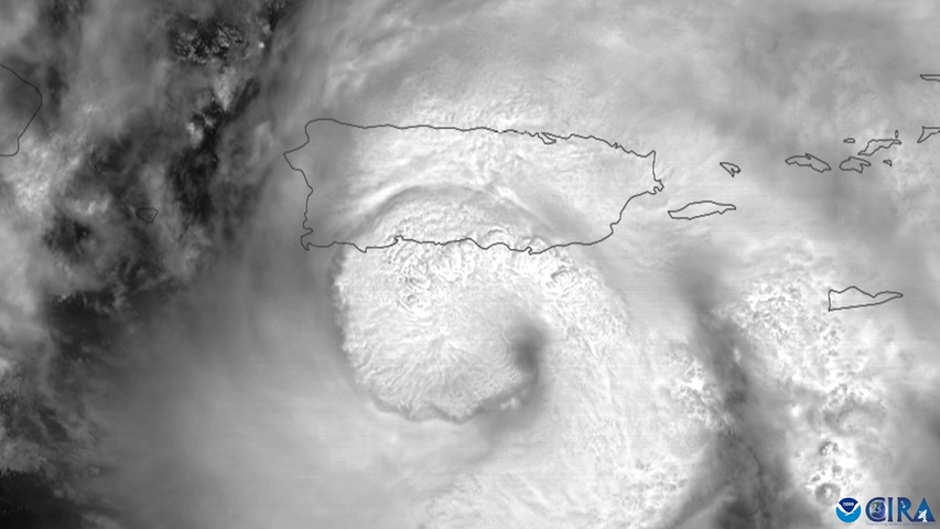
Hurricane Fiona made landfall on Puerto Rico’s southwest coast at roughly 3:20 pm local time on Sunday afternoon.
At landfall, Fiona was a category one hurricane generating one-minute sustained winds of 85 mph (140 km/h) with a pressure of 986 mb. The landfilling hurricane also produced heavy rain and a storm surge.
Video: Satellite images showing Hurricane Fiona making landfall over the southwest coast of Puerto Rico on Sunday afternoon. Source: CIRA
Despite only being a category one hurricane when it crossed the coast, Fiona caused power outages across the entire island.
LUMA Energy, the company responsible for providing power in Puerto Rico, said late Sunday that “as a result of severe weather, including Hurricane Fiona’s 80 mph winds, the electrical system has experienced several transmission line outages, which contributed to an island-wide blackout.”
One reason Fiona was able to cause an island-wide blackout, despite arriving as a category one hurricane, was because Puerto Rico is still recovering from damage caused by Hurricane Maria in 2017.
Maria was a much stronger system, reaching Puerto Rico’s coastline as a strong category four hurricane. This monstrous system caused catastrophic flooding and wind damage, including an island-wide blackout and knocked out 80 percent of the island’s power lines.
According to LUMA Energy, power may not be fully restored in Puerto Rico for several days due to the scale of the damage and ongoing dangerous weather.
Hurricane Fiona will continue to cause heavy rain, flooding, dangerous winds and large wave in parts of Puerto Rico and the Dominican Republic on Sunday night into Monday.
The system is then expected to gain strength and move further north on Monday and Tuesday, possibly causing severe weather in the Turks and Caicos Islands and parts of the Bahamas.
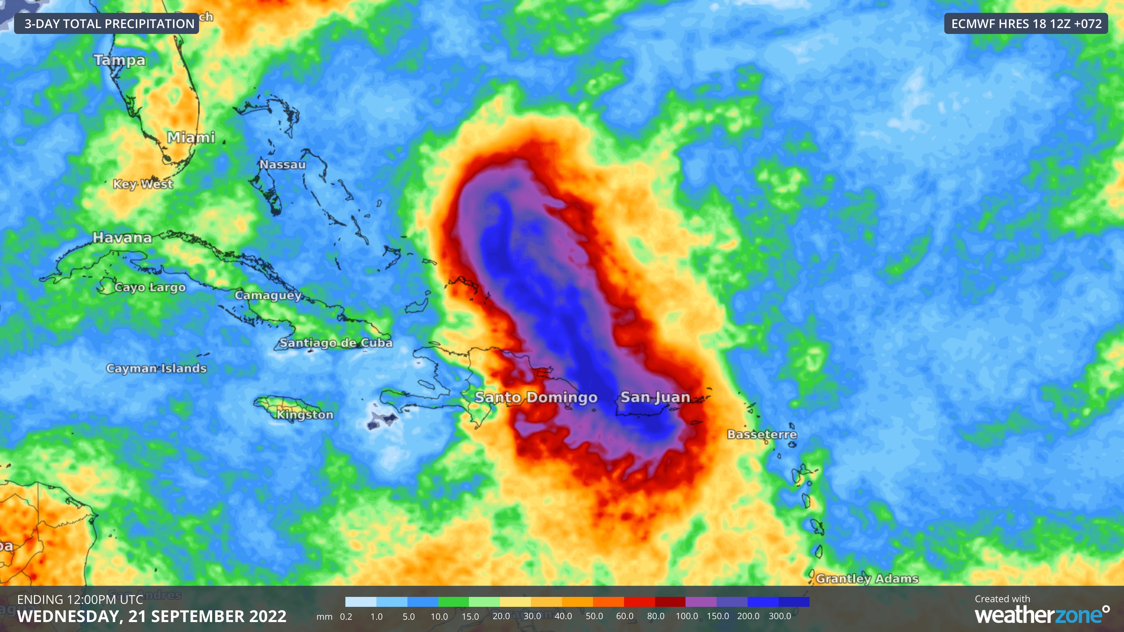
Image: Forecast accumulated rainfall during the 72 hours ending at 12:00pm UTC on Wednesday, September 21, according to the ECMWF-HRES model.
The latest advisories and more information about Hurricane Fiona can be found on the U.S. National Hurricane Centre’s website.
How can Weatherzone help this cyclone season in Australia?
Weatherzone provides extended forecast information with regards to the potential development and then tracking of tropical cyclones out to 7 days. Advisory text by our team of meteorologists delivers bespoke advice on the risk involved and likelihood of development, allowing for suitable preparations to be made. Seasonal tropical cyclone forecasts and wet season outlooks are also delivered to clients, helping businesses prepare in advance for the upcoming season. For more information, please contact us at apac.sales@dtn.com.


