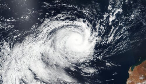
Australia’s tropical cyclone season coming to an end
The 2023-24 Australian tropical cyclone season is almost over and while it was a quiet season based on overall numbers, some of the landfalling systems had a big impact. The Australian tropical cyclone season officially runs from November until April. During this time, we usually see an average of about 9 to 10 tropical cyclones […]
Fog blanketed Kalgoorlie on Sunday
A rare sight of fog graced Kalgoorlie in the early hours of Sunday morning, starting from around 5am, peaking just after 6am as the sun rose, and lifting by 7am as winds started to pick up. Images (west-facing) on Sunday, April 14 AWST: (Top)- Kalgoorlie at 6:09am, and (Bottom) – Kalgoorlie at 7:14am (Bureau […]
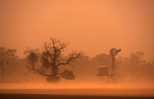
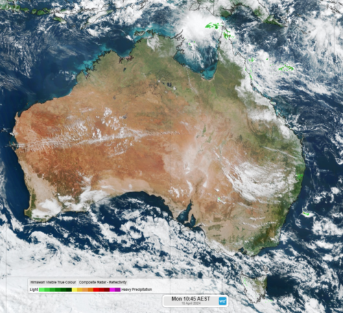
Great week for solar
Solar output across large areas of Australia should peak this week, with many areas not expected to receive a drop of rain. The dry week across WA, parts of the NT, SA and Vic this week comes as blocking high pressure systems prevent any major cold fronts from impacting the regions this week. The satellite […]
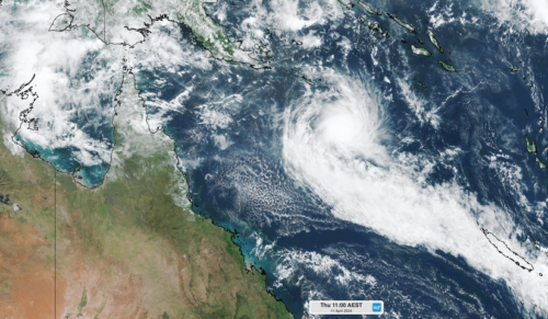
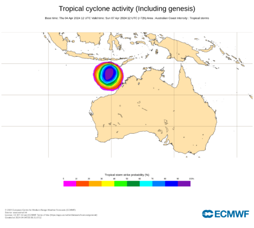
Tropical Cyclone Paul forms in Australian region
Tropical Cyclone Paul has formed over the northeast Coral Sea and could reach category three intensity by Thursday afternoon. Paul formed in the early hours of Thursday morning, becoming the 8th tropical cyclone in the Australian region so far this season. On Wednesday, Bureau of Meteorology outlooks only suggested a low chance of tropical cyclone […]
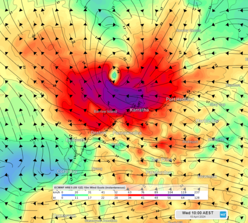
Gale force winds lashing the Pilbara
Ex-Tropical Cyclone Olga is edging ever so slightly closer to the Pilbara on Wednesday, bringing damaging winds and rain to the far western Pilbara and its islands. Ex-Tropical Cyclone Olga is currently about 200kmh northwest of Karratha on Wednesday morning, with the satellite image below showing thick cloud and lightning offshore. Image: Himawari- 9 […]
Tropical Cyclone Olga to bring rain to parts of WA
Tropical moisture from Severe Tropical Cyclone Olga will bring rainfall to parts of the Pilbara and Gascoyne as it tracks parallel to their coastline this week. The satellite image below shows Tropical Cyclone Olga sitting off the northwest shelf of WA and thick cloud extending 1700km into the NT. Image: Himawari-9 satellite image at […]
Tropical Cyclone Olga could develop this weekend
There is a high risk that Tropical Cyclone Olga will develop to the northwest of Australia this weekend. The satellite images below show a tropical low sitting between WA and Indonesia on Friday morning. Video: Satellite images showing a tropical low to the north of WA on the morning of Friday, April 5, 2024. This […]
Seventh tropical cyclone of season possible this weekend
There are increasing signs that two tropical lows could develop over northern Australia in the next week, with one a high risk of developing into a tropical cyclone. The enhanced tropical risk comes as the Madden Julian Oscillation (MJO) makes its way towards the Australian region in the coming week. While the MJO currently […]
East Coast soaking on Friday
Heavy rainfall of up to 300mm is expected this Friday and Saturday for southeast Queensland and eastern NSW, as a powerful cut-off low and a moisture-rich coastal trough combine. A pool of cold air currently crossing the Great Australian Bight is expected to produce an upper-level low pressure system over southeastern Australia by Thursday. This […]