
There is a high risk that Tropical Cyclone Olga will develop to the northwest of Australia this weekend.
The satellite images below show a tropical low sitting between WA and Indonesia on Friday morning.
Video: Satellite images showing a tropical low to the north of WA on the morning of Friday, April 5, 2024.
This tropical low, designated Tropical Low 11U, was sitting more than 500 km to the northwest of the Kimberley coast on Friday morning.
Most forecast models suggest that Tropical Low 11U will move slowly towards the south or southwest on Friday and into the weekend. This track will move the low over very warm waters off the north coast of WA, where sea surface temperatures are currently hovering around 30ºC. These bath-like waters should help the system intensify over the next few days.
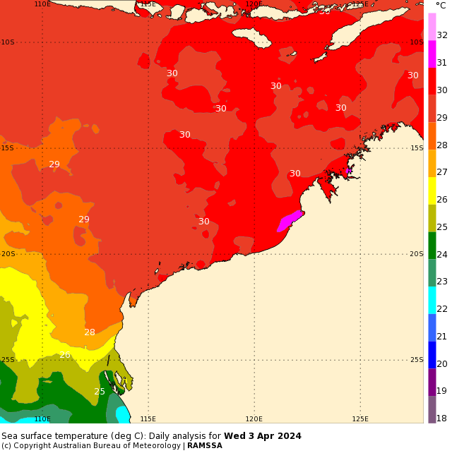
Image: Sea surface temperatures to the northwest of Australia on April 3, 2024. Source: Bureau of Meteorology
According to the Bureau of Meteorology, there is a high risk that Tropical Low 11U will become a tropical cyclone on Saturday or Sunday.
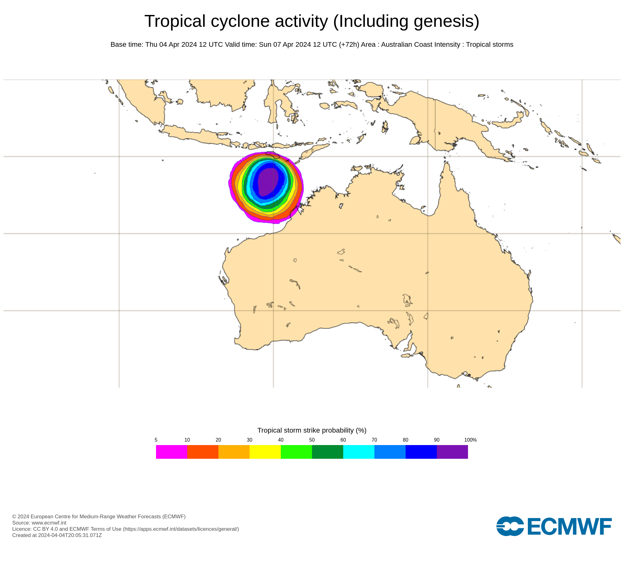
Other international forecast organisations also show a strong possibility of tropical cyclone development near WA on the weekend. The image below shows the likelihood of tropical cyclone activity within a 48-hour window of Sunday night, according to the European Centre for Medium-Range Weather Forecasts (ECMWF),
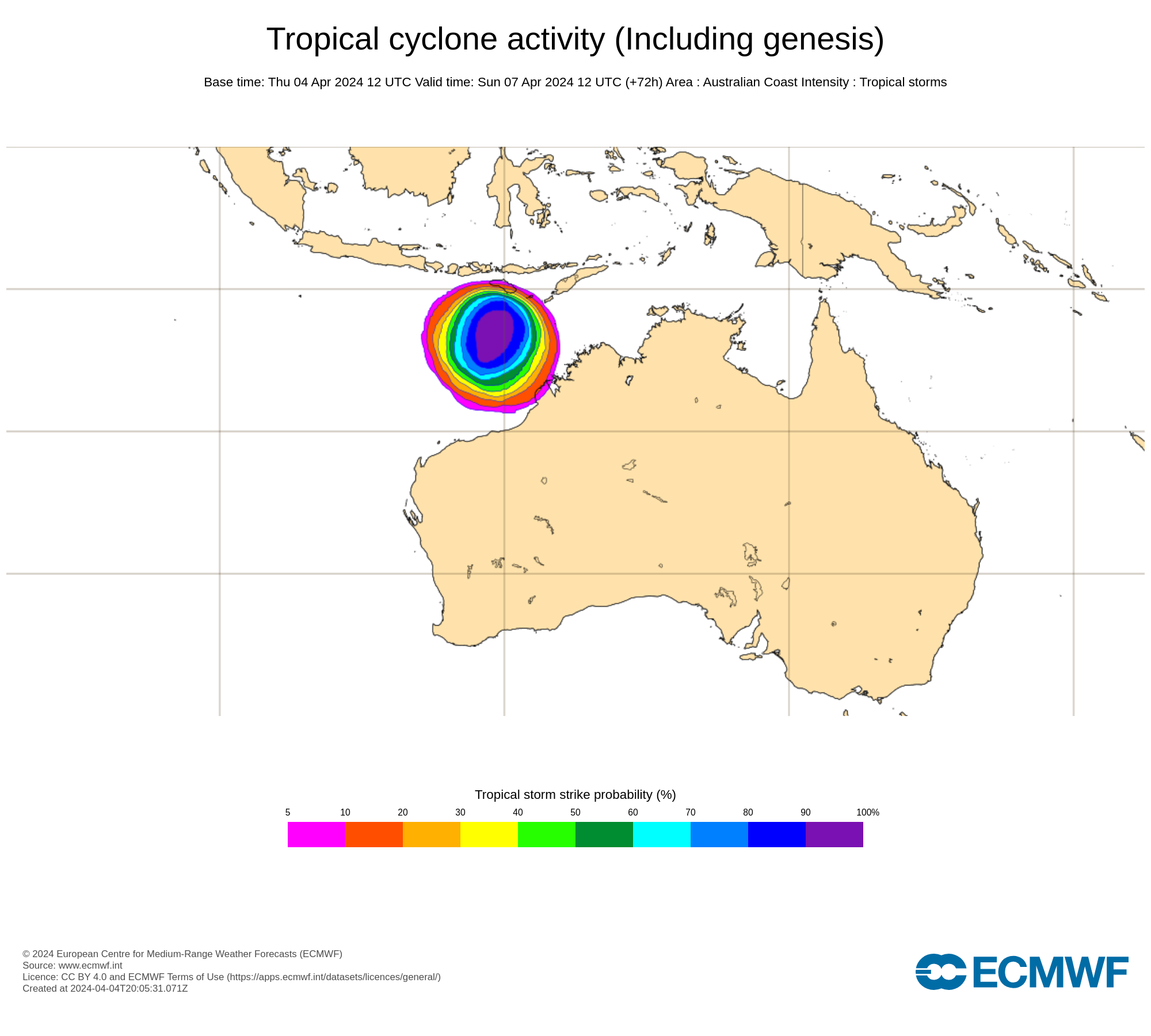
Image: Probability that a tropical cyclone will pass within a 300 km radius of a given location within a 48-hour time window centred on Monday night. Source: ECMWF
If a tropical cyclone does form to the north of WA on the weekend, it will be assigned the next available name on the list for Australian tropical cyclones.
Australia has a pre-determined list of tropical cyclone names that runs alphabetically and alternates between male and female names. The following names have already been assigned to tropical cyclones that formed in Australia’s area of responsibility this season:
The next name on the list is Olga and there is a good chance that Tropical Cyclone Olga will form to the north of WA this weekend.
Looking ahead, most forecast models predict that Tropical Low 11U/Tropical Cyclone Olga will start to weaken early next week and move towards the west or southwest, roughly parallel to the northern coastline of WA. This path would keep the system away from WA and prevent landfall on the Australian mainland.
The image below shows that every ensemble member in the U.S. Global Ensemble Forecast System (GEFS) expects this system to stay offshore over the coming week.
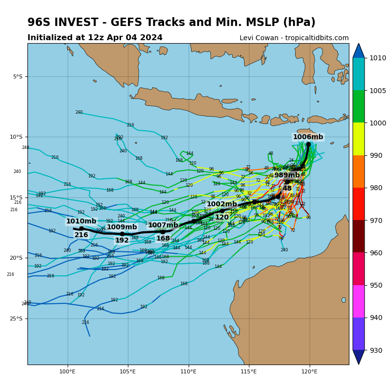
Image: The most likely forecast tracks for Tropical Low 11U, according to the GEFS model. Source: tropicaltidbits.com
There are also early signs that a separate tropical low could form over the Arafura Sea, to the north of the NT, around the middle of next week. There are indications that this system will also have an increased risk of developing into a tropical cyclone during the second half of next week. More reliable information for this system will become available over the weekend and early next week.
Be sure to stay up to date with the latest tropical cyclone advisories over the coming days for the most accurate information on these developing tropical systems.
DTN APAC, specialises in industry-leading forecast, alerting and threat analysis of tropical cyclones, offering you expert, customised solutions when the weather turns wild.
Providing rapid-update forecast information, we alert you to any low-pressure system gaining power within your region and, unlike other providers, can track its development out to 7 days. This gives you the time to prepare and safeguard your staff, sites and assets.
You will have the most precise weather intelligence charting rainfall, wind speeds and potential storm surges to help you make critical decisions quickly. Whether it’s adjusting key work schedules, protecting your staff or securing your site, we have the alerting capability to keep you steps ahead of the storm.
We will support you, 24/7, keeping you informed and making your critical decisions easier. For more information, please contact us at apac.sales@dtn.com.




