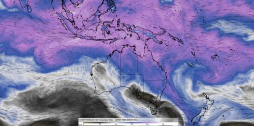
Two giant atmospheric waves are about to clash near Australia – here’s what to expect
Northern Australia faces an increased risk of heavy rain and tropical cyclone activity in the coming weeks thanks to the interaction of two huge atmospheric waves near Australia. While Earth’s atmosphere may appear chaotic, there are distinct wave-like patterns in the sky that meteorologists watch out for to help predict the weather in the coming […]
La Niña and negative IOD declarations unlikely this summer
Australia should experience summer without the influence of major climate drivers like La Niña or a negative IOD, potentially heightening the risk of heatwaves, extreme heat and bushfires across parts of the country. Pacific Ocean climate driver During much of 2024, the sea surface temperatures across the central and eastern Pacific have been cooler than […]
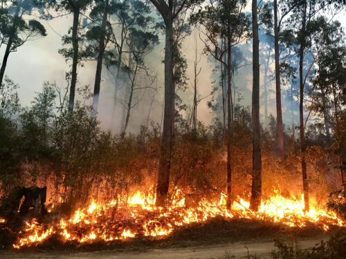
Australia faces high fire danger this summer
Australia recorded its warmest spring on record, with also severe rainfall deficiencies occurring across parts of the country, setting the stage for high fire risk this summer. The Australasian Fire and Emergency Services Authorities Council (AFAC) released their summer bushfire outlook for 2024 on Thursday, November 28, showing large areas of the NT, Vic and […]
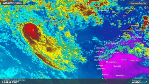
Tropical Cyclone Robyn forms in Australian region
Tropical Cyclone Robyn has formed inside Australia’s area of responsibility, becoming the first named cyclone of the 2024-25 season. Robyn became a category one tropical cyclone over the eastern Indian Ocean on Thursday afternoon, forming roughly 740 km to the west southwest of the Cocos (Keeling) Islands at about 2pm AWST. Image: Visible satellite images […]
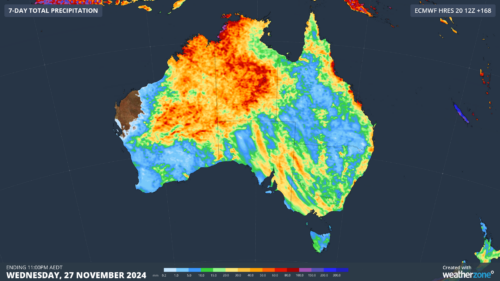
Hundreds of millimetres to lash northern Aus as MJO nears
An extremely wet week is on the cards for northern Australia, with frequent thunderstorm activity and heavy rainfall likely impacting mining operations in the country’s north. The soggy week is being partially caused by the Madden Julian Oscillation (MJO) which is currently over the Indian Ocean and nearing Australia. Models suggest that the MJO may […]
Tropics awakening, increasing risk of cyclones, heavy rain and storms
The Madden Julian Oscillation and the monsoon should impact Australia in the next fortnight, increasing the risk of heavy rain, flooding, thunderstorms and tropical cyclones in the coming weeks. The Madden-Julian Oscillation (MJO) is currently over the Indian ocean and is forecast to move east towards Australia in the coming days and remain in the […]
Heavy rain to soak Queensland’s central coast on Thursday
A brief burst of heavy rain is likely to cause flash flooding along Queensland’s central coast on Thursday. A coastal trough being fed by a deep layer of moisture-laden winds coming off the Coral Sea will cause heavy rain over Qld’s central coast and adjacent inland on Wednesday night into Thursday. There also signs that […]
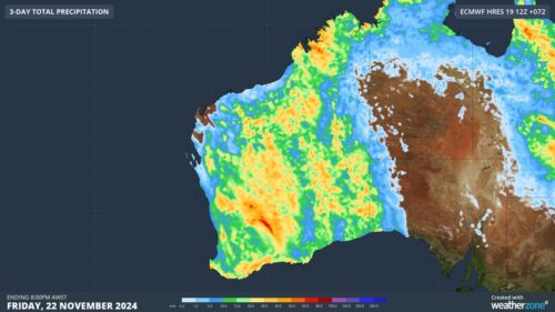
Storms drenching the west
A stormy week is well and truly underway for WA, with more to come in the coming days. Rain, and plenty of it, is set to soak virtually the entire state. And while some places will inevitably only see a few drops or miss out entirely, plenty of areas will see good falls. Image: Three-day […]
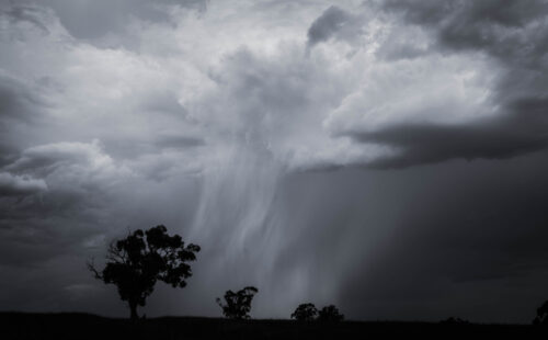
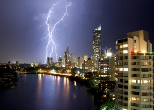
Australia bracing for thunderstorms every day this week
Thunderstorms will develop over large areas of Australia every day this week and likely continue into next week as the country becomes locked into a relentless stormy weather pattern through the middle of November. Thunderstorms require three key ingredients to form: Moisture in the atmosphere An unstable atmosphere A lifting mechanism that causes air to […]