
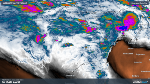
A tropical low to the northwest of WA is moving towards the Pilbara and could develop into a tropical cyclone over the weekend. But will it cross the coast? The tropical low designated 08U was southeast of Christmas Island on Wednesday morning. The system is expected to develop into a tropical cyclone on Friday […]
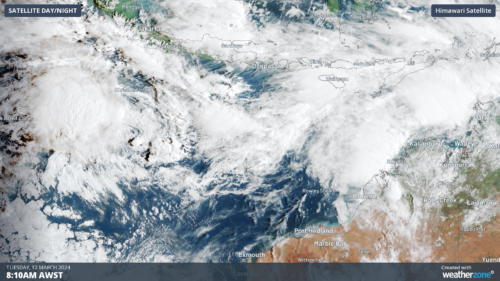
There are increasing signs that a tropical cyclone will develop offshore the WA coastline this week, possibly impacting the region over the weekend. A tropical low designated 08U is 270 km southwest of Christmas Island and is expected to pass south of the Island this morning as it moves east towards the WA mainland. […]
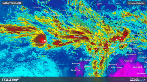
The tropics will awaken across northern Australia this week, with huge rainfall totals, thunderstorms, tropical lows and tropical cyclone risk all on the cards. This active week across northern Australia is being driven by a strong monsoon trough and the Madden Julian Oscillation (MJO) in the region. As we mentioned last week, the […]
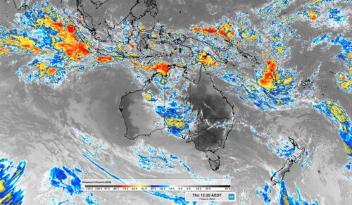
An active pulse of the Madden-Julian Oscillation will increase the risk of tropical cyclones and thunderstorms in the Australian region over the coming week. The Madden-Julian Oscillation (MJO) refers to a pulse of increased tropical cloud, rainfall and thunderstorm activity that moves through our planet’s atmosphere, from west to east, near the equator. The MJO […]
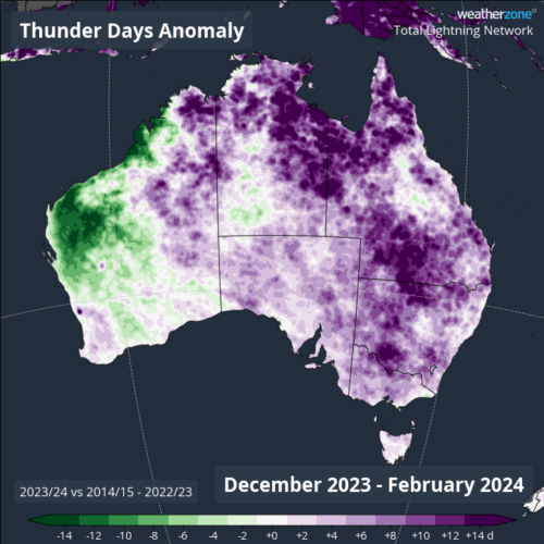
Large areas of Australia saw an above average number of lightning days this summer, with Melbourne, Canberra and Brisbane all seeing 5 to 6 extra storm days during the season. Australia always sees lots of lightning during summer as hot air, abundant moisture and ample atmospheric instability combine to create ideal conditions for thunderstorms. The […]

A dangerous mixture of hot, dry and windy weather is causing catastrophic fire danger ratings in parts of western Victoria today. The term ‘catastrophic fire danger’ refers to the highest rating on the Australian Fire Danger Rating System, which has four tiers: Moderate High Extreme Catastrophic Each category corresponds to a range of values in […]

Parts of central and western Victoria have just endured their driest February in more than 30 years, priming the landscape for extreme to catastrophic fire danger this Wednesday. While December and January were abnormally wet for most of Vic, the tap has been turned off for the western half of the state during February. The […]
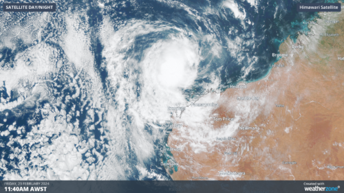
Ex- Tropical Cyclone Lincoln should re-develop into cyclone off the Kimberley coast in WA on Friday night, before setting its sights on the Pilbara and northern Gascoyne in the next 48 hours. Lincoln will be the first Tropical Cyclone to impact WA this season, but it is the second Tropical Cyclone to move into the Western […]

The hot air mass that helped create large fires in Victoria and Tasmania on Thursday will shift its focus to NSW on Friday, causing temperatures to spike in Sydney. Thursday was a dangerous day of heat and fire danger in southeastern Australia as a mass of hot air combined with strong and dry winds […]

Australia’s tropical cyclone season is officially underway, but we may not see much activity for few months yet. The season runs from November to April, and for mining operators and businesses across northern Australia, 2026-27 is shaping up to be a season where the headline numbers and the real risk may not line up. On […]

A positive Indian Ocean Dipole is underway, but this one is unlikely to deliver the textbook dry spring and summer that businesses have come to expect from the pattern. The Bureau of Meteorology officially declared a positive IOD on Tuesday, October 27, which typically like El Niño can cause drier and warmer conditions over parts of […]

Waters off Indonesia have cooled in recent weeks, an indication that a positive Indian Ocean Dipole (IOD) event could be developing. It’s an important climate driver for Australia, and it could shape rainfall and temperatures heading into summer, with flow-on effects for farmers, energy and other industries. What is the Indian Ocean Dipole? The IOD […]

Leonora, WA, had its wettest September day on record earlier this month. Three weeks later, more than 1.3 million lightning pulses were detected within 800 km of the town in 48 hours. Why is a stalled trough delivering storms to mining country, and what it could mean for operations? The DTN Total Lightning Network detected […]
