The tropics will awaken across northern Australia this week, with huge rainfall totals, thunderstorms, tropical lows and tropical cyclone risk all on the cards.
This active week across northern Australia is being driven by a strong monsoon trough and the Madden Julian Oscillation (MJO) in the region.
As we mentioned last week, the proximity of the MJO in the Australian region will increase the likelihood of tropical cyclone development in the Australian waters in the coming week.
Several computer models are predicting the development of tropical lows or tropical cyclones in the Australian region in the coming week.
A tropical low (designated 08U) near the Cocos (Keeling) Islands brought sustained winds of 59 km/h and gusts up to 85 km/h on Monday morning.
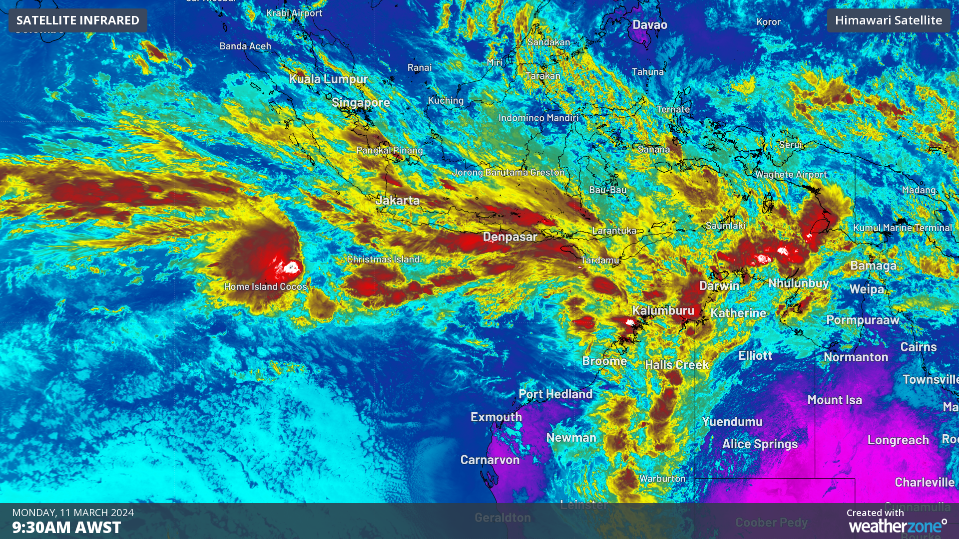
The map below shows a mass of cloud across northwestern Australia and Tropical Low 08U to the west of Australia near the Cocos (Keeling) Islands.
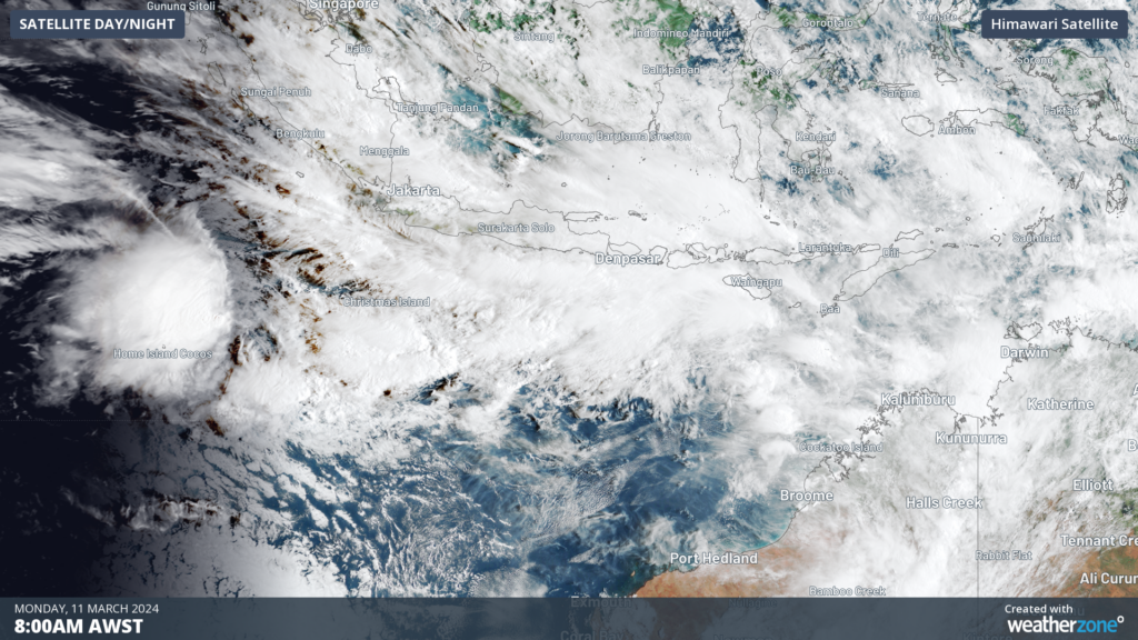
Image: Himawari-9 satellite image showing a tropical low near the Cocos Islands (far left centre of this image) at 8am AWST on Monday, March 11
This low (08U) will move to the east in the coming week towards Australia and has a high chance of developing into a tropical cyclone from Thursday.
If the low develops into a tropical cyclone, this will be the fifth named tropical cyclone this season.
While this low should pass well to the south of Christmas Island, gales could impact the Island at times on Tuesday.
The map below shows that the low’s centre (black solid line) should track east towards the Pilbara region later in the week, however you can see that there is a high degree of uncertainty in its track and strength.
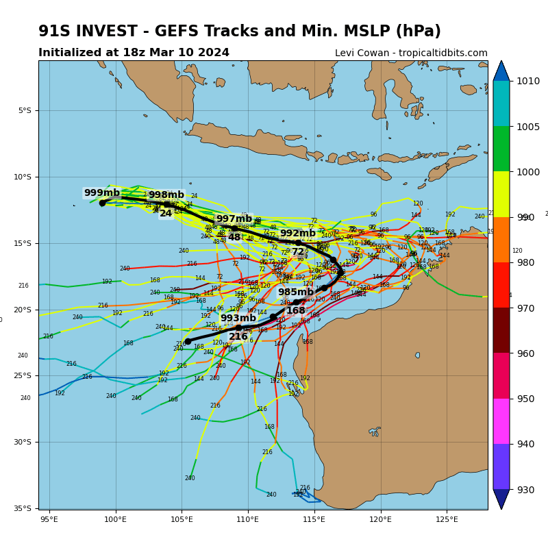
Image: GEFS ensemble member tracks for Tropical low 08U. Source: TropicalTidbits.com
The low or cyclone could come close to the WA coastline later in the week into early next week.
While the low near Cocos (Keeling) Islands has the highest risk of developing into a tropical cyclone this week, several other lows could develop in the Gulf Carpentaria, the Timor Sea and the Coral Sea over the coming fortnight. These systems have a low risk of developing into tropical cyclone at this stage.
Regardless of whether the lows make cyclone strength of not, the active monsoon is expected to bring huge rainfall totals across northern Australia this week.
The map below shows the forecast rainfall across northern Australia during the next 7 days, with some areas expecting 100-200mm of rainfall and isolated pockets above 250mm.
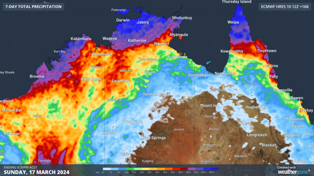
Image: 7-day total precipitation forecast to 9:30pm ACST on Sunday, March 17, according to ECMWF.
Anyone living in northern Australia should pay close attention to the latest tropical cyclone advisories and weather warnings over the next couple of weeks. For more information on Weatherzone’s tropical cyclone services, please contact us at apac.sales@dtn.com.


