

A three-day soaking has begun in NSW, with rain and thunderstorms expected to spread across most of the state over the next 72 hours. An upper-level cut-off low will pass over NSW from west to east between Friday and Sunday. As this upper low crosses NSW, it will interact with moisture-laden air to produce widespread […]
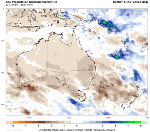
Signs are pointing to the second consecutive positive Indian Ocean Dipole (IOD) developing in the next few months. However, May is shaping up to be a time to make-or-break this event. What is a positive IOD? The IOD is a coupled ocean-atmosphere climate driver that changes the circulation patterns over the Indian Ocean. A positive […]
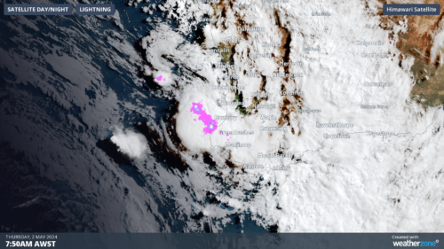
A line of severe thunderstorms is moving onshore towards the southwest of WA, which could produce heavy rainfall and large hail on Thursday morning. These thunderstorms are forming on a trough offshore ahead of an approaching cold front and sweeping across the region. The image below shows a shelf cloud over Bunbury on Thursday morning. […]
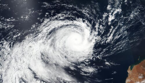
The 2023-24 Australian tropical cyclone season is almost over and while it was a quiet season based on overall numbers, some of the landfalling systems had a big impact. The Australian tropical cyclone season officially runs from November until April. During this time, we usually see an average of about 9 to 10 tropical cyclones […]

A prolonged rainfall event is set to bring large totals to parts of NSW and Qld from Saturday, with possible heavy falls and flooding. A low-pressure system in the Coral Sea, a deepening coastal trough and persistent easterlies will bring moisture-laden air into southeast Qld and northeast NSW will bring days of rainfall to the […]
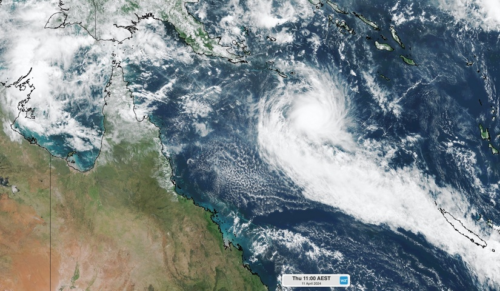
Tropical Cyclone Paul has formed over the northeast Coral Sea and could reach category three intensity by Thursday afternoon. Paul formed in the early hours of Thursday morning, becoming the 8th tropical cyclone in the Australian region so far this season. On Wednesday, Bureau of Meteorology outlooks only suggested a low chance of tropical cyclone […]

Heavy and remarkably widespread rain has fallen across New South Wales and southern Queensland overnight, with the heaviest falls centred on the Sydney region. The Sydney CBD copped an absolute drenching, with 111 mm in the gauge in the 24 hours to 9 am. That wasn’t too far off the daily record of 191 mm […]

There are increasing signs that two tropical lows could develop over northern Australia in the next week, with one a high risk of developing into a tropical cyclone. The enhanced tropical risk comes as the Madden Julian Oscillation (MJO) makes its way towards the Australian region in the coming week. While the MJO currently […]
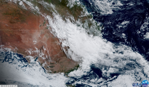
A thick stream of dense clouds and heavy rain will soak Sydney and other areas of eastern NSW over the next three days, with damaging winds and hazardous surf also on the cards from Friday. A deepening coastal trough and associated upper-level low pressure system will cause widespread rain and thunderstorms across southern Qld, NSW […]

Australia’s tropical cyclone season is officially underway, but we may not see much activity for few months yet. The season runs from November to April, and for mining operators and businesses across northern Australia, 2026-27 is shaping up to be a season where the headline numbers and the real risk may not line up. On […]

A positive Indian Ocean Dipole is underway, but this one is unlikely to deliver the textbook dry spring and summer that businesses have come to expect from the pattern. The Bureau of Meteorology officially declared a positive IOD on Tuesday, October 27, which typically like El Niño can cause drier and warmer conditions over parts of […]

Waters off Indonesia have cooled in recent weeks, an indication that a positive Indian Ocean Dipole (IOD) event could be developing. It’s an important climate driver for Australia, and it could shape rainfall and temperatures heading into summer, with flow-on effects for farmers, energy and other industries. What is the Indian Ocean Dipole? The IOD […]

Leonora, WA, had its wettest September day on record earlier this month. Three weeks later, more than 1.3 million lightning pulses were detected within 800 km of the town in 48 hours. Why is a stalled trough delivering storms to mining country, and what it could mean for operations? The DTN Total Lightning Network detected […]
