
A prolonged rainfall event is set to bring large totals to parts of NSW and Qld from Saturday, with possible heavy falls and flooding.
A low-pressure system in the Coral Sea, a deepening coastal trough and persistent easterlies will bring moisture-laden air into southeast Qld and northeast NSW will bring days of rainfall to the region.
While there is not a drop of rain on the radar over southeast Qld and Northeast NSW on Friday morning, the mass of cloud associated with a low in the Coral Sea will enhance rainfall over the weekend. You can also see on the image that showers are streaming into Far North Qld and showers and storms have developed in the Arafura Sea associated with a low-pressure system in the region.
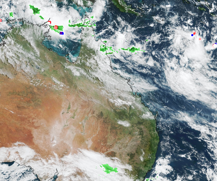
Image: Himawari-9 satellite image at 9:55am AEST on Friday, April 19
The low will edge closer to the Qld coast enhancing rainfall over the region between Saturday and early Tuesday morning.
The map below shows two computer model forecasts for the four days leading up to early Tuesday morning, with widespread falls of 40-80mm forecast across southeast Qld, with isolated falls of 80-100mm possible.
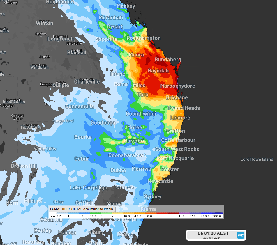
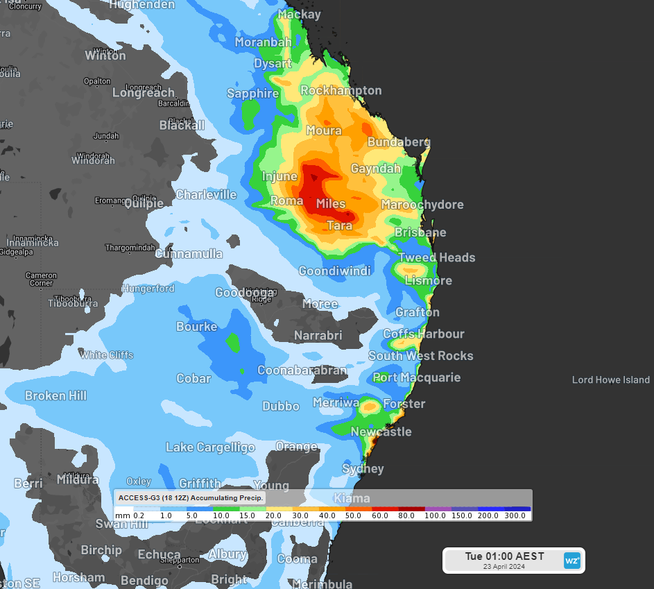
Images: Accumulated rainfall forecast for the four days leading up to 1am AEST on Tuesday, April 23, according to ECMWF (top) and ACCESS-G (bottom).
You can see that the forecast still varies between models with how much and where the rainfall will fall.
According to ECMWF, the heaviest falls are expected between Saturday evening and early Sunday morning, with falls between 50 to 80mm forecast between Rockhampton and Bundaberg. 3 hourly rainfall totals could reach 15-20mm during this period. This rainfall could lead to possible flooding in the area.
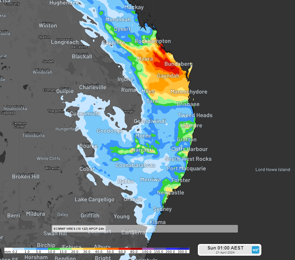
Image: 24 hour rainfall leading up to 1am AEST on Sunday AEST, according to ECMWF
The focus of the rainfall will then shift south during Sunday, with the heaviest falls expected across southeast Qld and northeast NSW, including Brisbane.
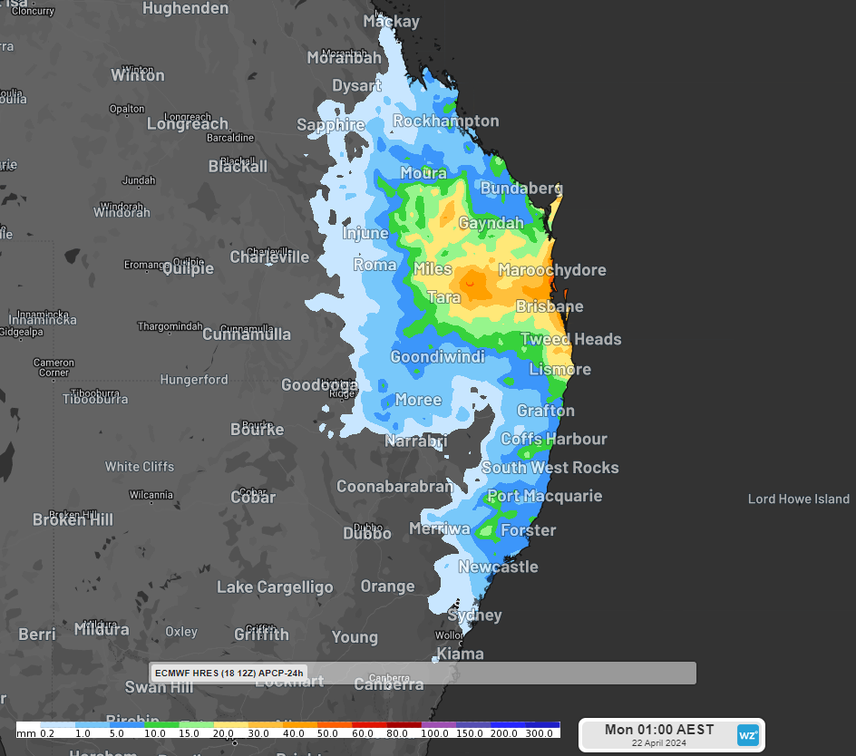
Image: 24 hour rainfall leading up to 1am AEST on Monday AEST, according to ECMWF
While the rainfall will continue into Monday, it should begin easing off as the trough weakens and the low moves offshore.
As this event unfolds, please keep an eye out for the latest warnings and alerts here.
DTN APAC provides a suite of services tailored towards the insurance industry. From severe weather ‘heads-up’ from our meteorologist team, to detailed warnings and extreme observation alerts, to post-event reporting, we can cover any major weather event. To find out more, please explore our website or email us at apac.sales@dtn.com.


