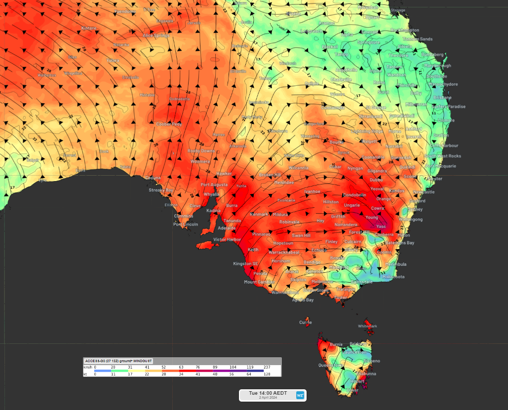
Exceptionally warm, dry March for parts of SA
Soaring temperatures and abundantly clear skies have just caused one of the warmest and driest Marches on record in parts of South Australia. Abnormally high pressure near southern Australia this month has kept rain-bearing systems away from SA, leading...
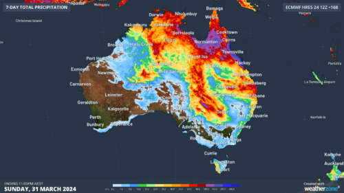
Easter deluge possible as tropical moisture moves south
The tropical moisture that caused significant flooding in the NT and Qld is set to move southeast over Easter, bringing heavy rainfall, thunderstorms and possible flooding and damaging winds with it. The map below shows the massive rainfall totals...
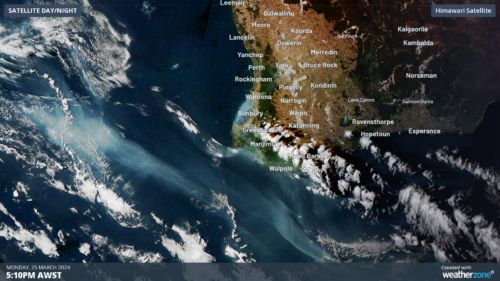
Smoke from WA bushfires seen from space
Several fires are burning across southwest WA this week, with smoke plumes seen from 36,000km above the surface. A previously out-of-control bushfire in Perth’s southwest is now under control, after burning 3000 hectares of land and damaging...
Cold water deep in Pacific Ocean increases likelihood of La Niña
A large pool of abnormally cold water sitting beneath the surface of the tropical Pacific Ocean is a clear sign that El Niño is on its last legs, with history suggesting a swift transition to La Niña could be...
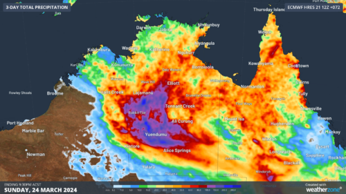
Wet week ahead for Qld, NT
Heavy rain and thunderstorms will continue in parts of Qld and the NT over the next few days, increasing the risk of flooding and outback road closures. This week’s wet weather is being caused by the remnants of...
A wet easter on the cards
There are early signs that parts of SA, the NT, NSW and Qld could get soaked on the Easter long weekend, as moisture left behind by ex-Tropical Cyclone Megan spreads south. Tropical Cyclone Megan made landfall over the...
Perth’s long frustrating wait for rain
As Perth and the southwest corner of Western Australia emerge from their traditional spring, summer, and early autumn dry season, the wait for decent rain is a lot more frustrating than usual. There are two reasons for the...
Air, ocean and ice climate records tumbled in 2023
The World Meteorological Organization has confirmed that 2023 was an astonishing year for our planet’s climate, with records obliterated in the atmosphere, hydrosphere and cryosphere. Atmosphere Global air temperatures frequently made headlines around the world in 2023 as records...