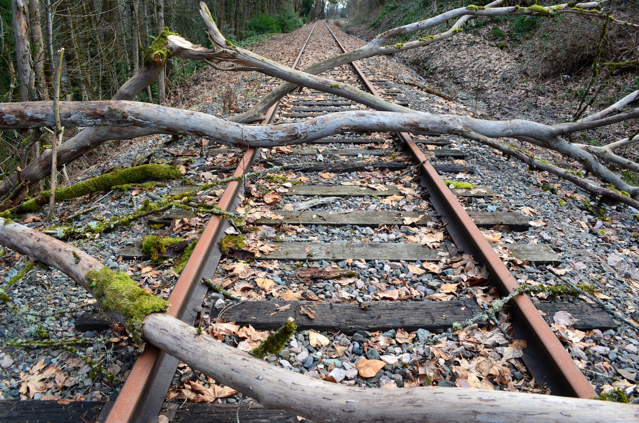
Major NSW train lines have reopened this week, after repair crews working tirelessly to clean up the damage following last week’s severe weather.
Hundreds of millimetres fell in a day late last week causing localised flooding and landslips across areas of NSW rail networks. The damage across parts of the network led to train lines closing for days, disrupting commuters.
Transport for NSW said that ’The wild weather over the weekend caused some significant flooding on the South Coast line’. Their post below shows flooding and damage along the rail tracks in Coalcliff Yard, Port Kembla and Bomaderry Fletchers Lane Level crossing.
This flooding was caused by persistent rain, falling across large area of eastern NSW between Thursday, April 4 and Saturday morning, April 7.
During the 48 hours leading up to 9am on Saturday, April 7 the highest totals across the Sydney basin and Illawarra were;
- Darkes Forest- 269mm
- Centennial Park- 258.7mm
- Beaumont-255.4mm
- Abbotsford- 255.3mm
- Penrith – 251.8mm
- Albion Park-250.8mm
- Chatswood-241mm
The heaviest falls during this period fell during the 24 hours leading up to 9am on Saturday, April 7, with Penrith and Richmond recording their wettest days in any month for 32 years.
The map below shows that widespread falls of 100-150mm fell across central NSW coastline, with isolated pockets in the Illawarra and Blue Mountains receiving around 200-300mm during this period.
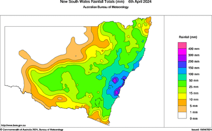
Image: NSW rain during the 24 hours leading up to 9am on Saturday, April 6, Source:Bureau of Meteorology
DTN APAC, a DTN company, can assist during severe weather events such as this with our expert insights and daily briefings, helping to reduce the disruptive delays across the network.
We specialise in building customised weather monitoring and alerting solutions. These guide transport operators to plan and respond effectively. We tailor our data and analytics to your exact requirements. The following tools help the transport and rail sector daily.
- Total Lightning Network- Precise lightning detection which pinpoints where your personnel need to prepare and respond.
- Stormtracker- visualise adverse weather conditions impacting your network, with multiple weather and alert layers which animate over your infrastructure.
- Nowcasting, forecasting and severe weather alerting services to help coordinate your team, limiting downtime and scheduling maintenance in optimal weather windows.
We provide customised weather intelligence to keep your transport business moving, for more information, please contact us at apac.sales@dtn.com.


