A tropical cyclone is likely to track over the Coral Sea this week and may move closer to Australia’s east coast at some stage next week.
The satellite image below show a tropical low sitting over the Solomon Sea on Monday afternoon. This low is expected to develop into a tropical cyclone on Tuesday.
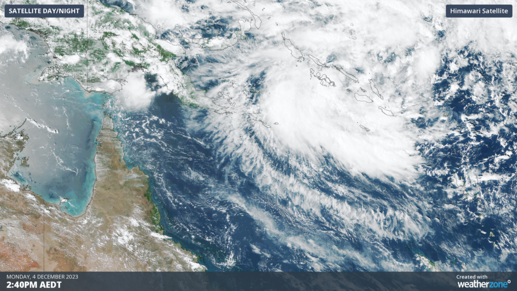
Image: Himawari Satellite image at 2:40pm AEDT on Monday, December 4 showing the low developing over the Solomon Sea.
As this system looks set to become a tropical cyclone in the far northeast corner of Australia’s area of responsibility, it is expected to be named Jasper by the Bureau of Meteorology. This would be the first tropical cyclone of the season in Australian waters.
Before looking at the future movement of this system, it is important to point out that there is a high degree of uncertainty in the forecast beyond Wednesday. This makes it difficult to accurately predict its track and strength from Thursday onwards.
At this stage, most forecast models predict that the system will become a tropical cyclone on Tuesday before moving towards the south-southwest on Wednesday while strengthening.
According to the Bureau of Meteorology, the system has a high chance of becoming a severe tropical cyclone (category 3 or higher) from Thursday as it moves towards the south over the northeastern Coral Sea.
While this system is not expected to directly impact Australia’s mainland between now and Friday, there is a growing potential for it to track towards eastern Qld from this weekend or early next week. However, it is too far out to know whether this system will stay offshore or move over Australia’s east coast. For now, anyone living south of Cairns should keep a close eye on the forecasts over the coming week.
The map below shows where the Bureau of Meteorology expect this system (02U) to be located on Monday, December 11, with the centre of the system expected to be located somewhere inside the red shaded area.
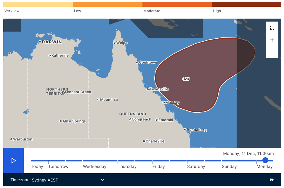
Image: The forecast location for the system (02U) on Monday, December 11 is expected to be located somewhere in the red shaded area. Source: Bureau of Meteorology.
We will be watching this system closely over the coming week and providing daily updates on the potential threat for Australia. For more information on our tropical cyclone forecasts and warnings please contact us at apac.sales@dtn.com.


