Tropical Cyclone Lola has become the earliest Category 5 tropical cyclone to form in the Southern Hemisphere on record as it bears down on Vanuatu.
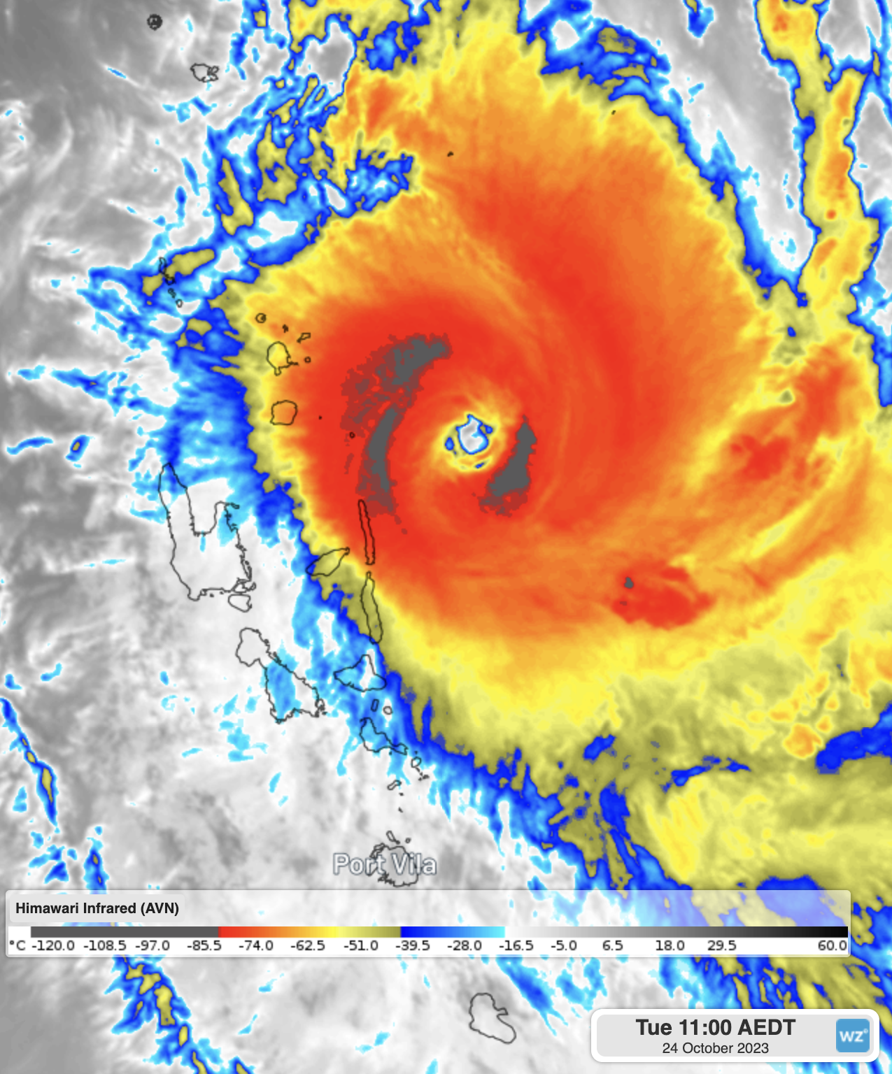
Tropical Cyclone Lola first developed on Sunday evening in Fiji’s Area of Responsibility and has since quickly intensified. Just 36 hours after its initial development it is now classified as a Category 5 tropical cyclone, the highest category, with wind speeds of 215km/h, gusting up to 260km/h.
Severe Tropical Cyclone Lola is the earliest Category 5 tropical cyclone to form, not only in the South Pacific basin, but the whole Southern Hemisphere during the Southern Hemisphere season (July to June). The previous record holders are:
- Tropical Cyclone Joan in 1975 and Tropical Cyclone Graham in 1991 became Category 5 on the 5th December, both in Australia’s region
- In the South West Indian Ocean, the earliest Category 5 (named ‘Very Intense Tropical Cyclones’) was Tropical Cyclone Ambali on December 6th 2019
- Tropical Cyclone Yasa was the previous earliest for the South Pacific on December 15th 2020
So Tropical Cyclone Lola has beaten the previous Southern Hemisphere record by 42 days.
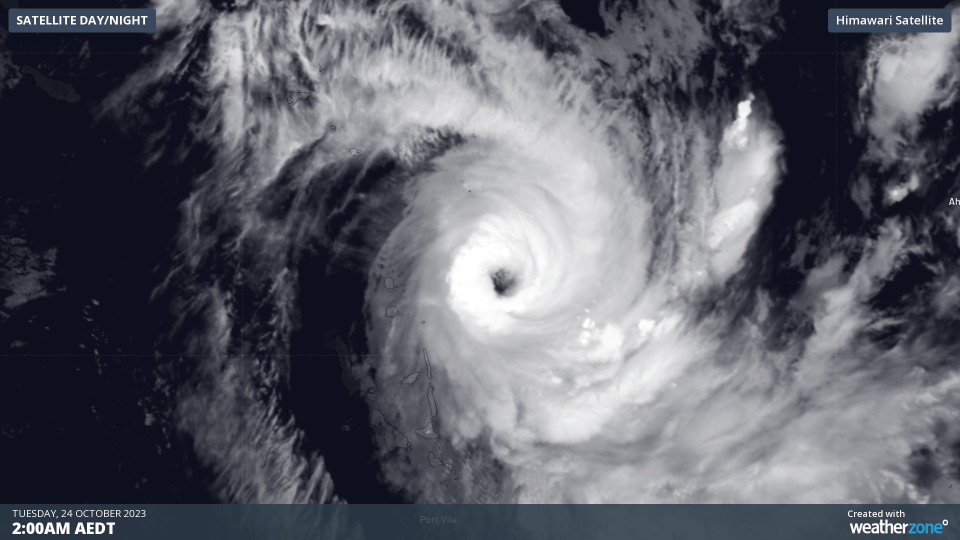
Tropical Cyclone Lola has formed a clearly visible eye and is a near perfect annulus (‘doughnut’ shape) indicating it is a fully mature and very strong system. It was able to strengthen so quickly mainly due to its small size, but was certainly aided by near-perfect conditions of very warm waters, high moisture, low wind shear, and good outflow, allowing it to develop uncontested.
Tropical Cyclone Lola is expected to track southwest, putting it on course for a direct hit on Vanuatu around 6am AEDT on Wednesday (Vanuatu time is also AEDT at this time of year). This could be one of the strongest tropical cyclones on record to make landfall over the Pacific Island nation. Some areas are already experiencing gales on the western side of the system. Official warnings and tracks issued by the Fiji Met Service can be seen here.
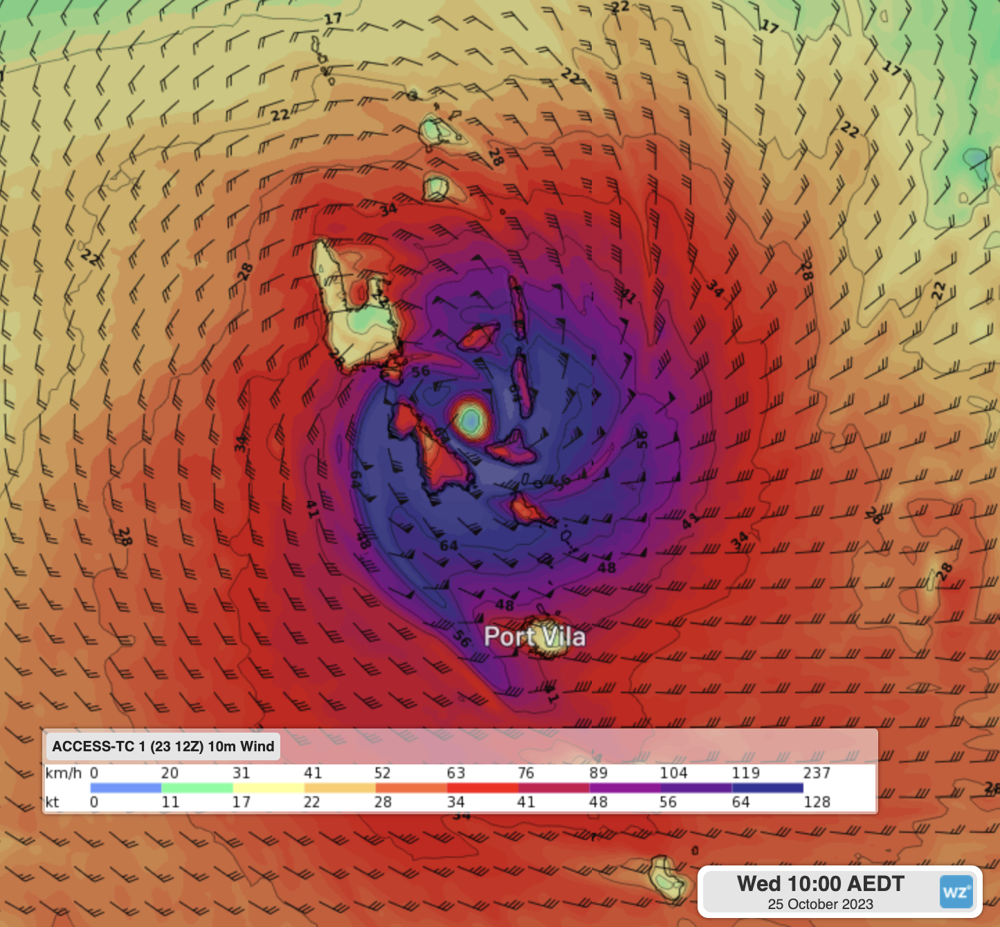
Image: Forecast sustained winds as Tropical Cyclone Lola makes landfall over the Vanuatu archipelago from Access-TC
From there, it is expected to make more of a southerly track towards New Caledonia and could make landfall there also. However, it will be moving into an area that is unfavourable for sustaining its current strength, with relatively cool waters and wind shear that will tear the system apart. It is now unlikely that Lola will move into Australia’s region.
Tropical cyclones developing during October is unusual, given that the official tropical cyclone season runs from November to April each year, but they are not unprecedented. What is unusual is how strong this system has become, with very few systems ever making it to a severe tropical cyclone (Category 3 or higher) out of the normal season.
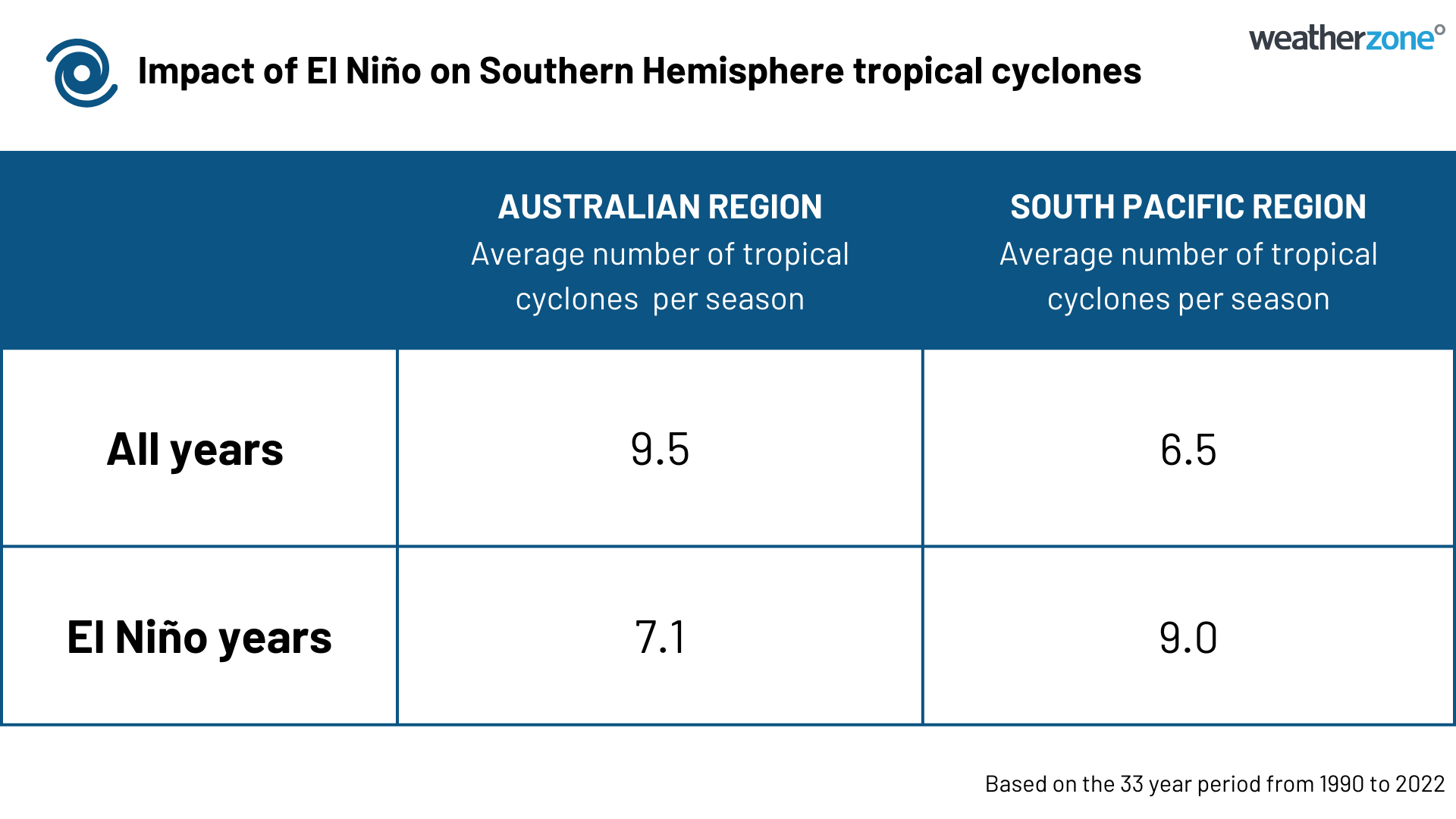
What has certainly aided this record-breaking tropical cyclone is an active El Niño. While El Niño decreases the number of tropical cyclones forming in the Australian region, it increases them in the South Pacific. This is due to the warmer than normal waters residing further east than usual, as well as the South Pacific Convergence Zone shifting to the northeast. As seen in the table below, Australia usually sees about 2.4 fewer (-25%) tropical cyclones in El Niño years, while the South Pacific sees 2.5 more (+38%) on average.
With such a significant system, we will keep up to date on the latest developments at Weatherzone.
Tropical Cyclone briefings have started for the upcoming 2023-24 season. For a detailed tropical cyclone outlook briefing for your region, as well as coverage on wet season rainfall and temperatures, please contact us at apac.sales@dtn.com.


