Wet weather is about to return to parched and fire-weary areas of eastern Australia, with 7 to 10 days of rain and thunderstorms set to soak parts of Qld and NSW.
A stationary low pressure trough being fed by persistent moisture-laden easterly winds will cause rain and thunderstorms over parts of eastern Australia each day between this Friday and at least the middle of next week. Some models suggest this muti-day soaking could even last into late next week, potentially bringing around 10 days of wet and stormy weather in NSW and Qld.
The maps below show how much rain one forecast model is predicting over each of the next 10 days. This system will affect a broad area of eastern Australia, although the heaviest rain is expected to fall between Central Qld and Central NSW.
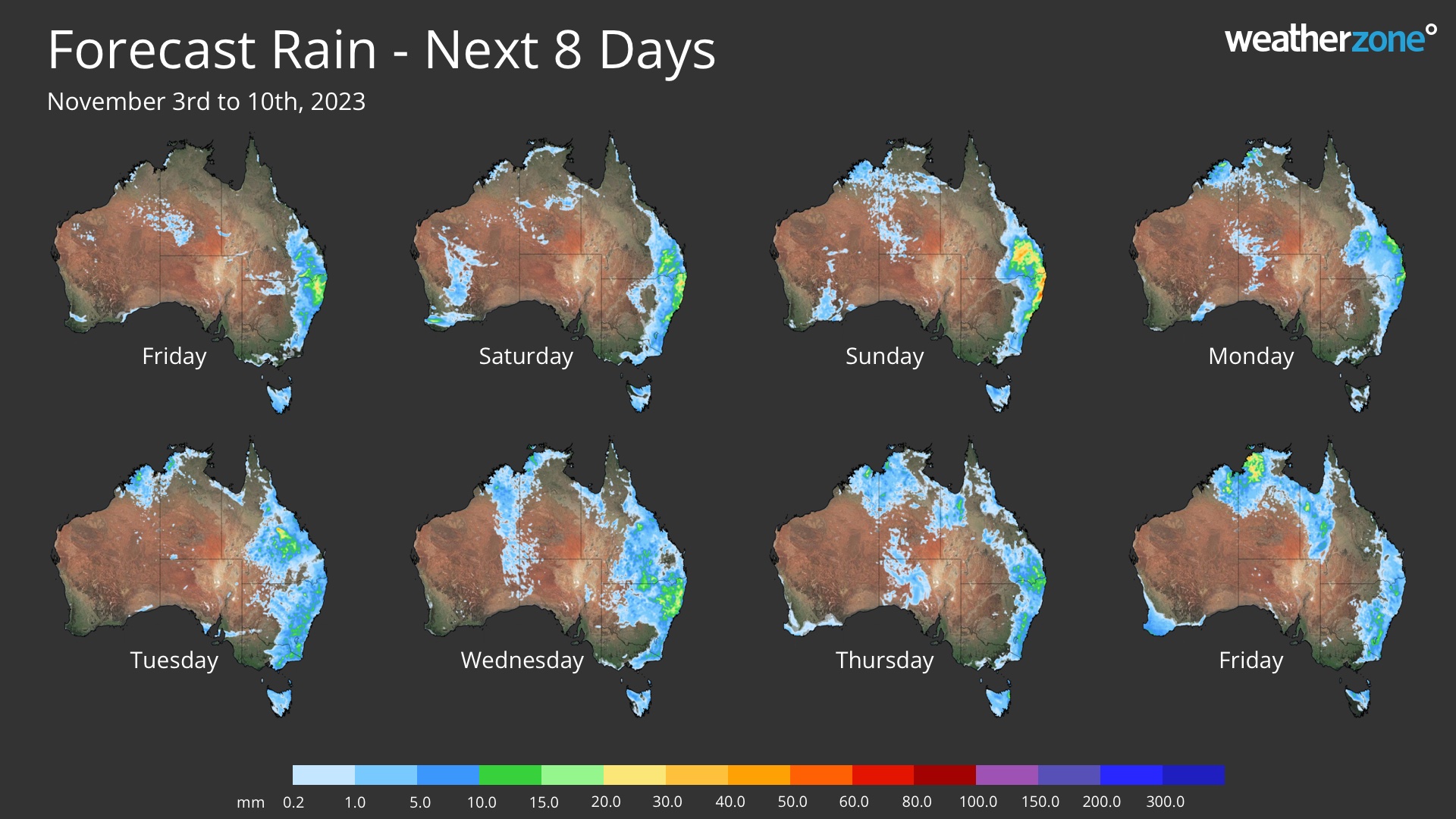
Image: Forecast daily rainfall during each of the next 8 days according to the ECMWF-HRES model.
While there is still some uncertainty regarding where and how much rain will fall from this system, falls of 20 to 40mm could occur over central and northern NSW and in southeast and central Qld. Most models suggest that heavier falls will occur in northern and northeast NSW, where accumulated totals could reach 50 to 100 mm by Friday next week, with isolated areas possibly picking up more than 100 mm.
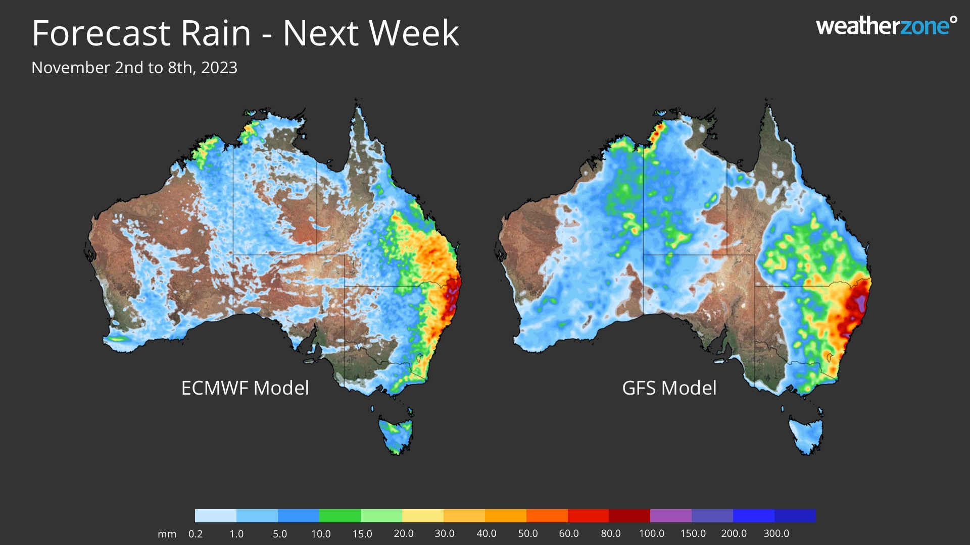
Image: Forecast accumulated rain during the 7 days ending on Wednesday, November 9, 2023.
Thunderstorms are likely to develop over parts of eastern Australia on most days during this period of wet weather and some of these storms will become severe. Any rain falling from these storms will bring an increased risk of flash flooding.
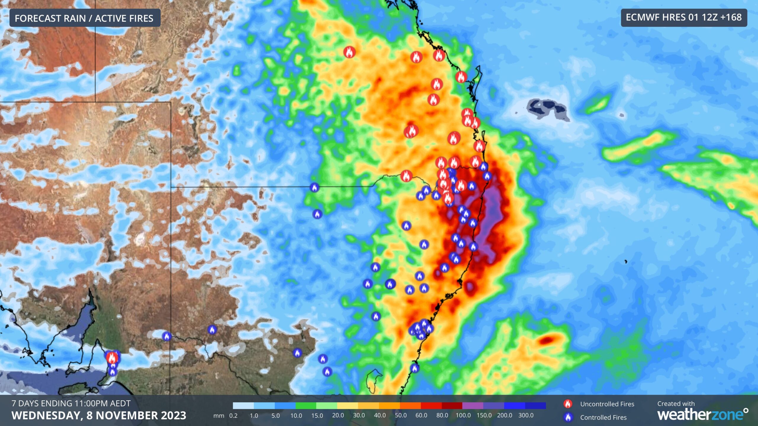
At this stage, useful rain is expected to fall over many of the active fire grounds in northern NSW and southern Qld from this Friday into next week. This rain, combined the cooler and more humid easterly winds, should make it easier for firefighters manage or extinguish these fires.

Image: ECMWF-HRES forecast accumulated rain between now and Wednesday, November 8, combined with the locations of active fires in NSW and Qld (valid at 10am AEDT on November 2).
The increased cloud cover, rainfall and easterly winds will also bring some cooler weather to eastern Australia over the coming week or two.
Daytime temperatures are only expected to reach the low-to-mid 20s in Sydney and the mid-to-high 20s in Brisbane during the next 7 to 10 days. This will bring a break from the recent run of hot weather, with Sydney already experiencing nine days over 30ºC so far this spring.
Weatherzone Business has grown to become the outright leader within the Australian energy market, serving wind, solar, hydro, trading, utilities and network companies. For more information, please contact us at apac.sales@dtn.com.


