Australia just had its warmest winter in more than a century of records with lean snow cover and prolific lightning rounding out an almost unrecognisable season.
Australia’s national mean temperature in winter 2023 was 16.73ºC, which is 1.53ºC above the 1961-1990 average. This was the country’s highest mean winter temperature in records dating back to 1910. The previous record anomaly was +1.46ºC in 1996.
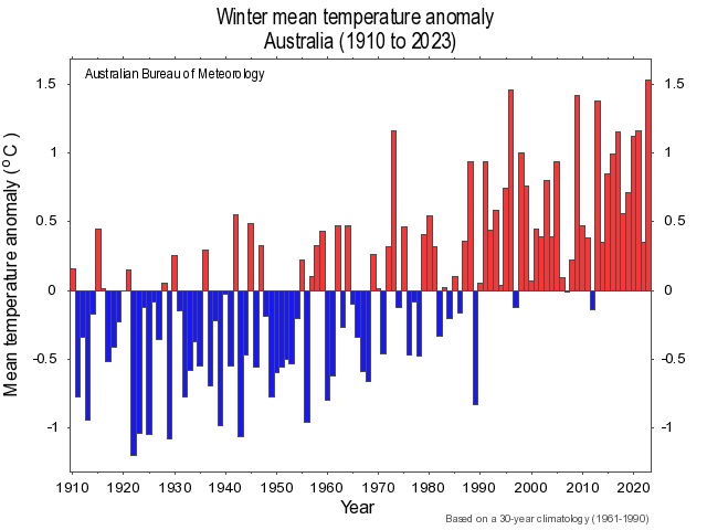
Image: Winter mean temperature anomalies between 1910 and 2023. Source: Bureau of Meteorology.
It was also Australia’s 2nd warmest winter based on daytime warmth, with an average maximum temperature of 23.65ºC, which is 1.85ºC above the 1961-1990 average. The only warmer winter was 2017, which had a maximum temperature anomaly of +1.94ºC.
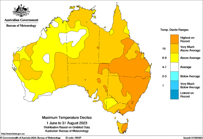
Image: Maximum temperature deciles during winter 2023. Source: Bureau of Meteorology.
In addition to the unprecedented national warmth, many of Australia’s state capital cities also had one of their warmest winters on record.
Here are some of the notable rankings based on mean temperature, which combines the daily maximum and minimum temperatures throughout the season:
- Adelaide 13.03ºC – warmest on record (data back to 1887)
- Brisbane 17.86ºC – warmest on record (data back to 1887)
- Sydney 14.73ºC – 2nd warmest on record (data back to 1859)
- Hobart 10.62ºC – 2nd warmest on record (data back to 1882)
- Canberra 7.82ºC – 2nd warmest on record (data back to 1939)
- Melbourne 12.09ºC – 5th warmest on record (data back to 1855)
- Darwin 26.68ºC – 7th warmest in record (data back to 1941)
Mixed rainfall
Rainfall was a mixed bag across Australia in winter, with above average rainfall in large areas of central and northern Australia, and unusually dry conditions in parts of the west, south and east.
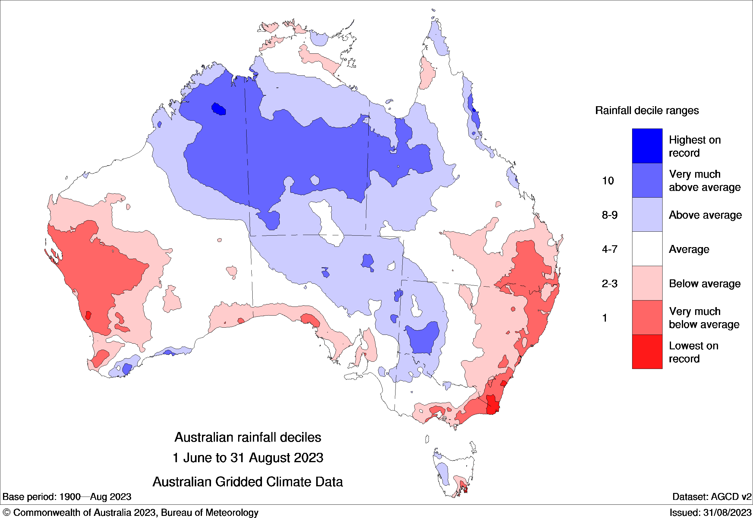
Image: Observed rainfall deciles during winter 2023. Source: Bureau of Meteorology.
Nationally, it was Australia’s wettest winter in six years. However, parts of northern Australia had one of their warmest winters on record, while pockets of southeastern and southwestern Australia had a record low rainfall this winter.
Lean snow
Winter’s abnormally warm and dry weather in southeastern Australia took a toll on snow cover in the high mountains of Tas, Vic and NSW. After some decent snow in June, natural snow depths thinned out during July and August.
The highest snow depth measured at Spencers Creek in NSW during winter was 131 cm on July 13. If this holds on as the peak for 2023, which is a good chance, it will be the earliest season peak on record at Spencers Creek, with data available back to 1954.
Lots of lightning
Despite below average winter rainfall in parts of eastern and southeastern Australia, the final weeks of the season featured a flurry of thunderstorms in NSW, Qld and Vic. This surge of late-winter storms was fuelled by abnormally warn near-surface air temperatures, and moisture-laden air coming off unusually warm water near Australia’s east coast.
The maps below show the average winter lightning density compared to the observed lightning density in winter 2023.
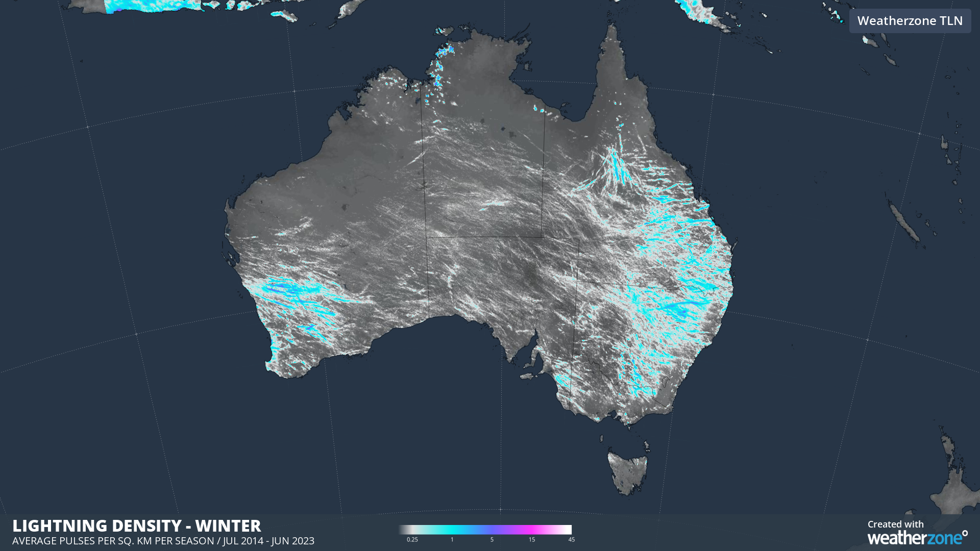
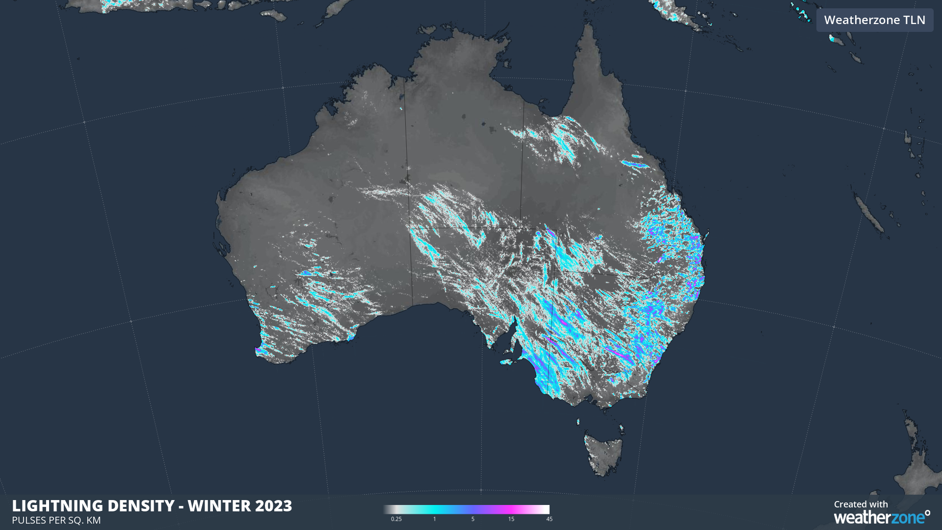
Images: The average seasonal lightning density in winter (top image) and the lightning density observed in winter 2023 (bottom image).
Why was winter 2023 so warm?
Australia’s 2023 winter unfolded against a backdrop of record-breaking global warmth, with July ranking as the planet’s warmest calendar month on record.
In the Australian region, several broad scale influences also helped suppress rainfall and increase temperatures, particularly during the second half of the season.
Developing El Niño and positive Indian Ocean Dipole patterns to the east and west of Australia reduced atmospheric moisture in the Australian region in recent weeks. These developing climate drivers helped suppress cloud and increase daytime temperatures in many areas, especially towards the end of the season.
Many of the cold fronts that usually sweep over Australia in winter were also pushed south by blocking high pressure systems in winter. This caused unusually warm and dry weather over parts of southern Australia and played a big role in starving the Alps of snow.
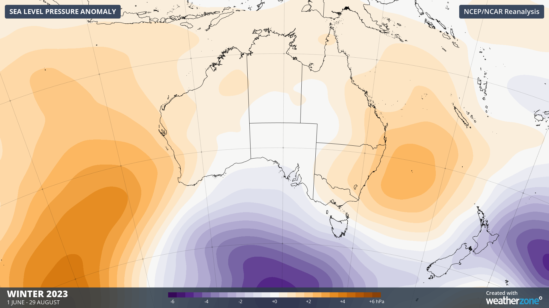
Image: Sea level pressure anomaly during winter 2023 (based on data from June 1 to August 29), showing unusually high pressure near and over Australia.
Like many areas of the planet in 2023, the last three months will go down as the warmest June to August period on record for Australia.
Looking ahead, most forecast models suggest that this abnormally warm and dry weather will longer into the start of spring as well.
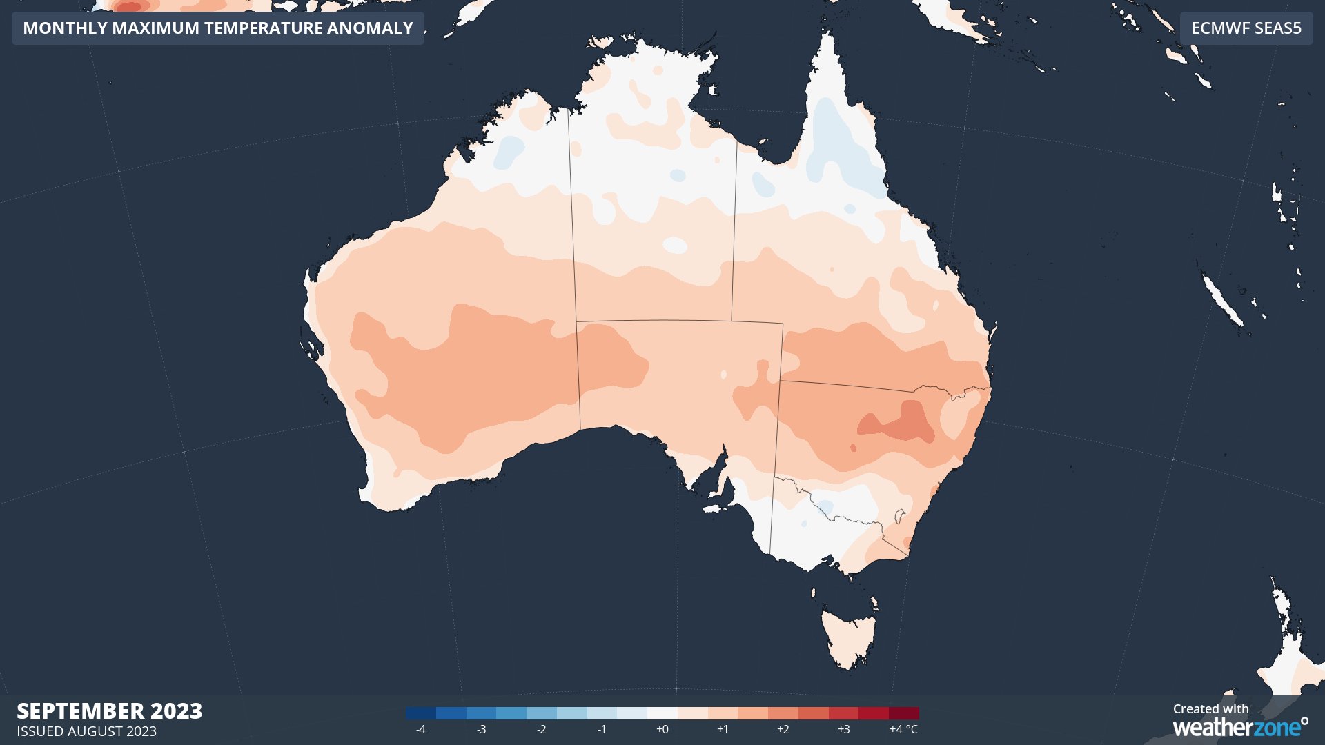
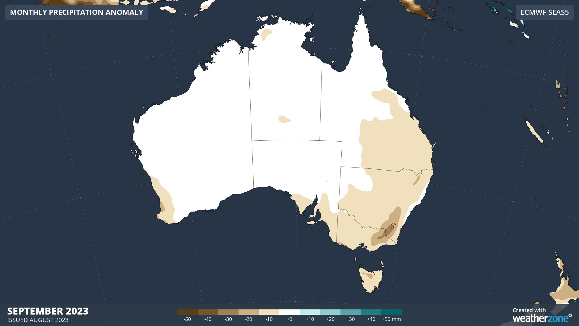
Images: Forecast maximum temperature (top) and rainfall (bottom) anomalies in September 2023, according to the ECMWF SEAS5 model.
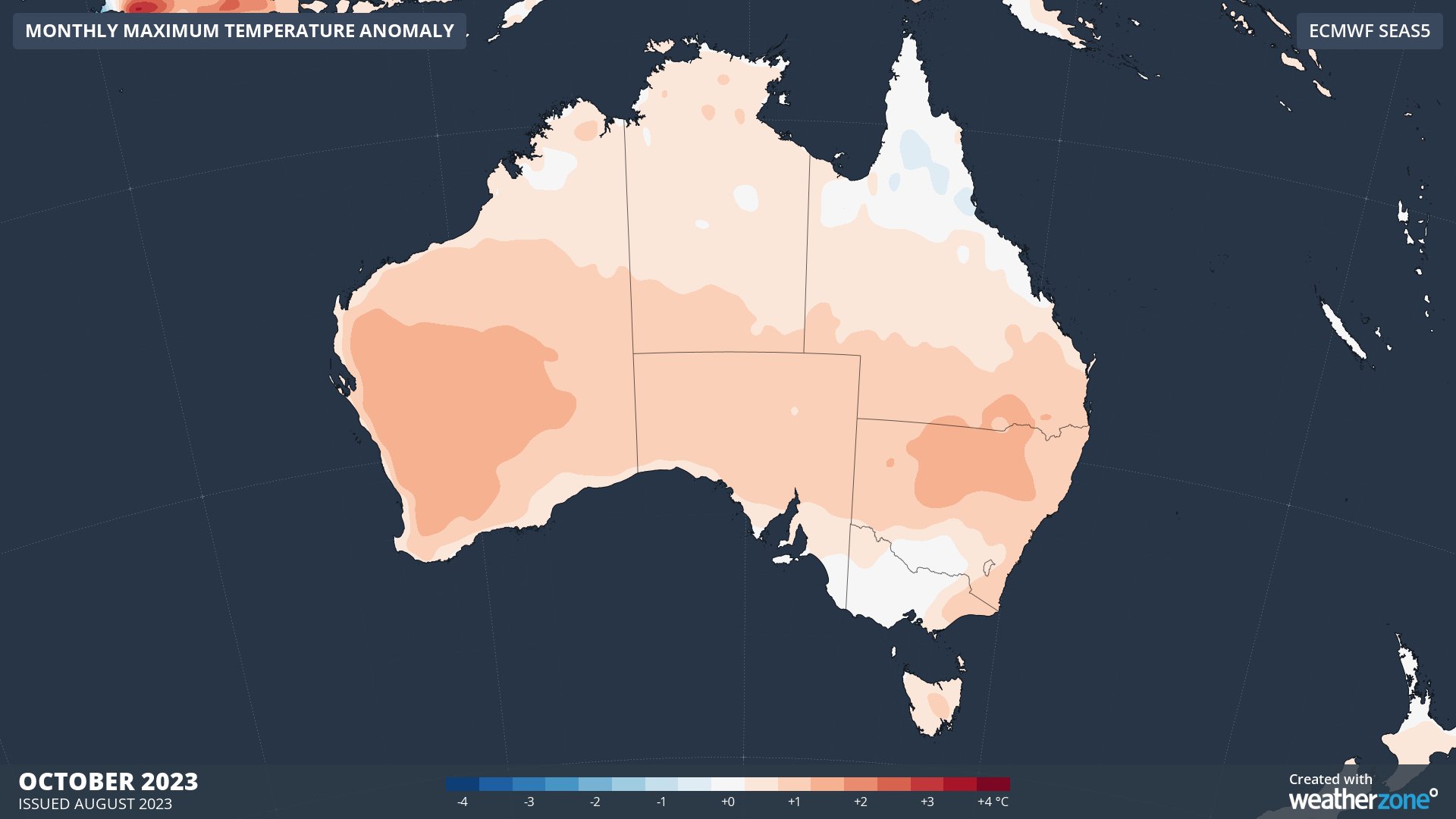
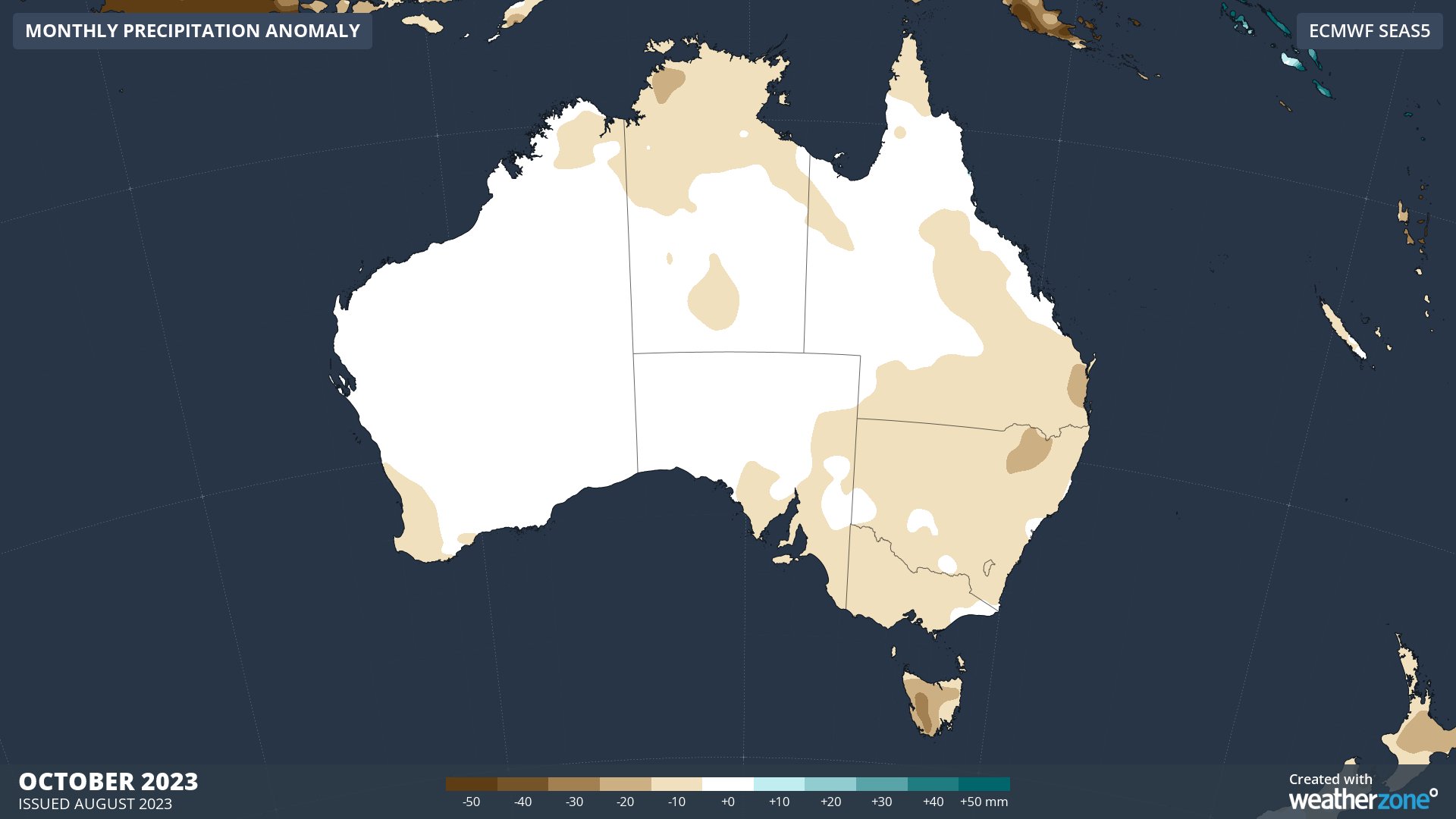
Images: Forecast maximum temperature (top) and rainfall (bottom) anomalies in October 2023, according to the ECMWF SEAS5 model.
DTN APAC is now doing climate briefings for spring and summer. To book a briefing, please contact us at apac.sales@dtn.com


