
An outbreak of severe wintry weather will affect southeastern and eastern Australia this week, with damaging winds, heavy rain, thunderstorms, flooding, widespread snow and hail. A strong cold front will impact southern Australia on Monday and Tuesday, leading to widespread rain and damaging winds. The front will then create a cut-off low over NSW, which will move slowly east […]
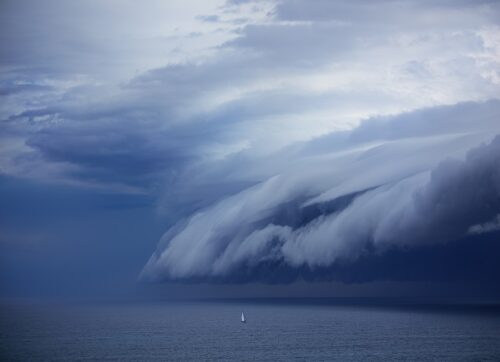
Squall lines pose a significant safety threat to offshore oil and gas operations. They also can cause serious damage to business assets as well as halting operations on the rig, decreasing the rigs efficiency. What are squall lines? Squall lines are not frequent across the northwest shelf of Australia and the Pilbara coastline, they […]
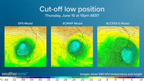
A large upper-level cut-off low pressure system will move over southern and south-eastern Australia next week, most likely between Tuesday and Saturday. This simply refers to a broad, isolated pool of cold air several kilometres above the ground that has moved up towards Australia from the Southern Ocean. This will cause windy, cold, wet and stormy weather. While there is some disagreement between the models regarding its position […]
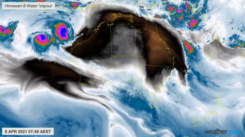
Australia’s tropical cyclone season has officially come to an end. All signs were pointing towards an above-average number of cyclones in the Australian region, so how many cyclones did we see this season?
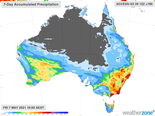
After a relatively benign April, unsettled weather is on its way for the opening week of May. Rain is expected to increase from next week for NSW and eastern Victoria, thanks to surface and upper-level low-pressure systems. During the next week pockets of 80-100mm of rainfall along the South Coast of NSW are forecast by both the Australian (Access-G3) and European (EC) models (figure 2). The computer models are having a hard time at discerning exactly where most of […]
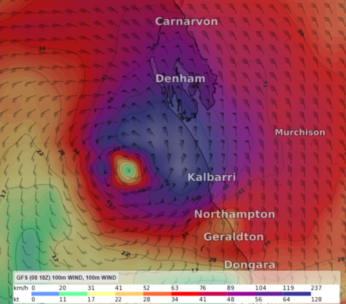
Tropical cyclone Seroja is expected to bring extremely dangerous weather conditions to the west coast during this coming Sunday or Monday 12 April. Seroja is forecast to make landfall between Carnarvon and Jurien Bay, late Sunday or early Monday morning. The dangerous weather generated by Seroja may also extend further south along the coast […]
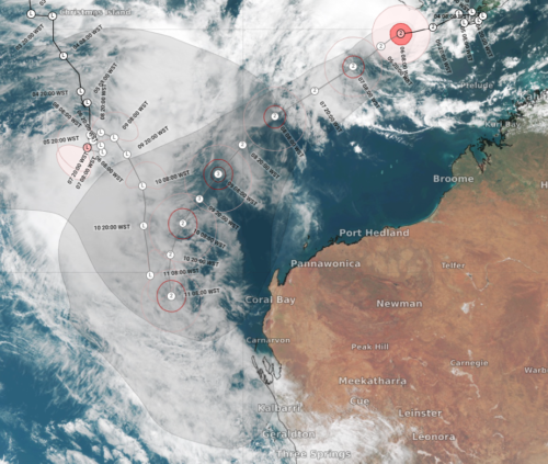
Tropical cyclone Seroja is currently located well to the north-northwest of Broome and unlikely to impact Western Australia during the next few days (right track figure 1). However, the cyclone is forecast to swing south later this week, tracking parallel to the coast near Exmouth and Carnarvon (figure 1). At the same time, a tropical low has also formed near Christmas Island and its interaction with Seroja will play a huge role in Seroja’s movement (left track […]
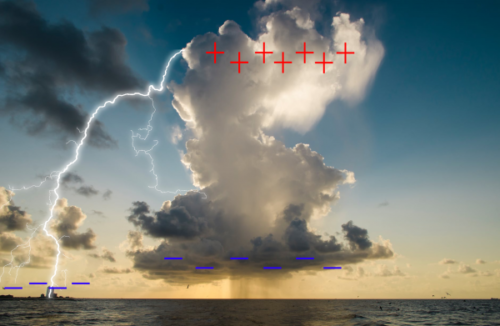
Lightning is one of the most dangerous weather phenomena to businesses across Australia. Producing weather’s most spectacular display, it is equally as fascinating scientifically and is the result of electrical discharge that occurs between clouds, within a cloud and from cloud to ground. Lightning and thunderstorms can occur at any time of the year in Australia. However, they occur most often during the warmer months from September to March. Thunderstorms crave the warmth and […]
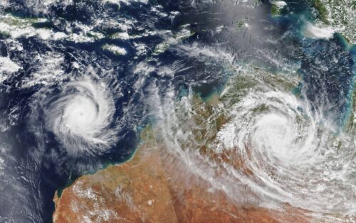
Australia’s tropical cyclone season is officially underway, but we may not see much activity for few months yet. The season runs from November to April, and for mining operators and businesses across northern Australia, 2026-27 is shaping up to be a season where the headline numbers and the real risk may not line up. On […]
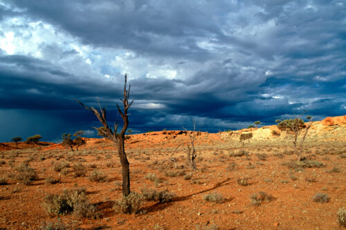
A positive Indian Ocean Dipole is underway, but this one is unlikely to deliver the textbook dry spring and summer that businesses have come to expect from the pattern. The Bureau of Meteorology officially declared a positive IOD on Tuesday, October 27, which typically like El Niño can cause drier and warmer conditions over parts of […]
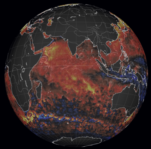
Waters off Indonesia have cooled in recent weeks, an indication that a positive Indian Ocean Dipole (IOD) event could be developing. It’s an important climate driver for Australia, and it could shape rainfall and temperatures heading into summer, with flow-on effects for farmers, energy and other industries. What is the Indian Ocean Dipole? The IOD […]

Leonora, WA, had its wettest September day on record earlier this month. Three weeks later, more than 1.3 million lightning pulses were detected within 800 km of the town in 48 hours. Why is a stalled trough delivering storms to mining country, and what it could mean for operations? The DTN Total Lightning Network detected […]