
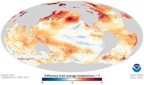
La Niña is looking increasingly likely later this year, with the Bureau of Meteorology issuing a La Niña Watch on Tuesday and US climate forecasters also upping their predictions in the past week. The Pacific Ocean has been showing signs of a developing La Niña for the last two months. Technically, this means cooler-than-average […]

There are signs that northern Australia’s dry season is nearing its end, with the western Top End to see dry season rain this week. The dry season across Northern Australia occurs between May and September, where sunny days and daytime temperatures in the low 30s are a regular occurrence on the forecast. By contrast, the wet season occurs […]

Another burst of early spring warmth has begun across south-eastern Australia, with temperatures set to peak from Friday through to Monday. A high-pressure system sitting over NSW is responsible for the warm, dry and settled weather that we will see over the next few days. This high-pressure system is squeezing cold fronts further south, with warm northwesterlies prevailing for the eastern states. The warm north-westerly winds are […]

During April 2015, a massive 14.9 metre wave was recorded by the Manly Hydraulics Waverider Buoy offshore near Sydney. It was the largest wave recorded by this buoy between 1992 and 2016. This record-breaking wave was generated by one of the strongest East Coast Lows this century, which produced severe weather along the NSW coast for a number of days. These waves pounded the NSW coastline and caused severe coastal erosion, which contributed to Narrabeen Beach retreating by around 25 metres during this event. The 14.9 metre wave only just broke the previous record of 14.1 metres, […]

A burst of warm and windy weather will cause a spike in fire danger ratings across southern Australia during the opening days of spring. Australia’s spring, which officially starts on September 1, has arrived right on time in the nation’s southern states. Warm and gusty north-westerly winds are developing over Western Australia today ahead of an approaching […]

Around two-thirds of Australia are tipped to see above-average rain this spring, with cool days and warm nights also on the cards with wet spring still on the horizon, despite recent lapse in IOD. As winter draws to a close in the southern hemisphere, Australia finds itself surrounded by abnormally warm waters. These warm […]

When a flight takes off, it of course has a destination. But did you know that every flight has an alternate airport or back up plan in case of bad weather? A flight will divert to another airport when weather conditions at the original destination airport are too adverse to land in. There are […]

The Australian Fire and Emergency Services Authorities Council (AFAC) just released the national Seasonal Bushfire Outlooks for spring. This outlook is based on the current state of the environment, including soil moisture and vegetation growth, and the future predictions of rainfall and temperature. The map below gives an overview of the bushfire potential across Australia during […]

A cold front and intense low-pressure system will cause a dangerous mix of heavy rain, thunderstorms, damaging winds and large waves in eastern NSW during the next 48 hours. The satellite image below shows clouds passing over NSW near and ahead of an approaching cold front at midday on Monday. These clouds are causing rain, which is heavy in some areas, and thunderstorms. Behind this cold front, a broad region of […]
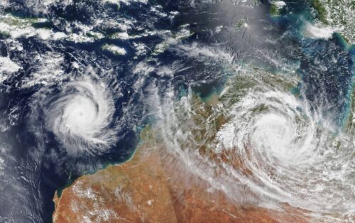
Australia’s tropical cyclone season is officially underway, but we may not see much activity for few months yet. The season runs from November to April, and for mining operators and businesses across northern Australia, 2026-27 is shaping up to be a season where the headline numbers and the real risk may not line up. On […]
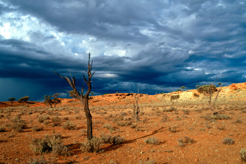
A positive Indian Ocean Dipole is underway, but this one is unlikely to deliver the textbook dry spring and summer that businesses have come to expect from the pattern. The Bureau of Meteorology officially declared a positive IOD on Tuesday, October 27, which typically like El Niño can cause drier and warmer conditions over parts of […]
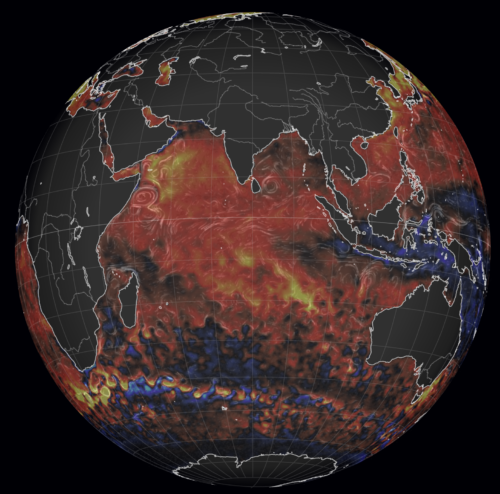
Waters off Indonesia have cooled in recent weeks, an indication that a positive Indian Ocean Dipole (IOD) event could be developing. It’s an important climate driver for Australia, and it could shape rainfall and temperatures heading into summer, with flow-on effects for farmers, energy and other industries. What is the Indian Ocean Dipole? The IOD […]

Leonora, WA, had its wettest September day on record earlier this month. Three weeks later, more than 1.3 million lightning pulses were detected within 800 km of the town in 48 hours. Why is a stalled trough delivering storms to mining country, and what it could mean for operations? The DTN Total Lightning Network detected […]